Whitsundays by kayak
- Distance
- Varies with your plan. For scale, the Ngaro Sea Trail islands are 10 to 40 km south-east of Airlie Beach.
- Country
- Australia
- Difficulty
- Moderate
- Type of trip
- Kayak & canoe
There’s no set kayak route through the Whitsundays. It’s a paddling area: 74 continental islands off the central Queensland coast, about 900 km north of Brisbane, the peaks of a coastal mountain range drowned when sea levels rose between about 19,000 and 6,000 years ago. Whitsunday Islands National Park protects 32 of them, including Whitsunday, Hook and Langford islands. Paddlers launch from Shute Harbour or Airlie Beach, or take a camper transfer boat out to the islands, then hop between national park camping areas such as Whitehaven Beach, Chance Bay, Nari’s Beach and Crayfish Beach. This is Ngaro Country. The Ngaro people, described as canoe people, have lived on these islands for around 9,000 years.
Queensland Parks and Wildlife Service is blunt about what it takes. You need a planned itinerary, camping permits booked and paid for before you arrive (check the current fee with Queensland Parks and Wildlife Service), a good chart and the fitness to cross the passages between islands. There’s no fresh water on the uninhabited islands, so carry at least 5 litres per person per day for drinking, cooking and washing. Tides range up to 4 m. Marine stingers, sharks and saltwater crocodiles can be in the water in any month. Mobile signal is unreliable, so carry a personal locator beacon and ideally a marine VHF radio.
Highlights along the way
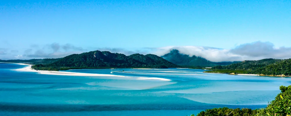
- Whitehaven Beach: 7 km of white silica sand on the east coast of Whitsunday Island, the largest island in the group. There’s a national park camping area near its southern end, so you can stay after the day boats leave.
- Hill Inlet: at the northern end of Whitehaven, where the tide moves white sand and turquoise water through the inlet. The Hill Inlet lookout track at Tongue Point looks down on it.
- Whitsunday Ngaro Sea Trail: the parks service’s sea trail links walks and camping areas on Whitsunday, Hook and South Molle islands, 10 to 40 km south-east of Airlie Beach. Paddlers can follow it from camp to camp and walk the island tracks along the way, including the climb up Whitsunday Peak.
- Nara Inlet, Hook Island: one of two long, narrow inlets on Hook Island’s south side. A short track leads to the Ngaro Cultural Site, a cave with rock art.
- Fringing reefs: coral grows close to shore around many islands. Black Island has a day-use area where you can snorkel at high tide. Wear a full-body stinger suit whenever you go in.
Distance
Varies with your plan. For scale, the Ngaro Sea Trail islands are 10 to 40 km south-east of Airlie Beach.
Best time to go
April to October. Days are milder and humidity is lower, but this is also when the prevailing south-easterly winds blow, so plan crossings around the forecast and allow spare days. Stinger season is usually given as October to May. Summer is the wet season, and the cyclone season runs from November to April.
More journeys in Australia
- Western Australia · Newluks
- Katoomba tourist! · Greg
- North With Larinda · Chris
- World Trip - One Planet Expedition · David Bossek (Nature Nomad World)
Flyby films from Australia
- Pacific Crossing - Panama To Austra · David Bossek (Nature Nomad World)
- Katoomba! · Greg
- South Bound. · Chris
- Turning Toward Home · Newluks
More routes like this
- Katherine Gorge by canoe · Australia
- Kayaking the Great Barrier Reef Islands · Australia
- Marlborough Sounds by kayak · New Zealand
- Shannon River by kayak · Ireland
- Hudson River by kayak · about 412 km (256 miles) · USA
- Sea kayaking the San Juan Islands · USA