West Highland Way
- Distance
- 154 km (96 miles)
- Country
- Scotland
- Difficulty
- Moderate
- Type of trip
- Hiking trail
The West Highland Way runs 154 km (96 miles) from Milngavie, on the northern edge of Glasgow, to Fort William. It opened in 1980 as Scotland’s first officially designated long-distance route, and the Highland Council says about 50,000 people now walk the whole thing each year. Most take seven or eight days; fit walkers do it in five or six. It’s normally walked south to north, so the easier lowland stages come first.
From Milngavie the path crosses farmland to Drymen, climbs Conic Hill and drops to Loch Lomond at Balmaha, then follows the east shore of the loch for about 30 km. North of Inversnaid the path is rough and bouldery, and many walkers find it the hardest section. After Tyndrum it heads onto open moor on old drove and military roads, past Bridge of Orchy and Kingshouse, over the Devil’s Staircase to Kinlochleven, and on along the side of the valley to Glen Nevis and Fort William. You sleep in B&Bs, hotels, bunkhouses, pods or campsites in the villages along the way. Trains run from Glasgow to Milngavie and back from Fort William, and Citylink buses on the A82 stop at several points on the route if you want to walk it in sections.
Highlights along the way
- Conic Hill: a 361 m hill above Balmaha that sits on the Highland Boundary Fault.
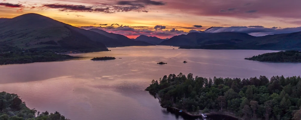
- Loch Lomond: the largest lake in Great Britain by surface area, 36 km long. The Way follows its eastern shore from Balmaha to the head of the loch, past Rowardennan and Inversnaid.
- Rannoch Moor: a huge open spread of bog and lochans. The Way crosses its western edge between Bridge of Orchy and Kingshouse, one of the emptiest stretches of the walk.
- Devil’s Staircase: a zigzag climb from the A82 near the head of Glen Coe to 550 m, the highest point of the Way, followed by a long descent to sea level at Kinlochleven.
- Fort William: the finish, at the foot of Ben Nevis (1,345 m), the UK’s highest mountain. Since June 2026 there’s an optional waymarked High Route round the side of Cow Hill, with views over the head of Loch Linnhe, before you drop into town.
Distance
154 km (96 miles) from Milngavie to Fort William, split by the official route into eight sections of 14.5 to 24 km.
Best time to go
April to October. Midges are worst from about June to early September, mostly on still, damp days and around dawn and dusk. From 1 March to 30 September the National Park’s camping management zones, which take in part of the east shore of Loch Lomond, only allow camping at a campsite or with a permit in a permit area. Check the current rules and fee with Loch Lomond & The Trossachs National Park. The Park reviewed these byelaws in 2026 and any changes are expected from March 2028.
More journeys in Scotland
- Scotland West Coast Train · Greg
- Cycling the Hebridean Way · Simon & Lucy
- The History of the Sea · saeunn
- Highland Adventure · Nick
- Christmas Ski Trip To Les Arcs · Peter
Flyby films from Scotland
- The Great Escape · saeunn
- Mallaig..and Train Back To Glasgow! · Greg
- THE ATLANTIC · SY
- Mallaig to Fort William · Simon & Lucy
More routes like this
- Speyside Way · 137 km (85 miles) · Scotland
- John Muir Way · 215 km (134 miles) · Scotland
- Pennine Way · about 431 km (268 miles) · England, Scotland
- Cape Wrath Trail · about 320 km (200 miles) · Scotland
- Skye Trail · about 128 km (80 miles) · Scotland
- Fife Coastal Path · 188 km (117 miles) · Scotland