Great Glen Way
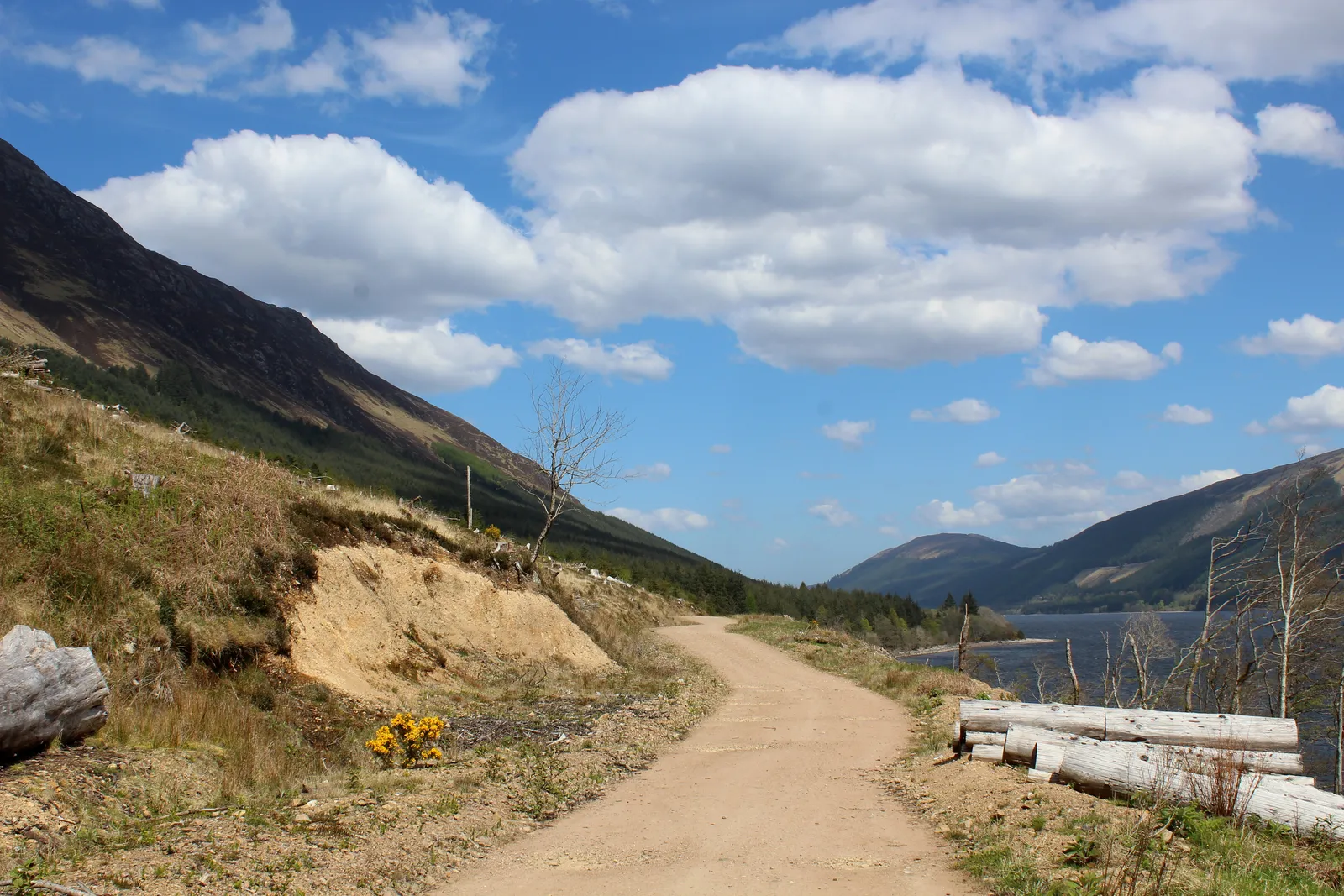
Photo: Chris Heaton, CC BY-SA 2.0, via Wikimedia Commons
- Distance
- 121 km (75 miles)
- Country
- Scotland
- Difficulty
- Moderate
- Type of trip
- Hiking trail
The Great Glen Way starts at the Old Fort in Fort William and ends at Inverness Castle. It follows the Great Glen on canal towpath, forest tracks, old drove roads and some minor roads, past Loch Lochy, Loch Oich and Loch Ness. The team that looks after it says it takes 4 to 7 days, and Scotland's Great Trails says 5 to 7. It's waymarked, and most people walk it south-west to north-east so the prevailing wind is behind them. The first two days out of Fort William are low and easy, mostly on towpath. After Fort Augustus it climbs and drops much more, and much of it is forest track, where you see the lochs at times rather than all day.
There are no permits or bookings for the route. You sleep in the villages along the glen. Gairlochy has little accommodation and no shop, so many people stay in Spean Bridge, 4.5 miles away, and some hosts will collect you. Most people split the long last stage at Abriachan or get a lift from halfway. Wild camping is legal under the Scottish Outdoor Access Code, and Scottish Canals has free pitches along the canal. Citylink buses between Fort William and Inverness stop along the glen.
Highlights along the way
- Neptune's Staircase: Near the start, eight locks lift Thomas Telford's Caledonian Canal, opened in 1822. It's the longest flight of locks on the canal, with views back to Ben Nevis.
- Loch Oich: Along the loch the path follows the old Spean Bridge to Fort Augustus railway, last used in 1947, and there's a small museum at the old Invergarry Station. Across the water are the ruins of Invergarry Castle, once the seat of the MacDonells of Glengarry.
- Acquisition Number 1: On the low route out of Fort Augustus you walk through the first site the Forestry Commission planted in Scotland, among huge Douglas firs and Sitka spruces.
- The high routes above Loch Ness: Between Fort Augustus and Drumnadrochit you can take a high route instead of the lower forest tracks. It's steep in places and reaches 420 m, with views over Loch Ness.
- Abriachan: This was the first community woodland in the UK bought from the Forestry Commission. The high route here reaches 434 m, the highest point of the walk.
Distance
The route's own section pages add up to about 121 km (75 miles) on the low routes. Scotland's Great Trails gives 125 km, with 1,835 m of climbing if you take the high routes and 1,230 m if you don't. There are six sections, from 11.7 km (7.3 miles) between Fort Augustus and Invermoriston to 30.2 km (18.8 miles) between Drumnadrochit and Inverness.
Best time to go
The route is open all year. Midges are at their worst from June to September, though it depends on the weather. Check the news page on greatglenway.com before you set off. In November 2026 the low route between Invermoriston and Alltsigh was closed for about six weeks from 2 November for forest road works, with a link track halfway along to the high route. A diversion along Loch Lochy, around the Coire Glas hydro scheme, is expected to stay until about 2030 and adds 600 m.
More journeys in Scotland
- Scotland West Coast Train · Greg
- Cycling the Hebridean Way · Simon & Lucy
- The History of the Sea · saeunn
- Highland Adventure · Nick
- Christmas Ski Trip To Les Arcs · Peter
Flyby films from Scotland
- The Great Escape · saeunn
- Mallaig..and Train Back To Glasgow! · Greg
- THE ATLANTIC · SY
- Mallaig to Fort William · Simon & Lucy
More routes like this
- Skye Trail · about 128 km (80 miles) · Scotland
- Rob Roy Way · 128 km (79 miles) · Scotland
- Pennine Way · about 431 km (268 miles) · England, Scotland
- Speyside Way · 137 km (85 miles) · Scotland
- John Muir Way · 215 km (134 miles) · Scotland
- Cape Wrath Trail · about 320 km (200 miles) · Scotland