Alps 2 Ocean Cycle Trail
- Distance
- 315 km (196 miles)
- Country
- New Zealand
- Difficulty
- Moderate
- Type of trip
- Cycling route
The Alps 2 Ocean Cycle Trail runs 315 km across the South Island of New Zealand, from the foot of Aoraki/Mount Cook to the harbour at Oamaru on the east coast. It’s one of Ngā Haerenga, the New Zealand Cycle Trail’s Great Rides, and the longest of them. The official start is White Horse Hill Campground, 2 km north of Aoraki/Mount Cook Village. Early on you take a short helicopter hop across the Tasman River from Mount Cook Airport, which you should book ahead and which depends on the weather and the river. To avoid it, start at Lake Tekapo instead: a 54 km section past hydro canals takes you to Twizel, where it joins the main trail.
Most riders allow five to seven days for the whole ride. Each night is in a town or lodge: Twizel, Lake Ohau Lodge, Omarama, Otematata, Kurow and Duntroon. Every section is graded easy (Grade 2) or intermediate (Grade 3). It mixes purpose-built trail with quiet country roads. InterCity buses stop in some of the towns, including Twizel and Oamaru. Local companies run shuttles and luggage transfers, which you should book in advance.
Highlights along the way
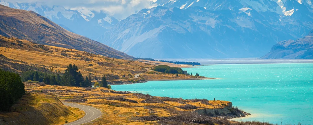
- Lake Pukaki: one of the turquoise lakes of the Mackenzie District, with Aoraki/Mount Cook behind you. At 3,724 m it’s New Zealand’s highest mountain.
- Tarnbrae high point: the top of the trail at 900 m, on the Lake Ohau to Omarama section, reached by a gradual climb from Lake Ohau Road. Earlier, between Twizel and Lake Ohau Lodge, the Ohau Weir crossing is closed to cyclists when water is spilling over it, so check for updates after wet weather.
- Waitaki hydro lakes: the trail follows the chain of lakes and dams down the Waitaki Valley, past Benmore, Aviemore and Waitaki dams.
- Takiroa and Elephant Rocks: Takiroa is a Māori rock art site. Elephant Rocks are huge limestone boulders scattered across a grassy paddock.
- Oamaru: the finish, with a Victorian harbour precinct built from the local white limestone known as Oamaru stone, and a little blue penguin colony in an old quarry.
Distance
315 km (about 196 miles) from Aoraki/Mount Cook to Oamaru. Starting at Lake Tekapo instead, the first leg to Twizel is 54 km.
If you have a GPX of this route from its official site or a planning app, open it in our free GPX viewer to see the distance, the climb and the height profile. The file stays on your device.
Best time to go
December to May is usually the best time. The trail is open all year, but winter weather and floods can close sections, so check the trail website for closures and detours before you go, and after any heavy rain.
More journeys in New Zealand
- Van Life In New Zealand · Nick
- Te Araroa · The long walk of Te Waipounamu
- Bikepacking Through NZ · Kate
Flyby films from New Zealand
- Sunday 15th · The long walk of Te Waipounamu
- Auckland-Santiago-Buenos Aires · Karen
- French Polynesia to Fiji · Adam
- North Island · Nick
More routes like this
- Otago Central Rail Trail by bike · 152 km (94 miles) · New Zealand
- Rheinradweg (Rhine Cycle Route in Germany) · about 1,019 km (633 miles) · Germany
- Elberadweg (Elbe Cycle Route) · 1,270 km (789 miles) · Germany, Czech Republic
- Werratal-Radweg by bike · about 300 km (186 miles) · Germany
- Camino del Cid by bike · about 1,485 km (923 miles) · Spain
- Via Claudia Augusta by bike · about 700 km (435 miles) · Austria, Italy, Germany