Elberadweg (Elbe Cycle Route)
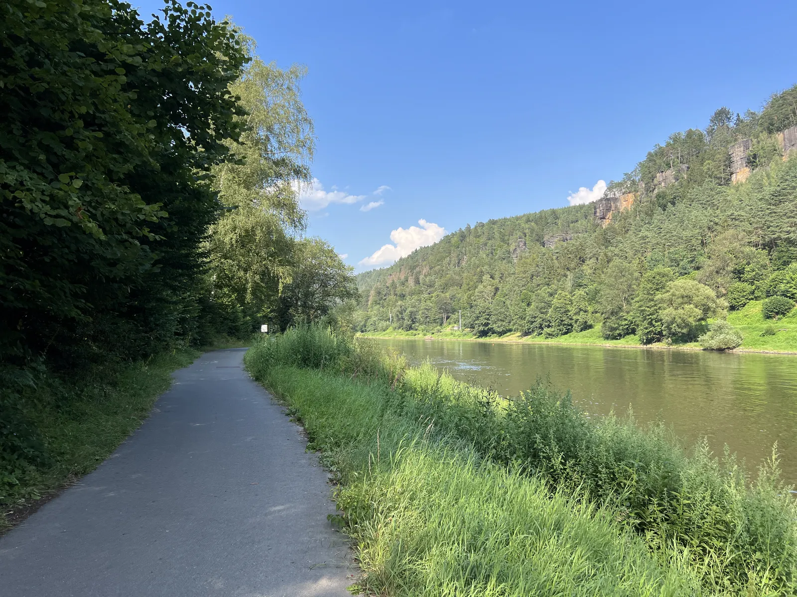
Photo: Lukas Beck, CC BY 4.0, via Wikimedia Commons
- Distance
- 1,270 km (789 miles)
- Countries
- Germany, Czech Republic
- Difficulty
- Easy
- Type of trip
- Cycling route
The Elberadweg follows the Elbe from the Krkonoše mountains in the Czech Republic to the North Sea at Cuxhaven. Most people ride only the German part, which is 840 km and starts at Schöna or Bad Schandau on the Czech border. From there the route runs through Saxon Switzerland to Dresden and Meißen, then on past Wittenberg, Dessau and Magdeburg, across the wide floodplains of the UNESCO Elbe River Landscape biosphere reserve, and through Hamburg and the Altes Land to Cuxhaven. The official site says to allow at least 14 days to ride the whole thing in one go, or to split it into two or three trips. You sleep in towns and villages along the river. There's nothing to book or pay for the route itself.
The Czech part, about 370 km from Špindlerův Mlýn, is signed in yellow as route 2. Wikivoyage calls it beautiful but demanding, and in worse shape than the German side. In Germany one sign is used the whole way. South of Magdeburg it's mostly tarmac with short cobbled stretches and the odd hill between Bad Schandau and Riesa. North of Magdeburg it's more than 90% flat, with hills only on the high banks in the Wendland and between Lauenburg and Hamburg. Where there's a path on both banks you can pick your side, and ferries link them. The wind usually comes from the west or north-west, so Wikivoyage suggests riding upstream if you're not used to long days.
Highlights along the way
- Saxon Switzerland: The first 53 km from Schöna to Dresden run between sandstone cliffs. Königstein, with its fortress, is at km 14, and Rathen at km 20 is where you leave the bike for the Bastei.
- Meißen: Meißen is 28 km past Dresden, among steep vineyards, and a little further on there's a ferry at Diesbar-Seußlitz.
- Wörlitz and Dessau: Between Wörlitz and Dessau the route follows the Fürst-Franz-Weg for 16 km through the Garden Realm, on a very good path. Dessau has the Bauhaus, and Wittenberg, the Luther town, is a short day upstream.
- Tangermünde and Jerichow: North of Magdeburg, Tangermünde has a historic old town and a bridge with a cycle path. Across the river, Jerichow has a brick-built monastery with a museum.
- Altes Land and Cuxhaven: From Hamburg's Landungsbrücken, ferry line 62 takes you to Finkenwerder for the left bank through the Altes Land, one of Europe's biggest fruit-growing areas. The last 2 km into Cuxhaven run along the beach, and the Kugelbake beacon that marks the end of the Elbe can only be reached on foot.
Distance
The official site gives about 1,270 km (789 miles) from the source to the sea, including the detour to Prague, and rounds it up to 1,300 km on its home page. The German part is 840 km (522 miles). Over the whole route you climb about 2,150 m and drop about 2,270 m.
Best time to go
There's no official season, but a few things change through the year. Many Elbe ferries stop when the water is low, and some stop for the winter; in 2026 the Neu-Darchau ferry was listed as out of service from 27 July to 10 November because of low water. Below Hamburg on the right bank, the sluice gates on the Pinnau and Krückau are closed to bikes from 1 October to 30 April, which adds about 25 km. As of 3 November 2026 the official site listed more than a dozen diversions, including flood-protection work at Boizenburg until 31 March 2027, so check the page of roadworks, diversions and ferry outages at elberadweg.de before you go.
More journeys in Germany, Czech Republic
- Cycle Exped to Japan via Finland · Mark
- The Great Spirits Route · johan
- UK to Georgia by Bike · Simon & Lucy
- Denmark! · Christopher
- Istanbul To Ashby · Harry
- Beer hike · Christopher
Flyby films from Germany, Czech Republic
- Dag 8: Schongau - Innsbruck · johan
- Stuttgart-Amsterdam · JereFü
- St Malo to Vienna · Lucy
- The Start · Christopher
More routes like this
- EuroVelo 7 – Sun Route by bike · about 7,650 km (4,753 miles) · Austria, Czech Republic, Denmark, Germany, Italy, Malta, Norway, Sweden, Finland
- Moselradweg (Mosel Cycle Path) · about 311 km (193 miles) · Germany, Luxembourg, France
- North Sea Cycle Route in Germany (Nordseeküstenradweg) · about 900 km (560 miles) · Germany
- Romantische Straße by bike · about 500 km (310 miles) · Germany
- Rhine Cycle Route (EuroVelo 15) · about 1,233 km (766 miles) · France, Germany, Netherlands, Switzerland, Austria, Liechtenstein
- EuroVelo 6 - France to Romania by bike · about 4,700 km (2,900 miles) · Austria, France, Germany, Hungary, Romania, Switzerland, Slovakia, Croatia, Serbia, Bulgaria