Kumano Kodo on foot
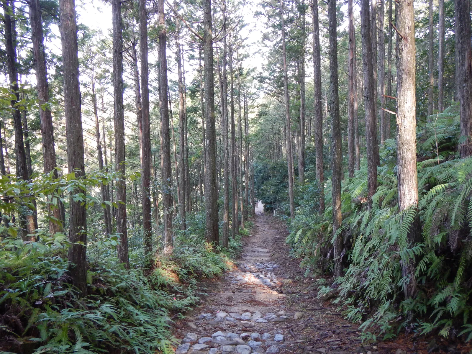
Photo: Nekosuki, CC BY-SA 4.0, via Wikimedia Commons
- Distance
- about 38 km (24 miles)
- Country
- Japan
- Difficulty
- Moderate to challenging
- Type of trip
- Hiking trail
The Kumano Kodo is a network of old pilgrim trails on the Kii Peninsula in Wakayama, leading to the three Grand Shrines of Kumano. The Nakahechi is the main route. The Tanabe City Kumano Tourism Bureau calls it the imperial route, as emperors and courtiers walked it from the 11th century. It starts at Takijiri-oji, inland from Tanabe, and crosses forested mountains for about 38 km to Kumano Hongu Taisha. The bureau splits that into two full days. Two harder mountain sections then carry on to Kumano Nachi Taisha. The trails became part of a UNESCO World Heritage site in 2004.
You sleep in small villages along the way, and local buses link them. Turning up without a booking isn't normal in Japan, and if nobody has booked, some places don't prepare meals or don't open at all, so book ahead. There's a daily luggage shuttle. Signs and maps are in English. Only walking is allowed, not bikes or horses. Walk from Takijiri-oji to Hongu, and at least the last 100 km of the Camino de Santiago on foot, and you can register as a Dual Pilgrim.
Highlights along the way
- Takijiri-oji: The old entrance to the sacred area of Kumano, beside the Tonda River. The Kumano Kodo Kan Pilgrimage Center next door has a small exhibition about the route and gives out the free Dual Pilgrim credential.
- Hosshinmon-oji: One of the oji, the small shrines that mark the way. The 7 km from here to Kumano Hongu Taisha is the most popular half-day walk.
- Kumano Hongu Taisha: The head shrine of more than 3,000 Kumano shrines in Japan, at the top of a long stone staircase among cedar and cypress. It stood on the Oyunohara sandbank until a flood in 1889. The steel torii there, put up in 2000, is 33.9 m tall.
- Ogumotori-goe: The bureau calls it one of the toughest sections. Out of Koguchi the Dogiri-zaka, the 'body-breaking slope', climbs 800 m in about 5 km.
- Kumano Nachi Taisha: The shrine sits about 350 m up Mount Nachi next to Nachi-no-Otaki, which at 133 m is the tallest waterfall in Japan.
Distance
About 38 km (24 miles) from Takijiri-oji to Kumano Hongu Taisha, which most people walk in two days. Takijiri-oji to Tsugizakura-oji is about 17 km (10.6 miles) and takes 7 to 10 hours. Tsugizakura-oji to Kumano Hongu Taisha is about 21 km (13 miles), 8 to 11 hours. The bureau gives about 30 km (19 miles) between Hongu and Nachi. That's the Kogumotori-goe, about 13 km (8 miles) from Ukegawa, half an hour along the road from Hongu, to Koguchi, and then the Ogumotori-goe, about 14 km (8.5 miles) from Koguchi to Nachi with about 1,260 m of climbing.
Best time to go
The Nakahechi is open all year. The south of the Kii Peninsula is mostly mild. Winter can bring frosts, and snow falls now and then on the high ground but melts quickly. Summers are often hot and humid. Spring and autumn are the busy seasons, when buses can be crowded or full, so book early. It rains a lot here in any season, so pack for it. Landslides and typhoons sometimes close trails and roads, and typhoons can stop trains too. The bureau lists detours and closures on its tips page at tb-kumano.jp. Winter days are short and the valleys get dark early, so set off in good time.
More journeys in Japan
- Japan 2026 · David
- Japan Bike: Nagasaki to Nemuro · St John
- Japan Adventure · Keith & Frances
Flyby films from Japan
- Nagusa Itsukushima Shrine Loop · Gio Brecci
- Ashikaga Hills Loop · Gio Brecci
- Hiking Day: Mount Yakedake · David
More routes like this
- Nakasendo Trail · 8 km (5 miles) · Japan
- Overland Track · 65 km (40 miles) · Australia
- Austrian Way of St James · about 750–800 km (466–497 miles) · Austria, Germany
- Camino from Sarria · 114 km (71 miles) · Spain
- Westerborkpad on foot · about 340 km (211 miles) · Netherlands
- Dales Way · 128 km (80 miles) · England