Wild Atlantic Way by bike
- Distance
- about 2,500 km (1,550 miles)
- Country
- Ireland
- Difficulty
- Challenging
- Type of trip
- Cycling route
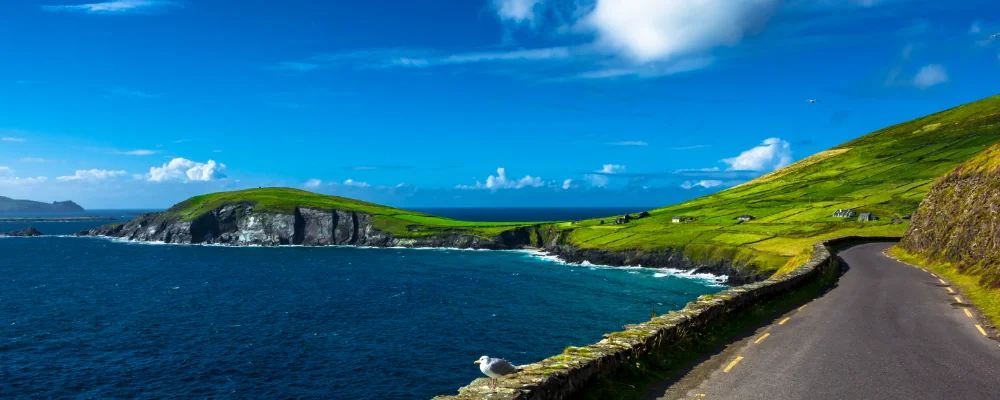
The Wild Atlantic Way is a signed coastal driving route of about 2,500 km down the west coast of Ireland, set up by Fáilte Ireland in 2014. It officially starts at Muff on the Inishowen Peninsula in County Donegal, passes Malin Head, and ends in Kinsale, County Cork, taking in nine counties from Donegal to Cork. It wasn’t designed as a cycle route, but plenty of cyclists ride it, or sections of it. Fáilte Ireland’s own cycling version is about 1,600 km in 13 stages, from Malin Head to the Old Head of Kinsale.
Much of the road line is chosen for cars. EuroVelo 1, the Atlantic Coast Route, covers the same coast on smaller and quieter roads where it can, and its Irish section is effectively the cycling alternative. Greenways give you some traffic-free stretches, one of the longest being the Great Western Greenway in Mayo. Expect wind and rain in any month: the prevailing wind is from the south and west, and the west of Ireland gets 1,000 to 1,400 mm of rain a year, more in the mountains.
Highlights along the way
- Malin Head: the most northerly point of mainland Ireland, at the tip of Inishowen. Fáilte Ireland’s cycle route starts here.
- Sliabh Liag (Slieve League): a 601 m mountain in south-west Donegal with some of the highest sea cliffs in Europe.
- Great Western Greenway: a traffic-free trail of about 49 km, mostly on an old railway line, from Westport through Newport and Mulranny to Achill, along Clew Bay. Achill, the largest of Ireland’s offshore islands, is joined to the mainland by a bridge.
- Cliffs of Moher: about 14 km of sea cliffs on the edge of the Burren in County Clare, reaching 214 m just north of O’Brien’s Tower.
- Mizen Head: the most south-westerly point of Ireland, at the end of the Mizen Peninsula in West Cork, a day’s ride from the finish at Kinsale.
Distance
About 2,500 km (1,550 miles) for the full driving route from Muff to Kinsale. Fáilte Ireland’s suggested cycle route is about 1,600 km, in stages of 80 to 160 km. EuroVelo 1 in Ireland is a separate route of about 2,500 km from Rosslare Harbour, which also takes in the south coast and carries on past Derry/Londonderry to Belfast.
If you have a GPX of this route from its official site or a planning app, open it in our free GPX viewer to see the distance, the climb and the height profile. The file stays on your device.
Best time to go
May to September, for the longest days. April and May are the driest months on average; December is the wettest. Wind is the main thing to plan around, and it can blow hard on exposed headlands in any month.
Journeys that follow this route
On part of the route or all of it.
- Ireland To Home. · Phil · 182 km of the route
More journeys in Ireland
- Euro Trip 2024 · mmalty
- The Rick Trip · Phil
Flyby films from Ireland
- Heading back to France · Phil
- Glenveagh National Park Day Trip · Phil
- THE ATLANTIC · SY
More routes like this
- Atlantic Coast Route – EuroVelo 1 by bike · about 11,000 km (6,835 miles) · England, France, Ireland, Norway, Portugal, Scotland, Spain, Wales, Northern Ireland
- Carretera Austral by bike · about 1,240 km (770 miles) · Chile
- Death Road by bike · about 64 km (40 miles) · Bolivia
- Great Ocean Road by bike · about 240 km (150 miles) · Australia
- ViaRhôna by bike · about 815 km (506 miles) · France, Switzerland
- Alpe-Adria Cycle Path · about 410 km (255 miles) · Austria, Italy