Lechweg on foot
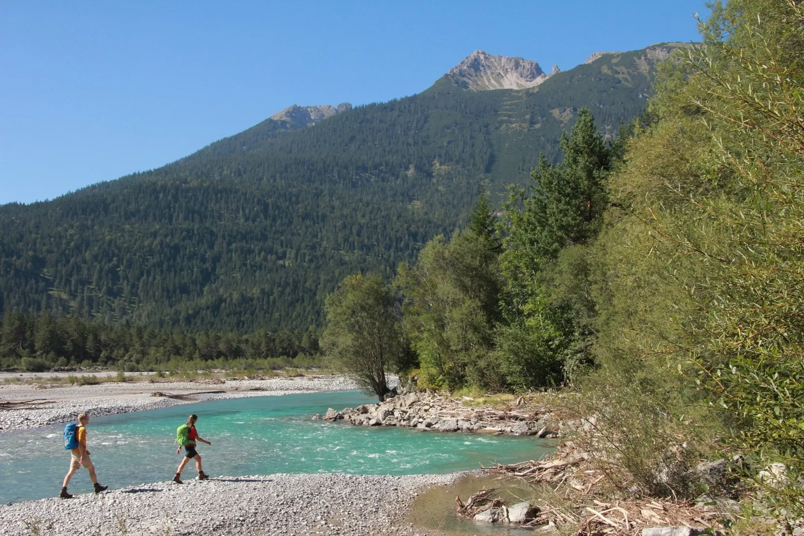
Photo: Gerhard Eisenschink, CC BY-SA 4.0, via Wikimedia Commons
- Distance
- about 125 km (78 miles)
- Countries
- Austria, Germany
- Difficulty
- Moderate
- Type of trip
- Hiking trail
The Lechweg follows the river Lech for about 125 km, from the Formarinsee above Lech am Arlberg in Vorarlberg, down the Lechtal in Tyrol and past Reutte, to the Lechfall in Füssen in Bavaria. The official site suggests 7 days if you're fit, 8 at an easier pace or 10 if you want to take your time. It's split into 15 sections, so you can plan your own days, and it's signed in both directions. You sleep in the villages, in hotels and guesthouses. July and August are high season, so book ahead. There are campsites only at Häselgehr, Vorderhornbach, Reutte and Füssen, and wild camping is against the law.
It opened on 15 June 2012 and carries the European Ramblers' Association label Leading Quality Trails – Best of Europe. The waymark is a white L on a dark grey background, never more than about 250 m apart. The official site calls it a moderate trail through an alpine region, and points out that moderate doesn't mean a stroll. It isn't a bike route. Mountain bikes aren't welcome on it, and cyclists have the separate Lech-Radweg from Füssen and Reutte up to Steeg.
Highlights along the way
- Formarinsee: The walk starts at 1,793 m, where the walkers' bus from Lech stops. Near the lake the Formarinbach rises, and a few kilometres on it meets the Spullerbach to become the Lech. You pass a monument to the ibex brought back here in 1958, and the official site puts the colony at about 600 animals.
- The Holzgau suspension bridge: A footbridge 200 m long and 110 m above the ground. It's an option for people with a head for heights. The main route goes up the Höhenbachtal past the Simmswasserfall instead.
- Elbigenalp: A woodcarving village and the birthplace of Anna Stainer-Knittel, the painter known as the Geierwally. From here the path runs right beside the river to Häselgehr.
- The wild river below Stanzach: Between Stanzach and Weißenbach you walk on the gravel banks of the Lech, which the official site calls one of the last wild river landscapes in Europe. It's the stretch it suggests for children.
- Alpsee and the Lechfall: The last section leaves the Lech, crosses the Kniepass into Bavaria and comes to the Alpsee, with views of Hohenschwangau and Neuschwanstein. It finishes over the Kalvarienberg and down to the Lechfall in Füssen.
Distance
About 125 km (78 miles) from the Formarinsee to the Lechfall. On the 7-day plan the days run from 10.7 km to 24.8 km, and the last day, Wängle to Füssen, is the hardest at about 10 hours with 651 m of climbing. Wikipedia gives a start at about 1,800 m and a finish at about 800 m, so it's mostly downhill, though there's climbing most days. To get back to the start, the bus from Füssen to Lech takes just under 3 hours with a change at Reutte, and the official site says the last one leaves at about 14:00.
Best time to go
The whole route is open from mid or late June to early October. Before that expect old snow between the Formarinsee and Warth. Places to stay in Lech and Warth open at the start of the season, and the Formarinsee bus only runs from the third weekend in June. In 2026 the full route opened on 18 June. In May and October the official site suggests a shorter spring version from Steeg to Füssen. Check diversions and closures on lechweg.com before you go.
More journeys in Austria, Germany
- Cycle Exped to Japan via Finland · Mark
- UK to Georgia by Bike · Simon & Lucy
- St Malo- Vienna- ...? · Lucy
- The Great Spirits Route · johan
- Istanbul To Ashby · Harry
- Greece - Sweden · Giorgos
Flyby films from Austria, Germany
- Day 18 · Giorgos
- Dag 8: Schongau - Innsbruck · johan
- Stuttgart-Amsterdam · JereFü
- St Malo to Vienna · Lucy
More routes like this
- Munich to Venice on foot (Traumpfad) on foot · about 550 km (340 miles) · Germany, Austria, Italy
- Via Alpina on foot · 2,000 km (1,240 miles) · Slovenia, Italy, Austria, Germany, Switzerland, Liechtenstein, France, Monaco
- E5 from Oberstdorf to Meran on foot · about 120 km (75 miles) · Germany, Austria, Italy
- Austrian Way of St James · about 750–800 km (466–497 miles) · Austria, Germany
- Jakobsweg on foot · about 770 km (480 miles) · Germany, Spain, France, Austria
- Pfälzer Weinsteig on foot · about 172 km (107 miles) · Germany