Rheinsteig on foot
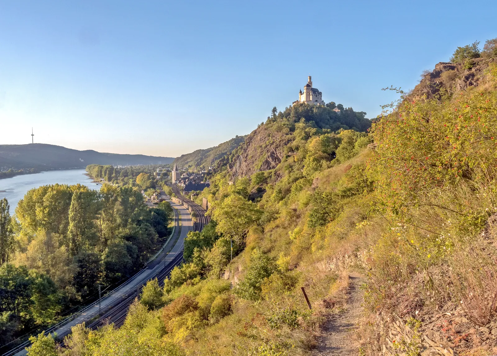
Photo: Rolf Kranz, CC BY-SA 4.0, via Wikimedia Commons
- Distance
- about 320 km (199 miles)
- Country
- Germany
- Difficulty
- Moderate
- Type of trip
- Hiking trail
The Rheinsteig follows the right bank of the Rhine for about 320 km, from the market square in Bonn to Schloss Biebrich in Wiesbaden. It crosses the Siebengebirge, goes round the Neuwied basin and through Koblenz-Ehrenbreitstein, then follows the Upper Middle Rhine Valley, a UNESCO World Heritage Site, to Rüdesheim. The last part runs along the top of the Rheingau vineyards and loops into the Taunus past Kloster Eberbach and Schlangenbad. It mostly stays high, near the edge of the valley, and keeps dropping into side valleys and climbing out again, on narrow paths and steep, rocky sections. The official stage list has 21 stages walking north to south, but they're only suggestions.
Almost every village in the valley has a railway station, and every place on the route has public transport, so it's easy to walk it in day stages or a few days at a time. Yellow-marked link paths lead from stations and village centres up to the main trail, which is marked with a white R on blue. You sleep in hotels and guesthouses in the towns along the river; the certified Rheinsteig partner hosts offer luggage transfer, shuttles and packed lunches. It opened on 8 September 2005 and has held the German Hiking Institute's Premium trail seal since 2006. It's a footpath: cycling and riding aren't allowed on its narrow sections.
Highlights along the way
- Drachenfels: In the Siebengebirge, south of Bonn. The castle ruin on top sits at 321 m, about 270 m above the river.
- Festung Ehrenbreitstein: The Prussian fortress built between 1817 and 1828 above Koblenz, opposite the point where the Moselle meets the Rhine.
- Marksburg: The 13th-century castle above Braubach is the only medieval hilltop castle on the Middle Rhine that was never destroyed. The stage south from Braubach is one of two the trail rates as hard.
- Loreley: A 132 m slate cliff at St. Goarshausen, at the deepest and narrowest point of the Middle Rhine. The next stage, to Kaub, is 21.8 km and takes about 7 hours.
- Niederwalddenkmal: The 38 m Germania monument above Rüdesheim, built between 1877 and 1883, marks the end of the 20.5 km stage from Lorch.
Distance
About 320 km (199 miles) in all, from Bonn to Wiesbaden. The 21 suggested stages are 8.4 to 23.8 km (5 to 15 miles), the longest being the first, from Bonn to Königswinter, at about 7 hours. German Wikipedia puts the total climbing at 11,700 m.
Best time to go
The Rheinsteig doesn't name a best season. Its safety notes warn that the paths get muddy and slippery in bad weather, that fallen leaves in autumn hide roots, stones and holes, and that there isn't always somewhere to eat or drink, so carry water. In 2026 Deutsche Bahn closed the railway on the right bank between Troisdorf and Wiesbaden for rebuilding from 10 July to 12 December, with replacement buses, so check how you'll get to and from each stage. Notices about closures and diversions are on each stage's page on rheinsteig.de.
More journeys in Germany
- Cycle Exped to Japan via Finland · Mark
- The Great Spirits Route · johan
- UK to Georgia by Bike · Simon & Lucy
- Denmark! · Christopher
- Istanbul To Ashby · Harry
- Beer hike · Christopher
Flyby films from Germany
- Dag 8: Schongau - Innsbruck · johan
- Stuttgart-Amsterdam · JereFü
- St Malo to Vienna · Lucy
- The Start · Christopher
More routes like this
- Westweg on foot · about 285 km (177 miles) · Germany
- Munich to Venice on foot (Traumpfad) on foot · about 550 km (340 miles) · Germany, Austria, Italy
- Lechweg on foot · about 125 km (78 miles) · Austria, Germany
- Altmühltal-Panoramaweg on foot · about 200 km (124 miles) · Germany
- Albsteig (HW1) on foot · about 360 km (224 miles) · Germany
- Marskramerpad on foot · about 372 km (231 miles) · Netherlands, Germany