Saar-Hunsrück-Steig on foot
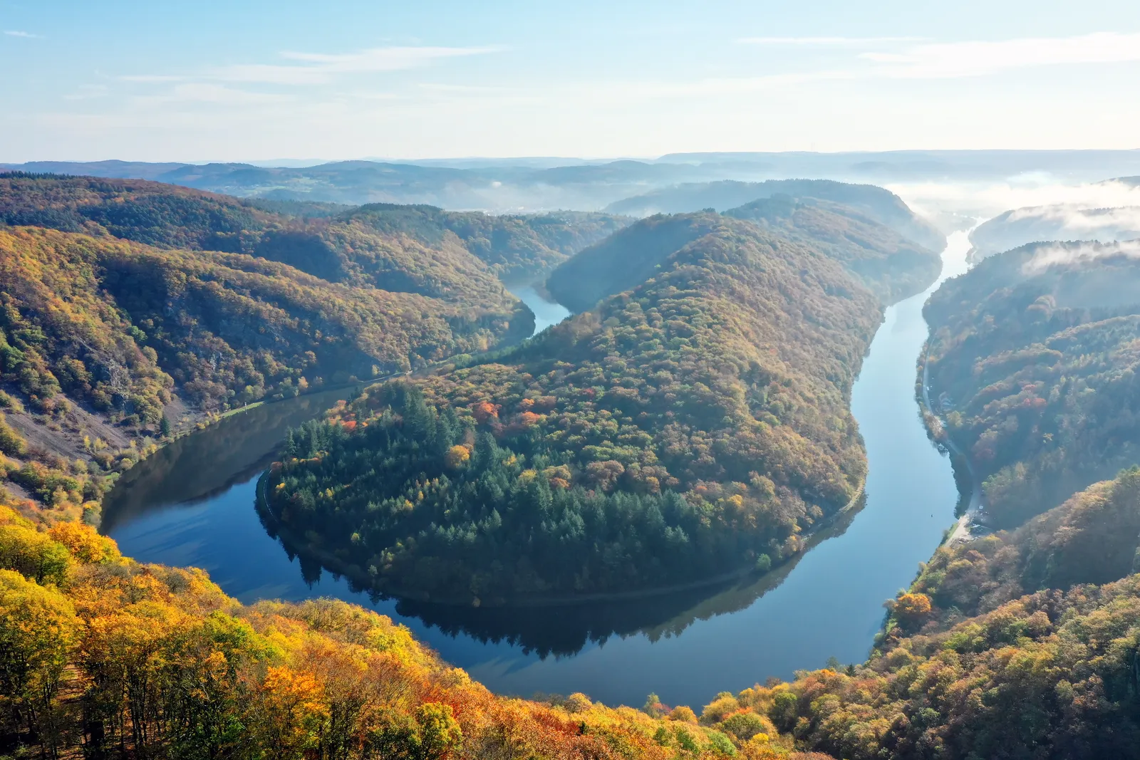
Photo: Pascal Dihé, CC BY-SA 4.0, via Wikimedia Commons
- Distance
- about 415 km (258 miles)
- Country
- Germany
- Difficulty
- Moderate
- Type of trip
- Hiking trail
The Saar-Hunsrück-Steig starts in Perl, on the Moselle where Germany meets Luxembourg and France, and crosses the Saar-Hunsrück Nature Park from the Saarland into Rhineland-Palatinate. It passes the Saar loop at Mettlach, goes by Hermeskeil and through the Hunsrück-Hochwald National Park, drops to Idar-Oberstein on the Nahe and carries on over the Hunsrück to Boppard on the Rhine. A branch from the Grimburg goes to Trier instead. The official figure is about 415 km, split into 27 stages. It's mostly forest, open high ground and stream valleys; German Wikipedia says only 5% is on tarmac and more than 70% on natural paths.
It opened in 2007 and grew in steps: two stages from the Saar loop to Perl were added in 2012, and the stretch from Idar-Oberstein to Boppard in 2015. It holds the German Hiking Institute's Premium trail seal with 69 points, the highest score of any long-distance trail it has certified. The trail logo marks it all the way, signposts show both directions, and orange signs lead off on link paths to the nearest village. Wardens check the signs at least four times a year. You sleep in hotels, holiday flats and a few trekking camps, and the trail office sells packages with accommodation. Around it are more than 110 Traumschleifen, waymarked circular walks.
Highlights along the way
- Saarschleife and the Cloef: The Saar makes a loop of nearly 10 km round a wooded ridge, though its two ends are only about 2 km apart. The Cloef viewpoint at Orscholz sits 180 m above the river, on stage 2 before you drop down to Mettlach.
- Ringwall von Otzenhausen: On stage 9 from Nonnweiler you pass this Celtic hill fort, begun around the 5th to 4th century BC. Its wall is 2.5 km long and still up to 10 m high.
- Idar-Oberstein: Stage 12 ends in the town. The Felsenkirche, built between 1482 and 1484, stands on the foundations of an old cave castle, under a rock face above the Oberstein quarter, and you get in through a tunnel cut in 1980 and 1981. Stage 13 leaves on the Felsenpfad, a rock path.
- Geierlay: Stage 19 ends at Mörsdorf, next to this suspension footbridge over the Mörsdorfer Bachtal. It's 360 m long and up to almost 100 m above the ground, and it opened on 3 October 2015.
- Baybachklamm and Ehrbachklamm: Near the end, stage 22 follows the Baybach through a gorge lined with high rocks, and stage 23 passes the Ehrenburg into the Ehrbachklamm. The last day looks down into the Rhine valley before Boppard, where the trail meets the RheinBurgenWeg.
Distance
About 415 km (258 miles) in all by the official figure, which includes the branch to Trier; German Wikipedia says 410 km (255 miles). Wikipedia's 24 stages from Perl to Boppard add up to about 380 km (236 miles), at 10 to 23.5 km (6 to 15 miles) each, and its three stages from the Grimburg to Trier to about 43 km (27 miles).
Best time to go
The trail office doesn't name a best season, but warns that in winter the higher parts can be impassable with snow and ice. When a section is shut, for example for tree felling, a diversion or closure is signed on the ground. The Hunsrück's highest hill, the Erbeskopf at 816 m, gives its name to Thalfang am Erbeskopf on stage 10, and German Wikipedia says its winters are still snowy in many years. The Geierlay bridge closes in storms and thunderstorms. Check saar-hunsrueck-steig.de before you go.
More journeys in Germany
- Cycle Exped to Japan via Finland · Mark
- The Great Spirits Route · johan
- UK to Georgia by Bike · Simon & Lucy
- Denmark! · Christopher
- Istanbul To Ashby · Harry
- Beer hike · Christopher
Flyby films from Germany
- Dag 8: Schongau - Innsbruck · johan
- Stuttgart-Amsterdam · JereFü
- St Malo to Vienna · Lucy
- The Start · Christopher
More routes like this
- Pfälzer Weinsteig on foot · about 172 km (107 miles) · Germany
- Harzer Hexenstieg on foot · about 94 km (58 miles) · Germany
- Westweg on foot · about 285 km (177 miles) · Germany
- Malerweg on foot · about 116 km (72 miles) · Germany
- E5 from Oberstdorf to Meran on foot · about 120 km (75 miles) · Germany, Austria, Italy
- Lechweg on foot · about 125 km (78 miles) · Austria, Germany