Harzer Hexenstieg on foot
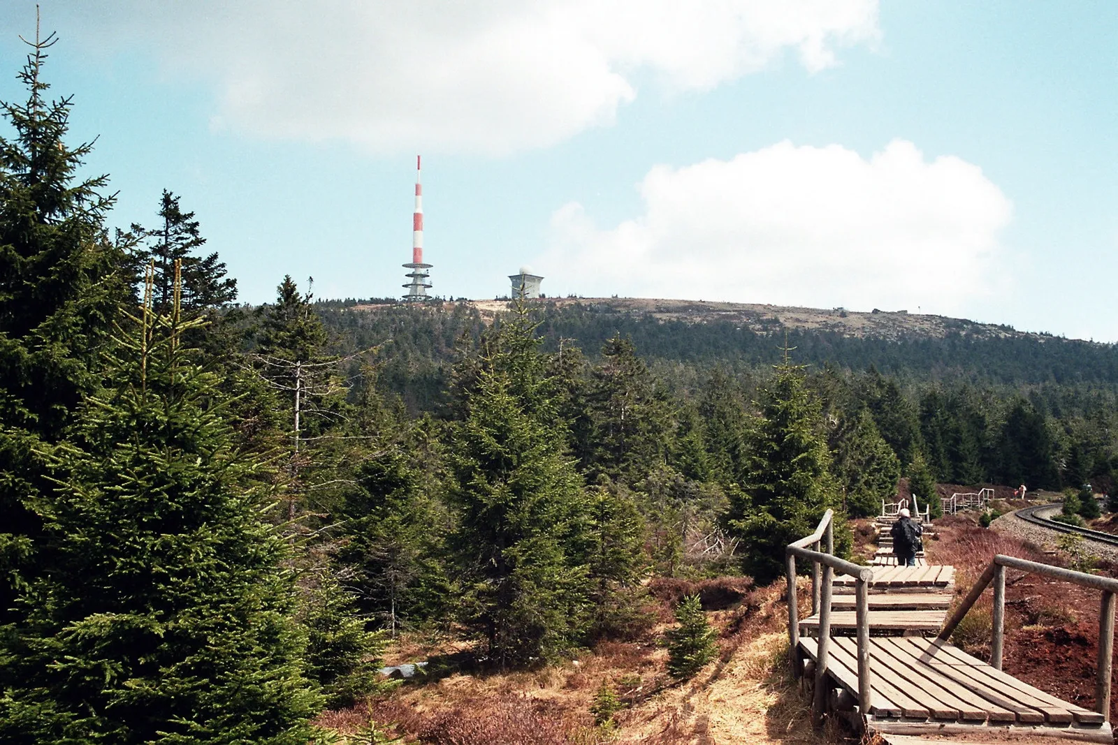
Photo: Dguendel, CC BY 3.0, via Wikimedia Commons
- Distance
- about 94 km (58 miles)
- Country
- Germany
- Difficulty
- Moderate
- Type of trip
- Hiking trail
The Harzer Hexenstieg, the Harz Witches' Trail, crosses the Harz from west to east, from Osterode to Thale. The direct route is 94 km and goes over the Brocken, the highest hill in northern Germany. At Torfhaus you can take the main route up the Goetheweg or a bypass round the Brocken through St. Andreasberg and Braunlage. Further east there's a second choice at Königshütte, past Rübeland or past the Rappbode reservoir and through Hasselfelde. The tourist board recommends five stages of around 20 km, and you sleep in hotels and guesthouses in the villages on the way.
The Harzklub, the Harz National Park and the Harz tourist board run it together. It's a certified Qualitätsweg Wanderbares Deutschland, and between Altenau and Drei Annen Hohne it's inside the national park. There are 28 stamping points for the Harzer Wandernadel, the Harz walking badge, along the way. The name comes from the witch legends of the Brocken and the Hexentanzplatz above Thale. The Bode gorge section at the end is closed for part of the year.
Highlights along the way
- Upper Harz ponds and ditches: The first two stages follow the old mining ponds around Buntenbock and the Dammgraben ditch. They are part of the Upper Harz Water Management System, a UNESCO World Heritage Site since 2010, and swimming is allowed in many of the ponds.
- Goetheweg: Stage 3, 19.9 km from Torfhaus to Drei Annen Hohne, climbs to the Brocken on the Goetheweg, past moorland and partly alongside the narrow-gauge Brocken railway, which has run to the top since 1899.
- Brocken: At 1,141 m it's the highest point in northern Germany and the top sits above the natural tree line. It has fog on more than 300 days a year on average, so don't count on a view.
- Rappbodetalsperre: On stage 4 you pass the reservoir system of the Rappbode. Its main dam, at 106 m the highest in Germany, holds back the country's largest drinking-water reservoir.
- Bodetal: The last stage, 14.2 km from Altenbrak to Thale, follows the Bode through a gorge about 10 km long and up to 280 m deep, past the Bodekessel and the Teufelsbrücke.
Distance
About 94 km (58 miles) on the direct route from Osterode over the Brocken to Thale. With the bypass round the Brocken it's 107 km (66 miles). The five stages are 11.6 to 30.3 km (7 to 19 miles); stage 4, from Drei Annen Hohne to Altenbrak, is the long one at 29 km (18 miles) by Rübeland or 30.3 km (19 miles) by Hasselfelde.
Best time to go
The Brocken has short, cool summers and long winters, with snow lying on 178 days a year on average, so expect rough weather on stage 3 even outside winter. From November to March the path through the Bode gorge between Treseburg and Thale is closed because of the risk of falling rock, and the signed diversion goes up past the Hexentanzplatz instead. Forestry work and storm or ice damage can close other sections at short notice, so check the current notices on the Harzer-Hexen-Stieg pages of harzinfo.de before you go.
More journeys in Germany
- Cycle Exped to Japan via Finland · Mark
- The Great Spirits Route · johan
- UK to Georgia by Bike · Simon & Lucy
- Denmark! · Christopher
- Istanbul To Ashby · Harry
- Beer hike · Christopher
Flyby films from Germany
- Dag 8: Schongau - Innsbruck · johan
- Stuttgart-Amsterdam · JereFü
- St Malo to Vienna · Lucy
- The Start · Christopher
More routes like this
- Altmühltal-Panoramaweg on foot · about 200 km (124 miles) · Germany
- Schluchtensteig on foot · 119 km (74 miles) · Germany
- Eifelsteig trail · about 313 km (195 miles) · Germany
- Hermannsweg on foot · about 163 km (101 miles) · Germany
- Rennsteig on foot · 169 km (105 miles) · Germany
- Malerweg on foot · about 116 km (72 miles) · Germany