Malerweg on foot
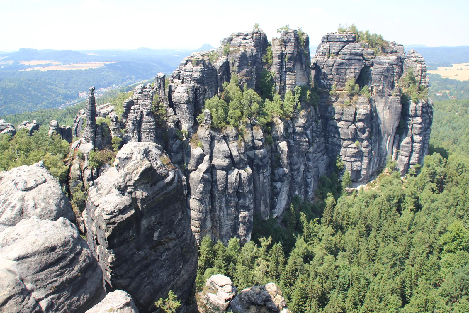
Photo: Geoprofi Lars, CC BY-SA 4.0, via Wikimedia Commons
- Distance
- about 116 km (72 miles)
- Country
- Germany
- Difficulty
- Moderate to challenging
- Type of trip
- Hiking trail
The Malerweg, or Painters' Way, is a walk through the Elbe Sandstone Mountains in Saxon Switzerland, a short train ride from Dresden. It starts in the Liebethaler Grund near Pirna, heads through the rocks of the Saxon Switzerland National Park almost to the Czech border, crosses the Elbe at Schmilka and comes back along the left bank, over the table mountains, to the old town of Pirna. It's about 116 km. The tourist board splits it into eight stages of 11 to 18 km, one a day. That doesn't sound much, but there are a lot of steps and iron ladders, and the longest days take around seven hours of walking without breaks.
It opened and was waymarked in 2006, and it roughly follows the route that travellers and the painters who came with them took until the middle of the 19th century. A letter M marks it in both directions. You sleep in guesthouses and hotels, many of them happy to take one-night bookings and help with moving your bags. Book ahead, especially from May to October. You can also stay in one place and use buses and trains to reach each stage. Wild camping isn't allowed. It's a walking route only, with no stage you can ride on a bike.
Highlights along the way
- Uttewalder Felsentor: On the first day, about 9 km in, the path goes through this rock arch in the Uttewalder Grund, which Caspar David Friedrich painted.
- Bastei: Stage 2 crosses the Basteibrücke, a stone bridge built into the rocks high above the Elbe. The rock castle next to it, the Felsenburg Neurathen, has been closed for safety reasons until further notice (as of late October 2026).
- Schrammsteine and the Kuhstall: Stage 4, at 18.3 km the longest, climbs iron ladders to the Schrammstein ridge path, with a short detour to the Schrammsteinaussicht. Later the same day you reach the Kuhstall, a rock arch 11 m high and 17 m wide.
- Großer Winterberg and the Kaiserkrone: At 556 m the Großer Winterberg on stage 5 is the highest point of the walk. Stage 6 passes the Kaiserkrone, the rocks Friedrich used for his Wanderer above the Sea of Fog.
- Papststein and Königstein: Stage 6 climbs the table mountains Papststein (451 m), which has an inn on top, and Gohrisch, both with iron ladders that you can walk round. Stage 7 goes to the foot of the Festung Königstein, one of the largest hilltop fortresses in Europe; allow 2 extra hours to look round it.
Distance
About 116 km (72 miles) in all. When the route opened the figure given was 112 km (70 miles), of which 68 km (42 miles) is on the right bank of the Elbe as far as Schmilka and 44 km (27 miles) on the left bank. The eight stages are 11 to 18 km (7 to 11 miles) each. Plan by the walking times on the signposts rather than the distance.
Best time to go
The tourist board says the Malerweg can be walked almost all year. The Großer Winterberg is only 556 m high, so snow isn't guaranteed in winter, but put the walk off in deep snow, ice or after a big storm, and check that your guesthouses are open between November and Easter. In late October 2026 there were diversions on stages 2, 3 and 5 after storm damage and dead spruce trees, the longest adding about 2 km; check the current notices on saechsische-schweiz.de before you go.
More journeys in Germany
- Cycle Exped to Japan via Finland · Mark
- The Great Spirits Route · johan
- UK to Georgia by Bike · Simon & Lucy
- Denmark! · Christopher
- Istanbul To Ashby · Harry
- Beer hike · Christopher
Flyby films from Germany
- Dag 8: Schongau - Innsbruck · johan
- Stuttgart-Amsterdam · JereFü
- St Malo to Vienna · Lucy
- The Start · Christopher
More routes like this
- Via Alpina on foot · 2,000 km (1,240 miles) · Slovenia, Italy, Austria, Germany, Switzerland, Liechtenstein, France, Monaco
- Albsteig (HW1) on foot · about 360 km (224 miles) · Germany
- Marskramerpad on foot · about 372 km (231 miles) · Netherlands, Germany
- Hermannsweg on foot · about 163 km (101 miles) · Germany
- Harzer Hexenstieg on foot · about 94 km (58 miles) · Germany
- Schluchtensteig on foot · 119 km (74 miles) · Germany