Tour du Queyras on foot
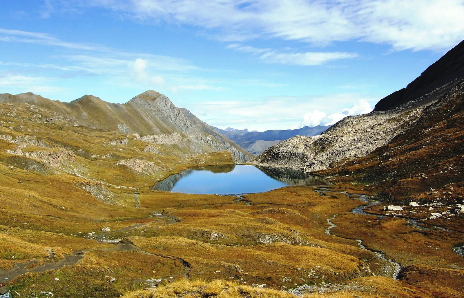
Photo: Dominicus Johannes Bergsma, CC BY-SA 3.0, via Wikimedia Commons
- Distance
- about 130 km (81 miles)
- Country
- France
- Difficulty
- Moderate to challenging
- Type of trip
- Hiking trail
The Tour du Queyras, the GR 58, is a 130 km loop round the Parc naturel régional du Queyras in the Hautes-Alpes, near the Italian border. It goes through every village in the Queyras. The FFRandonnée guidebook splits it into 10 stages from Ceillac, but you can start in any village and walk either way, and the tourist office says starting elsewhere or going the other way makes it easier to find room in the gîtes. Most people take five to eight days. You sleep in gîtes d'étape and refuges, often with half board, or in chambres d'hôtes, hotels and campsites. The local association of gîtes and refuges lists 34 of them, which you can book on its website, and you should book ahead. There's a bag-carrying service between gîtes if you don't want to carry everything.
It isn't a high-mountain route. The FFRandonnée says there are no scree slopes to climb, but the ground is varied and the passes are high, the top one at 2,884 m. The red and white waymarks are well kept, but take a map anyway. Wild camping is tolerated more than an hour's walk from villages and hamlets, for one night, with the tent up after 6 in the evening and down by 9 in the morning. It's banned in the Ristolas–Mont Viso nature reserve. The nearest station is Mont-Dauphin-Guillestre.
Highlights along the way
- Saint-Véran: The first stage from Ceillac crosses the Col des Estronques at 2,651 m and drops to Saint-Véran. At 2,042 m, the tourist office calls it the highest village in Europe.
- Col de Chamoussière: The second day climbs to the Col de Chamoussière at 2,884 m. The FFRandonnée calls it the highest pass on any of its GR routes. You end the day at the Col Agnel.
- Col Vieux: Day three crosses the Col Vieux at 2,806 m, then drops 1,120 m to La Monta. Day four goes over the Colette de Gilly to Abriès.
- Lacs Malrif: Abriès to Aiguilles, by the Malrif lakes at 2,579 m, is the stage with the most climbing, 1,290 m. Then you cross the Col de la Crèche to Souliers and the Col Tronchet to La Chalp d'Arvieux.
- Furfande: The refuge de Furfande sits at 2,300 m below the col of the same name. From there the last two short stages go down to Bramousse and back over the Col de Bramousse to Ceillac.
Distance
About 130 km (81 miles) for the whole loop, in 10 stages on the classic route. The tourist office puts it at about 50 hours of walking, with stages of four to six and a half hours. The daily climb runs from 210 m to 1,290 m. You can make it shorter or longer with the variants, which are now GR de Pays loops in their own right, the Tour du Pain de Sucre, the Tour de la Font-Sancte and the Tour de la Dent du Ratier. One variant goes into Italy.
Best time to go
The tourist office says mid-June to October, as long as you're ready for the cold. The FFRandonnée gives June to September and says autumn is the best time, but check that the gîtes are still open. Some high passes can hold snow until early July, which may mean an ice axe and crampons. June is when the meadows flower. People also do the tour in winter on touring skis or snowshoes, which is a different trip.
More journeys in France
- France June 2023 · Greg
- France Spain 2024 · Greg
- UK to Georgia by Bike · Simon & Lucy
- The Rick Trip · Phil
- Sailing Around The World · Adam
- Spain France Pyrenees 2026 · Greg
Flyby films from France
- PLM line - Champagnole to Pont-du-Navoy - 25483409 · CNJ tourisme
- Lamasquère Road Cycling · Michmich
- To sea, on a ferry, off the ferry · Phil
- The Great Escape · saeunn
More routes like this
- GR 34 (Sentier des douaniers) on foot · 2,000 km (1,240 miles) · France
- Chemin de Stevenson (GR 70) on foot · 272 km (169 miles) · France
- GR 10 across the Pyrenees on foot · 866 km (538 miles) · France
- GR 400 (Cantal volcano) on foot · about 140 km (87 miles) · France
- GR 5 through the Alps on foot · about 620 km (385 miles) · France
- Via Podiensis (GR 65) on foot · 755 km (469 miles) · France