GR 10 across the Pyrenees on foot
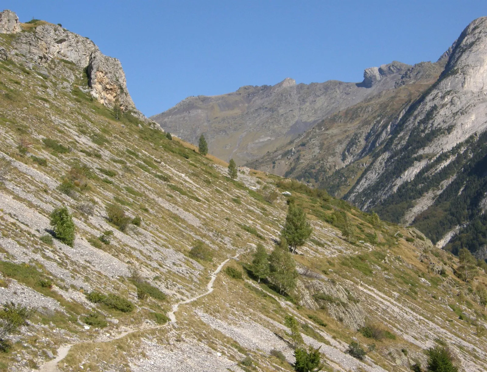
Photo: Gerard from Tarbes, CC BY-SA 2.0, via Wikimedia Commons
- Distance
- 866 km (538 miles)
- Country
- France
- Difficulty
- Challenging
- Type of trip
- Hiking trail
The GR 10 crosses the Pyrenees from Hendaye on the Atlantic to Banyuls-sur-Mer on the Mediterranean, and it stays in France the whole way, through the Pyrénées-Atlantiques, Hautes-Pyrénées, Haute-Garonne, Ariège and Pyrénées-Orientales. It's waymarked with the red and white stripes of the FFRandonnée, the French hiking federation. English Wikipedia puts it at 866 km and around 52 days for a fit walker used to mountains, with about 48,000 m of climbing. You sleep in hotels, gîtes d'étape and mountain refuges, some of them staffed. In the Ariège you'll need a tent for two or three nights.
It isn't a climbing route. There's no scrambling with ropes, but some days go up and down 1,200 m. The first sections were marked in the Hautes-Pyrénées in 1963 and the whole path was waymarked by 1975. Spain has its own crossing on the other side, the GR 11, and the Haute Randonnée Pyrénéenne follows the ridges between the two.
Highlights along the way
- Pic d'Anie: After the Basque Country you cross the col de La Pierre Saint-Martin into the Béarn. The FFRandonnée says the GR 10 enters the Parc national des Pyrénées at the Pic d'Anie.
- Chemin de la Mâture: In the Aspe valley the path runs along a ledge cut into the cliff, about 200 m above the gorges d'Enfer. It was finished in 1772 so oxen could drag timber out for Louis XV's navy, and it's about 1,200 m long.
- Gavarnie: The GR 10 comes through Gavarnie. The cirque at the head of the valley has walls close to 1,500 m high and a waterfall of 422 m, and it's been part of the Pyrénées-Mont Perdu World Heritage site since 1997.
- Hourquette d'Ossoue: French Wikipedia gives this pass in the Vignemale massif, at 2,734 m, as the highest point on the GR 10. The first big pass from the Atlantic is the Hourquette d'Arre, at 2,465 m.
- Canigou and Banyuls: The last section winds through the Canigou massif. The summit isn't on the GR 10 itself, so it's a side trip. Then you come down through the Albères to the beach at Banyuls-sur-Mer.
Distance
Sources don't agree. English Wikipedia says 866 km (538 miles), French Wikipedia 916 km (569 miles) in 52 stages, and the FFRandonnée's own page about 1,100 km (684 miles), so check the line you plan to follow. The federation reckons on a good month and a half for the whole thing, or a month for very fit walkers. Saint-Jean-Pied-de-Port, Cauterets, Luz-Saint-Sauveur, Bagnères-de-Luchon and Mérens-les-Vals are common overnight stops, and the FFRandonnée's site also splits the route into shorter sections of a few days.
Best time to go
The FFRandonnée's mongr.fr site advises June to October and calls late June the best time. Snow can sit on the high passes late in the season, so ask the PGHM (the mountain rescue gendarmes) or the refuge keepers before you set off. French Wikipedia gives mid-June to the end of October, depending on the weather. Winter snow makes the high sections impassable, and storms and heat are the other things to watch for in summer.
More journeys in France
- France June 2023 · Greg
- France Spain 2024 · Greg
- UK to Georgia by Bike · Simon & Lucy
- The Rick Trip · Phil
- Sailing Around The World · Adam
- Spain France Pyrenees 2026 · Greg
Flyby films from France
- PLM line - Champagnole to Pont-du-Navoy - 25483409 · CNJ tourisme
- Lamasquère Road Cycling · Michmich
- To sea, on a ferry, off the ferry · Phil
- The Great Escape · saeunn
More routes like this
- GR 5 through the Alps on foot · about 620 km (385 miles) · France
- Haute Route trek · about 215 km (134 miles) · France, Switzerland
- GR20 trek · about 180 km (112 miles) · Corsica, France
- Chemin de Saint-Guilhem on foot · about 240 km (149 miles) · France
- GR 34 (Sentier des douaniers) on foot · 2,000 km (1,240 miles) · France
- Via Alpina on foot · 2,000 km (1,240 miles) · Slovenia, Italy, Austria, Germany, Switzerland, Liechtenstein, France, Monaco