GR 34 (Sentier des douaniers) on foot
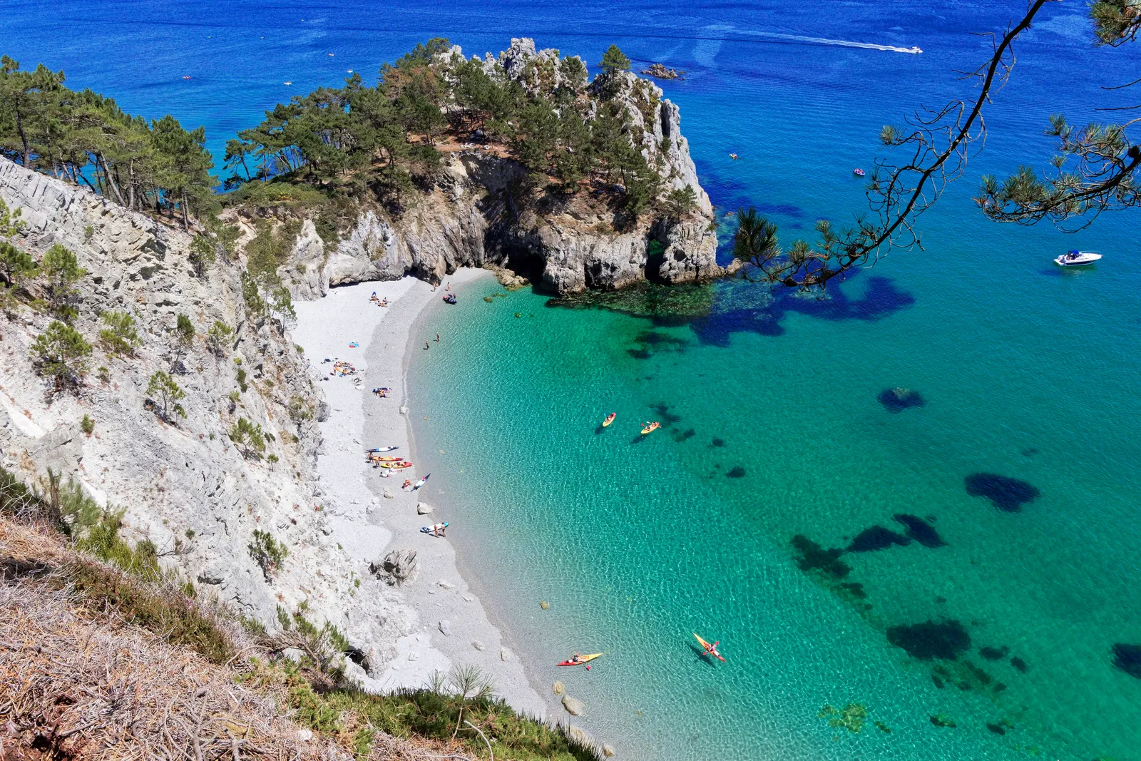
Photo: Thesupermat, CC BY-SA 4.0, via Wikimedia Commons
- Distance
- 2,000 km (1,240 miles)
- Country
- France
- Difficulty
- Moderate
- Type of trip
- Hiking trail
The GR 34 follows the coast of Brittany from the bay of Mont-Saint-Michel to the Saint-Nazaire bridge. In French it usually goes by its old name, the sentier des douaniers, the customs officers' path. Bretagne tourism and the FFRandonnée, the French hiking federation, both put it at more than 2,000 km, through the Manche, Ille-et-Vilaine, Côtes-d'Armor, Finistère, Morbihan and Loire-Atlantique. At about 20 km a day the tourist board reckons on roughly 100 days for the lot, so you'll probably walk it in sections, as the tourist board suggests. There's no mountain walking, but the path keeps dropping into coves and climbing out again, and most of that up and down comes between Mont-Saint-Michel and the Pointe du Raz. Villages along the way have gîtes, campsites, chambres d'hôtes and small hotels, and many of them will send your bag on to the next stop if you ask.
The path goes back to 1791, when customs men patrolled the coast day and night against smugglers and people looting wrecks. It fell out of use in the early 20th century. Walkers brought it back in 1968, and a 1976 law gave walkers a right of way along a 3 m strip beside the sea. The FFRandonnée says the route used to wander further inland and is now coastal all the way.
Highlights along the way
- Côte de Granit Rose: About 10 km of pink granite between Perros-Guirec and Trébeurden. The colour comes from iron in the feldspar. The stretch from Trestraou beach to Ploumanac'h is the best known, and about 700,000 people visit Ploumanac'h each year.
- Trébeurden and Lannion: The first stretch of the modern path was marked in 1968 between Beg Leguer and Pors Mabo, near Trébeurden, by Émile Orain. The red and white stripes started here.
- Crozon and the Finistère coast: The Finistère section takes in the Abers, Brest and the Crozon peninsula. It was voted the French public's favourite GR for 2018, with nearly 24% of 55,000 votes.
- Pointe du Raz: The western tip of Cap Sizun, 72 m above the sea, with the lighthouses of La Vieille and Tévennec out in the currents of the Raz de Sein. It has been a Grand Site de France since 2004.
- Morbihan and the islands: Further south the FFRandonnée's route takes in the Golfe du Morbihan, the Quiberon peninsula and the islands of Belle-Île, Houat and Hoëdic, which you reach by boat.
Distance
More than 2,000 km (over 1,240 miles) in all. Before 2017 the GR 34 started inland at Vitré, but that stretch now belongs to the GR 37. The whole Breton coast was waymarked by 2008, which made about 1,700 km (1,056 miles) walkable in one go. The end isn't quite settled. The FFRandonnée's page has it finishing at the Arzal dam on the Vilaine in one place and at Saint-Nazaire, via Guérande, in another, and Bretagne tourism says the Saint-Nazaire bridge.
Best time to go
The FFRandonnée calls the path walkable in every season. Bretagne tourism says the best time is spring, from mid-April to the end of June, and September is also good, with fewer people about.
More journeys in France
- France June 2023 · Greg
- France Spain 2024 · Greg
- UK to Georgia by Bike · Simon & Lucy
- The Rick Trip · Phil
- Sailing Around The World · Adam
- Spain France Pyrenees 2026 · Greg
Flyby films from France
- PLM line - Champagnole to Pont-du-Navoy - 25483409 · CNJ tourisme
- Lamasquère Road Cycling · Michmich
- To sea, on a ferry, off the ferry · Phil
- The Great Escape · saeunn
More routes like this
- GR20 trek · about 180 km (112 miles) · Corsica, France
- Haute Route trek · about 215 km (134 miles) · France, Switzerland
- Camino de Santiago on foot · about 770 km (480 miles) · Spain, France
- Via Alpina on foot · 2,000 km (1,240 miles) · Slovenia, Italy, Austria, Germany, Switzerland, Liechtenstein, France, Monaco
- Chemin de Saint-Guilhem on foot · about 240 km (149 miles) · France
- Chemin de Stevenson (GR 70) on foot · 272 km (169 miles) · France