La Véloscénie by bike
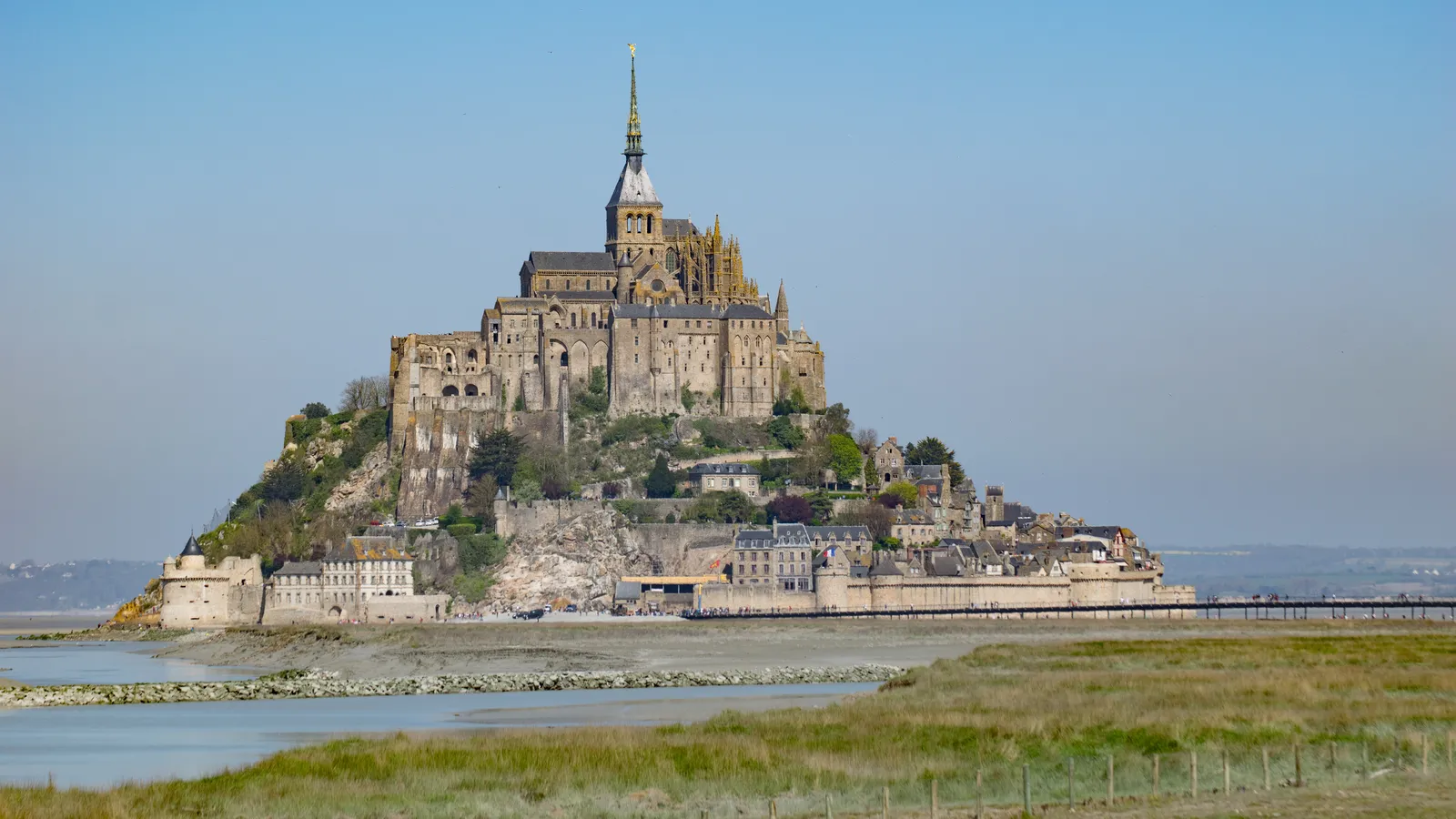
Photo: Antoine Lamielle, CC BY-SA 4.0, via Wikimedia Commons
- Distance
- 450 km (280 miles)
- Country
- France
- Difficulty
- Easy to moderate
- Type of trip
- Cycling route
La Véloscénie is a signed cycle route of 450 km from the Île de la Cité in Paris to the Mont-Saint-Michel. It goes out through Versailles or Limours to Rambouillet, then on to Chartres, across the Perche to Alençon, and through the Orne and the Manche to the bay. From Mortain to the Mont it shares the way with the Vélomaritime, the French part of EuroVelo 4. In France's national scheme it's the V40, and it was officially launched in 2012. The official site splits it into 27 sections, with two variants south of Alençon, and reckons on 7 to 10 days at 50 to 70 km a day. There are more than 200 Accueil Vélo places to stay along the way, which means they're set up for cyclists, and 13 railway stations on the route.
About half of it is on greenways and cycle paths; the rest is on quiet roads. The longest traffic-free stretches are in Normandy, including the greenway between Condé-sur-Huisne and Alençon and the 61 km greenway from Domfront to Pontaubault. It isn't flat. The official site gives 2,000 to 2,500 m of climbing in total, and rates the sections out of Paris as for people who ride regularly. Further west, many sections are rated for beginners and families.
Highlights along the way
- Vallée de Chevreuse: The Versailles branch runs past the château and into the Haute Vallée de Chevreuse regional nature park on its way to Rambouillet. The route also uses the promenade des vallons de la Bièvre, 12 km with no cars.
- Maintenon and Chartres: Stage 9 ends in Maintenon, with its château and aqueduct. The next stage, 20 km into Chartres, is rated for beginners and families, and the cathedral is in view as you arrive.
- The Perche: Nogent-le-Rotrou was the seat of the counts of the Perche, and its castle looks over the Huisne valley. From Condé-sur-Huisne a greenway takes you on to Alençon.
- Domfront: A medieval town with half-timbered houses, and secure lockers for bikes. The Vélo Francette joins here, and the 61 km greenway to Pontaubault starts here too.
- The bay: The last stage, 22 km from Ducey, is flat. At Pontaubault there's an 11-arch bridge, then a newer path along the bay through the salt meadows. You can ride onto the footbridge to the Mont, but you can't leave your bike on it or by the ramparts. Park at La Caserne and walk or take the shuttle.
Distance
450 km (280 miles) from Paris to the Mont-Saint-Michel. French Wikipedia counts 186 km (116 miles) of it on traffic-free path. The official sections run from 10 to 33 km.
Best time to go
The official site doesn't name a best season, so plan around the train home. In 2026 the direct Paris–Pontorson trains ran daily from 30 March to 11 October; the rest of the year there's one return trip on Fridays, Saturdays and Sundays. Bikes travel free on that line but you have to book a place. Pontorson station is about 10 km from the Mont on a signed greenway. When the official site was checked in November 2026, parts of the last stage were still diverted onto small roads because of works, so look at the stage page before you go.
More journeys in France
- France June 2023 · Greg
- France Spain 2024 · Greg
- UK to Georgia by Bike · Simon & Lucy
- The Rick Trip · Phil
- Sailing Around The World · Adam
- Spain France Pyrenees 2026 · Greg
Flyby films from France
- PLM line - Champagnole to Pont-du-Navoy - 25483409 · CNJ tourisme
- Lamasquère Road Cycling · Michmich
- To sea, on a ferry, off the ferry · Phil
- The Great Escape · saeunn
More routes like this
- La Vélodyssée by bike · 1,300 km (808 miles) · France
- Camino Francés by Bike · about 770 km (480 miles) · Spain, France
- La Vélo Francette by bike · about 640 km (400 miles) · France
- ViaRhôna by bike · about 815 km (506 miles) · France, Switzerland
- Atlantic Coast Route – EuroVelo 1 by bike · about 11,000 km (6,835 miles) · England, France, Ireland, Norway, Portugal, Scotland, Spain, Wales, Northern Ireland
- Rhine Cycle Route (EuroVelo 15) · about 1,233 km (766 miles) · France, Germany, Netherlands, Switzerland, Austria, Liechtenstein