Pan-American Highway
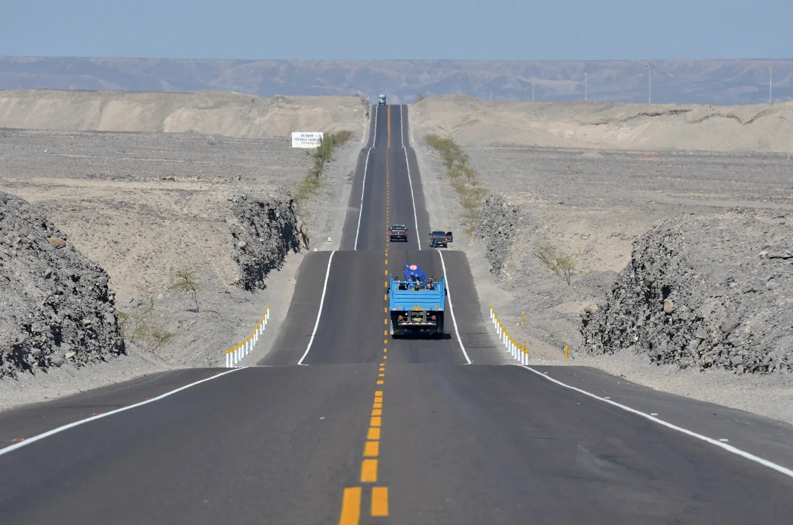
Photo: Pavel Špindler, CC BY 3.0, via Wikimedia Commons
- Distance
- 30,000 km (19,000 miles)
- Countries
- USA, Canada, Mexico, Guatemala, El Salvador, Honduras, Nicaragua, Costa Rica, Panama, Colombia, Ecuador, Peru, Chile, Argentina
- Difficulty
- Challenging
- Type of trip
- Road trip
The Pan-American Highway is a chain of roads that runs about 30,000 km from Prudhoe Bay in Alaska to Ushuaia in Argentina, through 14 countries. It isn't one road with one number. Outside Alaska, no road in the US or Canada is officially part of it, so overlanders pick their own way down to Mexico. Through Mexico and Central America it's the Inter-American Highway, signed CA-1 south of Mexico. The German Wikivoyage guide reckons it could be done in four months on paper, but rest days, sightseeing and breakdowns stretch that to six months at least, and many people take far longer.
There's no road through the Darién Gap, about 100 km of marshland between Yaviza in Panama and Turbo in Colombia, and no ferry either. The vehicle goes by sea between Panama and Colombia, usually to Cartagena, in a container or on a roll-on roll-off ship. One traveller who shipped a car in 2025 paid about US$1,150 on each side and said 2 to 3 weeks is normal. Almost every border means a temporary import permit for the vehicle, and often local insurance and fumigation too. Mexico's permit comes from Banjercito, the army bank, with a refundable deposit of up to US$400, and you only get it back if you cancel the permit on the way out before it expires.
Highlights along the way
- Dalton Highway: The northern end, 666 km (414 miles) from near Livengood, north of Fairbanks, to Deadhorse by the Prudhoe Bay oilfields. Most of it is unpaved and fuel is only at the Yukon River bridge, Coldfoot and Deadhorse. It crosses the Brooks Range at Atigun Pass, 1,444 m.
- Cerro de la Muerte: The highest point on the whole highway, 3,335 m, on Costa Rica's stretch of CA-1. Most of the road through Costa Rica is one lane each way.
- The Peruvian coast: Through Peru the road runs down the coast as the Panamericana Norte to Lima, then as the Panamericana Sur to Tacna. The Chilean border at Santa Rosa is 36 km south of Tacna.
- Los Libertadores pass: From Chile, Route 60 climbs into the Andes up a long run of hairpins to the Cristo Redentor tunnel at about 3,200 m. The border with Argentina is halfway through the 3,080 m tunnel. Snow and rockfall can shut the pass in winter.
- Strait of Magellan: To get to Tierra del Fuego, Argentina's Ruta 3 cuts through Chile and crosses the strait by ferry, 4.65 km and about twenty minutes. The road ends at the Lapataia River bridge past Ushuaia.
Distance
The usual figure is about 30,000 km (19,000 miles), but it depends on the line you take. One variant goes through Bolivia, by La Paz to Villazón, and joins Argentina's Ruta 9. One crew in a Land Rover Defender covered more than 45,000 km in 312 days going south to north.
Best time to go
The two ends set the timing. The German Wikivoyage guide gives a narrow window, May to September, for starting in Alaska, and warns that a September start puts you in Ecuador and Peru in the rainy season by December. In Central America the dry season runs from about mid-November to early May. At the far end, Ushuaia's summer is January and February. Permits, fees and shipping change all the time, so check each country's customs rules and the current options across the Darién Gap before you set off.
More journeys in USA, Canada, Mexico, Guatemala, El Salvador, Honduras, Nicaragua, Costa Rica, Panama, Colombia, Ecuador, Peru, Chile, Argentina
- Biking Across Canada For Charity · Jeremy
- World Trip - Zero Impact Expedition · David
- US Road Trip · Julia & James
- Southwest USA Road Trip · Qinggong
- Wandering South America 2024-2025 · Kelly
- 🎶 I Would Drive 5000 Miles 🎶 · Matt
Flyby films from USA, Canada, Mexico, Guatemala, El Salvador, Honduras, Nicaragua, Costa Rica, Panama, Colombia, Ecuador, Peru, Chile, Argentina
- Ginkgo forest · Xiao
- Second day · Camila
- Saindo de lake Havasu City · Camila
- Americas (Mexico) · David
More routes like this
- Blue Ridge Parkway road trip · 755 km (469 miles) · USA
- Icefields Parkway road trip · 232 km (144 miles) · Canada
- Route 66 road trip · 3,940 km (2,448 miles) · USA
- Ruta 40 road trip · 5,194 km (3,227 miles) · Argentina
- Alsace Wine Route road trip · about 170 km (106 miles) · France
- Great Alpine Road · 304 km (189 miles) · Australia