Ruta 40 road trip
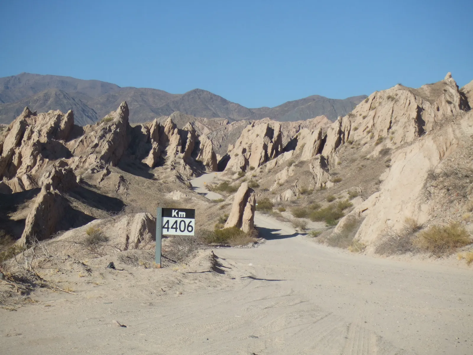
Photo: Anthony Letmon, CC BY 2.0, via Wikimedia Commons
- Distance
- 5,194 km (3,227 miles)
- Country
- Argentina
- Difficulty
- Moderate to challenging
- Type of trip
- Road trip
Ruta Nacional 40 runs down the western side of Argentina, close to the Andes, from La Quiaca on the Bolivian border to Cabo Vírgenes at the mouth of the Strait of Magellan. It's about 5,200 km and goes through 11 provinces. You can drive it by car, campervan or motorbike, and cyclists ride it too, sharing the road with the lorries. The German Wikivoyage guide reckons on at least three weeks for the whole road at around 200 km a day. You sleep in the towns along the way or camp, and in places the towns are a long way apart.
Most of the road is paved now, but not all of it. The longest gravel stretches are in the north, in Salta and Jujuy, including the climb to the Abra del Acay. In Santa Cruz 72 km were still unpaved in June 2022. The emptiest part of the whole route is north of Tres Lagos, through Gobernador Gregores to Bajo Caracoles. Fill up in Tres Lagos. Fuel isn't guaranteed anywhere in Patagonia, so top up at every pump you pass. The wind there can gust to gale force.
Highlights along the way
- Abra del Acay: The highest point on the road, in Salta, at close to 5,000 m. Sources give anything from 4,895 to 5,061 m. The way up is steep gravel and it can be impassable after summer rain or in winter ice and snow. A 4x4 is strongly recommended. The way round, about 100 km longer, is the RP 33 over the Cuesta del Obispo from Cachi.
- Cafayate to Cachi: North of Cafayate the road goes through the Calchaquí valley on long stretches of gravel. Near Angastaco it passes the Quebrada de las Flechas, a stretch of sharp tilted rock.
- Camino de los Siete Lagos: In Neuquén the road runs past a string of lakes to Villa La Angostura and on to Bariloche on Lago Nahuel Huapi. It can get snow here in winter.
- Bajo Caracoles and the Cueva de las Manos: Bajo Caracoles is a supply stop of about 100 people in Santa Cruz. From there a gravel side road of a little over 40 km leads to the Cueva de las Manos, a cave covered in painted hands thousands of years old.
- Cabo Vírgenes: Kilometre zero, with a lighthouse on the Strait of Magellan.
Distance
The usual figure is 5,194 km (3,227 miles), but sources give anything from about 5,080 to 5,224 km because the road has been rerouted and remeasured over the years. Since a 2004 resolution from Vialidad Nacional, km 0 is at Cabo Vírgenes and the numbers rise as you go north, so the km 4,406 post in the photo is in Salta.
Best time to go
The seasons work differently at each end. In Patagonia, frost and snow come in winter, and from Malargüe to Chos Malal there can be ice on the road. A cyclist writing for Adventure Cycling recommends December to late February for the south and warns the wind can still be fierce then. In the north it's the other way round. December to March is the rainy season, with short violent storms and flash floods that can cut the road, and winter is dry. TurismoRuta40.com.ar calls spring and autumn the best time for the whole road. Paving work carries on, so check the state of the gravel sections and the Abra del Acay with Vialidad Nacional (vialidad.gob.ar) before you go.
More journeys in Argentina
Flyby films from Argentina
- Lake Tota, Boyaca, Colombia · Kelly
- South America 1 · David
More routes like this
- Pan-American Highway · 30,000 km (19,000 miles) · USA, Canada, Mexico, Guatemala, El Salvador, Honduras, Nicaragua, Costa Rica, Panama, Colombia, Ecuador, Peru, Chile, Argentina
- Transpirenaica by motorbike road trip · 930 km (578 miles) · Spain, France, Andorra
- Stelvio Pass road trip · 49 km (30 miles) · Italy
- Great Alpine Road · 304 km (189 miles) · Australia
- Causeway Coastal Route road trip · about 193 km (120 miles) · Northern Ireland
- Ring of Kerry road trip · 179 km (111 miles) · Ireland