Icefields Parkway road trip
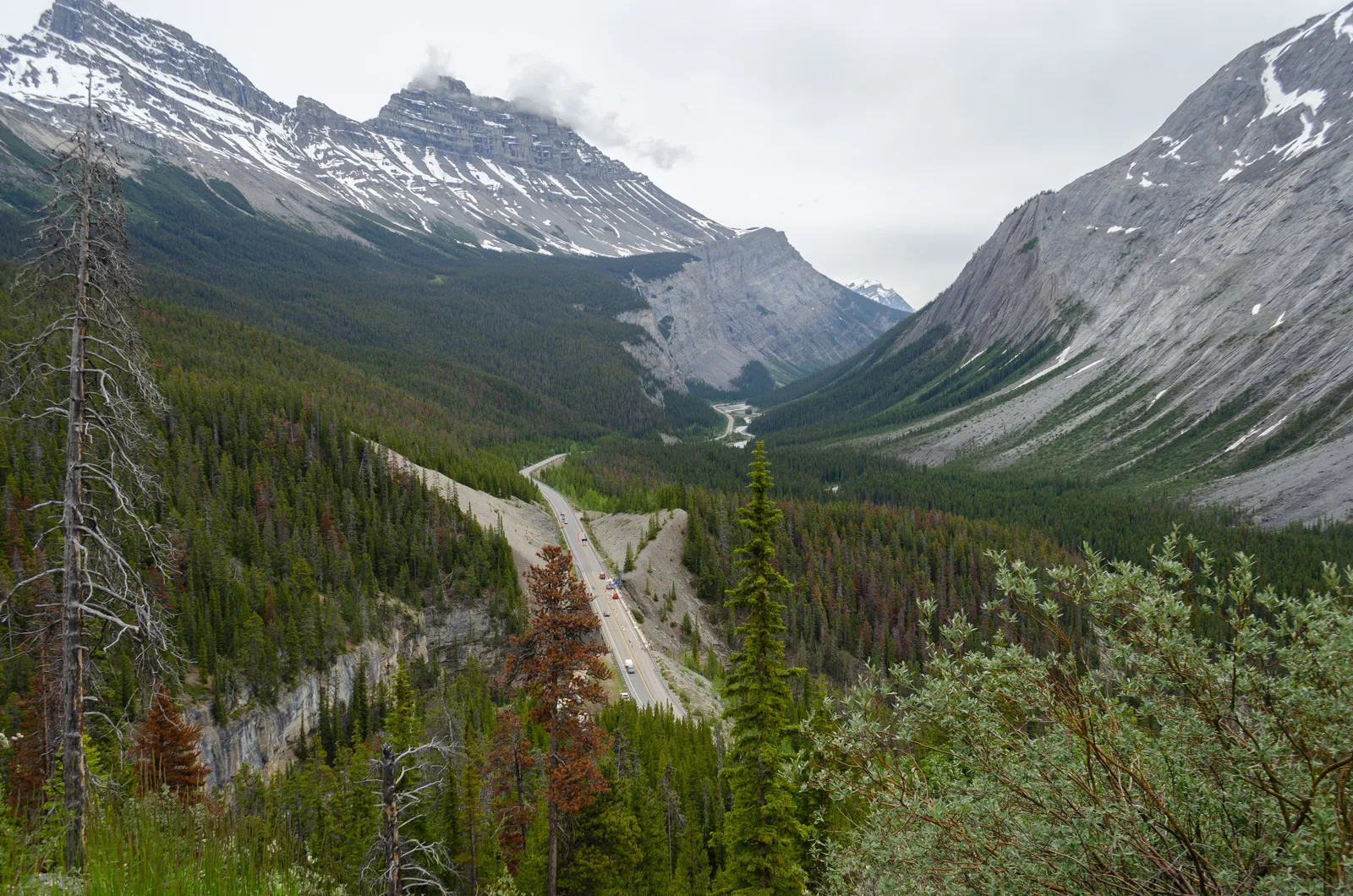
Photo: Ethan Sahagun, CC BY-SA 4.0, via Wikimedia Commons
- Distance
- 232 km (144 miles)
- Country
- Canada
- Difficulty
- Easy to moderate
- Type of trip
- Road trip
The Icefields Parkway is Highway 93 North between Lake Louise in Banff National Park and the town of Jasper in Jasper National Park. It runs for 232 km along the Continental Divide, and Banff & Lake Louise Tourism counts more than 100 glaciers along the way. They put the drive at three to six hours, and more if you want to walk anywhere. There's no town in between. You sleep in one of six HI wilderness hostels, a few lodges that open in summer, or one of 13 seasonal Parks Canada campgrounds, most of them basic and unserviced. You need a valid Parks Canada pass to drive the parkway. Buy it online or at the park gates at either end, either for the day or as an annual Discovery Pass. The day pass is per person or for up to seven people in one vehicle, and under-18s go free.
Services run from early May to mid-October. Fill up in Lake Louise or Jasper, because the only fuel in between is at Saskatchewan River Crossing, and only in summer. There's no mobile signal, apart from limited coverage at the Columbia Icefield from May to early October, so download maps before you set off. The limit is 90 km/h, lower at Saskatchewan River Crossing and the Icefield. Cyclists ride it too, and two of the Jasper campgrounds keep group sites just for them.
Highlights along the way
- Bow Lake: About 37 to 40 km from Lake Louise, half an hour's drive. The lakeshore is a short walk on gravel from the car park, which gets very busy in summer, so come early or late in the day.
- Peyto Lake and Bow Summit: At 43 km a short walk takes you up from the car park to a viewing platform high above the turquoise lake. Bow Summit, at 2,070 m, is the highest point on the parkway.
- Weeping Wall and the Big Bend: At 109 km the Weeping Wall is a 300 m cliff where snowmelt streams pour down in spring and early summer and turn to ice in winter. At 113 km the road doubles back on itself at the Big Bend, and from a pullout at the top a short walk leads to Bridal Veil Falls, a 370 m cascade on Cirrus Mountain.
- Columbia Icefield: Just past Sunwapta Pass (2,035 m), the boundary between Banff and Jasper, at about 128 to 130 km. The Athabasca Glacier comes down from the largest icefield in the Rockies opposite the Icefield Centre, and a short trail goes to its toe. It has been shrinking for 125 years. Stay behind the barriers; people have died falling into hidden crevasses.
- Athabasca Falls: At 203 km, 30 km short of Jasper, the Athabasca River pushes through a narrow gorge. Short paved paths lead to viewpoints and a bridge beside the falls.
Distance
232 km (144 miles), from the Trans-Canada Highway junction just north-west of Lake Louise to Highway 16 at Jasper. That's Parks Canada's figure; other sources give 227 or 230 km. Distances in Parks Canada's guide to the stops are counted from Lake Louise, as they are here.
Best time to go
Most campgrounds along the road open only in summer, and the lakes usually thaw by late June. July and August are the busiest months, with up to 100,000 vehicles a month. Winter weather lasts from early November to mid-June, and snow can fall in any month. From 1 November to 31 March you must have winter tyres (with a snowflake or M+S mark) or chains, and the road can close for avalanche control. Don't stop in any of the 38 marked avalanche paths. Check road conditions on 511 Alberta (511alberta.ca) before you go.
More journeys in Canada
- Biking Across Canada For Charity · Jeremy
- 🎶 I Would Drive 5000 Miles 🎶 · Matt
- White Rock Tour · Geoffrey
- Trip To Banff · Doug
- A Weekend In Whistler · jjsereday
- Three Bridges · Geoffrey
Flyby films from Canada
- ALASKA or BUST! · Matt
- deer · David
- Day 66 · Jeremy
More routes like this
- Pan-American Highway · 30,000 km (19,000 miles) · USA, Canada, Mexico, Guatemala, El Salvador, Honduras, Nicaragua, Costa Rica, Panama, Colombia, Ecuador, Peru, Chile, Argentina
- Transpirenaica by motorbike road trip · 930 km (578 miles) · Spain, France, Andorra
- Ring of Kerry road trip · 179 km (111 miles) · Ireland
- Ruta 40 road trip · 5,194 km (3,227 miles) · Argentina
- Great Alpine Road · 304 km (189 miles) · Australia
- Causeway Coastal Route road trip · about 193 km (120 miles) · Northern Ireland