Camino Olvidado
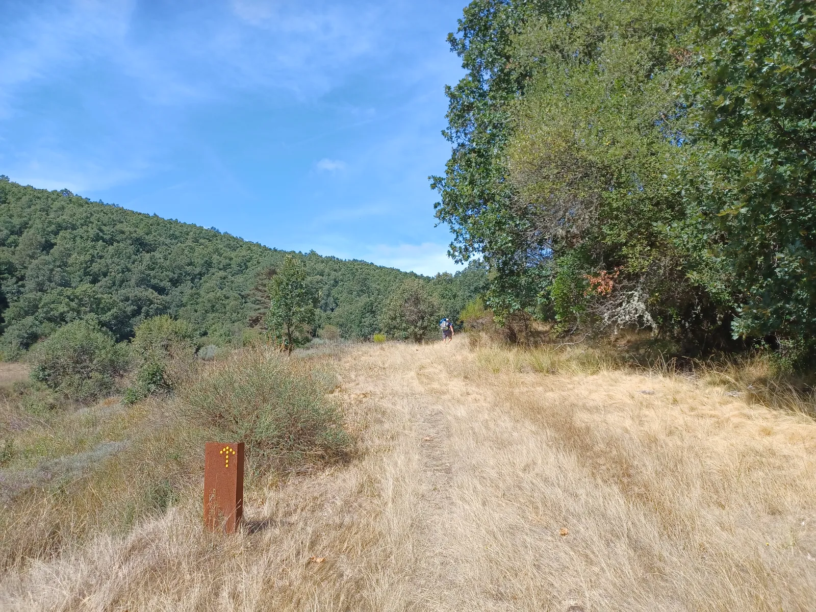
Photo: Simon Burchell, CC BY-SA 4.0, via Wikimedia Commons
- Distance
- about 532 km (331 miles)
- Country
- Spain
- Difficulty
- Moderate to challenging
- Type of trip
- Hiking trail
The Camino Olvidado, the Forgotten Way, starts outside Santiago Cathedral in Bilbao and heads west through Burgos, Cantabria, Palencia and León to Villafranca del Bierzo. There it joins the Camino Francés for the rest of the way to Santiago. The official guide says it was used from the ninth to the twelfth century and counts it among the oldest recorded routes to Santiago, along with the Camino Primitivo and the Camino de la Costa. It faded once the Camino Francés took over. In Villafranca, pilgrims who couldn't go on to Compostela could gain the indulgence at the Puerta del Perdón of the church of Santiago.
The route has been brought back by a group of local action groups, with the Asociación Cuatro Valles running the official app. They publish a free guide, a map and GPS tracks for 22 stages, some with two options. It's a quiet camino. Santiago Ways says it's signposted all the way but with fewer signs than the busier routes, so you have to watch for them, and that most of the beds are in rural houses, with few pilgrim hostels, most of them private. Plan your nights before you go.
Highlights along the way
- The Enderrozas road: Between the Valle de Mena and Espinosa de los Monteros the route follows the Camino de las Enderrozas, a well-kept medieval road, to the Hijuela waterfalls, then climbs the Alto del Cabrio past the old oaks of Villasante.
- Ojo Guareña: Stage 4 takes the Sonsierra trail to the Ojo Guareña natural monument. The park's information centre is in Quintanilla del Rebollar, a village that has kept the old building style of northern Burgos.
- The Ebro reservoir: Stage 6 crosses into Cantabria along the reservoir. At Villanueva de las Rozas the church tower, known as the cathedral of the fish, sticks up out of the water.
- Cervatos and Aguilar de Campoo: The collegiate church of San Pedro at Cervatos is known for its Romanesque carvings. Aguilar de Campoo has a castle and the collegiate church of San Miguel, and it's where the Camino Olvidado leaves the Camino de la Calzada.
- Los Calderones: On stage 15B, which the official guide calls tough, the path goes up from La Pola de Gordón through Los Calderones, a narrow limestone gorge, to Piedrasecha.
Distance
About 532 km (331 miles) from Bilbao to Villafranca del Bierzo, where the official map's height profile ends. By the official guide's stage lengths it's 505 to 545 km, depending on which of the A and B options you take. The official stages run from 16 km (La Robla to La Magdalena) to 39.3 km (Cervera de Pisuerga to Guardo). Other counts differ. Spanish Wikipedia gives about 637 km for the historical route, and Santiago Ways 489.5 km over its own 18 stages. From Villafranca it's about 180 km more to Santiago on the Camino Francés, by Santiago Ways' count.
Best time to go
Neither the official guide nor the map names a best season. The guide does say the last stage, through the orchards and vineyards of the Bierzo, is at its most peaceful in autumn. Several stages climb into the mountains of León, such as the Buiza pass and the long climb out of Fasgar towards the Gistredo range, so check the forecast outside summer. Beds are few, so book ahead. For news on the path, the official site points to the Asociación Leonesa del Camino Olvidado's Facebook page.
More journeys in Spain
- Camino De Santiago · Julia & James
- France Spain 2024 · Greg
- Cycling the Basque Region · Lucy
- Sailing Around The World · Adam
- Road trip tenerife · Josephine
- Camino De Santiago · Ruth
Flyby films from Spain
- Tenerife · Josephine
- The Great Escape · saeunn
- Bilbao to....? · Greg
- León, Mediterranean disease · Eike
More routes like this
- Camino Portugués on foot · 241 km (150 miles) · Portugal, Spain
- Caminito del Rey on foot · 8 km (5 miles) · Spain
- Ruta del Alba on foot · 14 km (9 miles) · Spain
- Camino Inglés · about 112 km (70 miles) · Spain
- Camino Primitivo · about 320 km (199 miles) · Spain
- Camino Lebaniego · about 73 km (45 miles) · Spain