Ruta de los Pueblos Blancos road trip
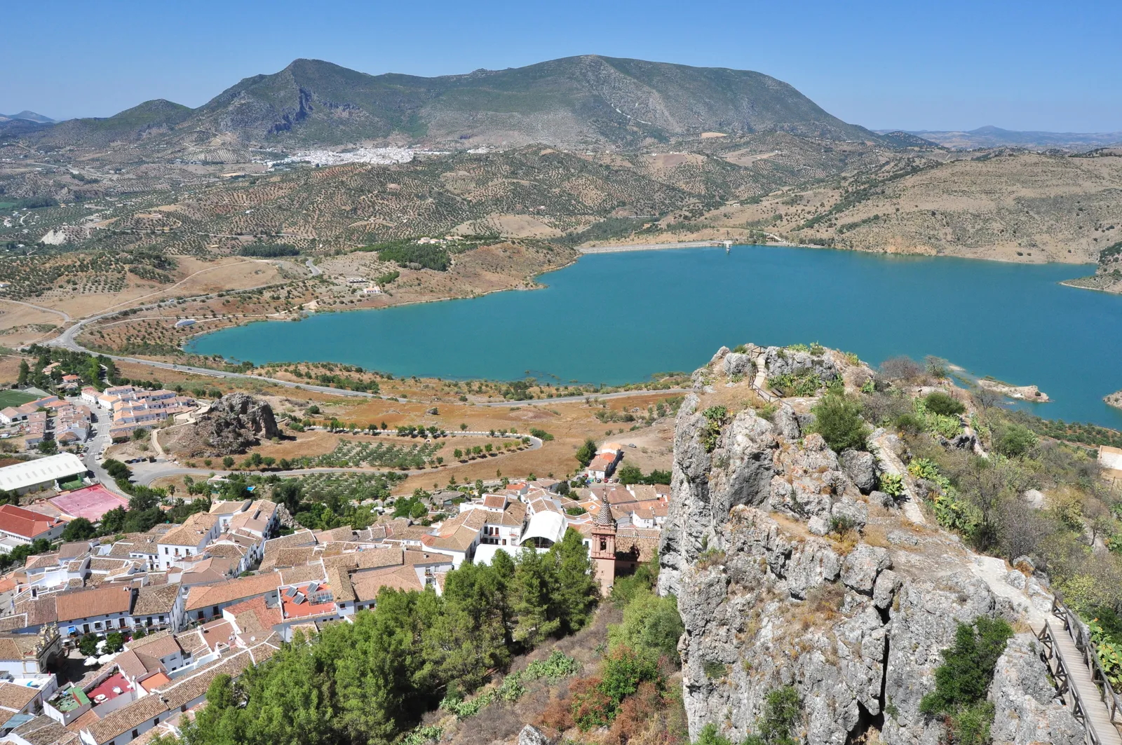
Photo: Luis Rogelio HM, CC BY-SA 2.0, via Wikimedia Commons
- Distance
- about 125 km (78 miles)
- Country
- Spain
- Difficulty
- Easy to moderate
- Type of trip
- Road trip
The Ruta de los Pueblos Blancos, the white towns route, is a drive through the whitewashed hill towns of the Sierra de Cádiz and, over the border in Málaga, the Serranía de Ronda. There’s no single fixed line. Spanish Wikipedia says the Cádiz route takes in 19 towns and that Málaga has no set route at all, and the Junta de Andalucía’s guide splits the area into several shorter routes. The version the DGT, Spain’s traffic authority, gives in its magazine starts at Arcos de la Frontera and ends at Setenil de las Bodegas, on the A-372 and CA-9104 through the Sierra de Grazalema Natural Park. The Junta’s guide ends its tour at Ronda, which it calls one of the oldest cities in Spain.
The DGT says the walls have been limewashed since the 19th century, to keep out the heat and disinfect the streets. These towns sat on the old frontier between Christians and Muslims, and it shows in their architecture. The roads through the sierra wind a lot, with viewpoints along the way. Allow more than a day, as the point is to stop, walk up to the castles and eat in the towns.
Highlights along the way
- Arcos de la Frontera: The start, on a cliff above the Guadalete, with the houses spilling down the slope. At the top there’s a viewpoint and the church of Santa María de la Asunción. Bornos, 11 km on, has the Palacio de los Ribera with its Renaissance garden and loggia.
- Grazalema and El Pinsapar: The A-372 runs from El Bosque, start of the Río Majaceite walk, to Grazalema, in the heart of the natural park. Its best-known walk is El Pinsapar, 10.5 km one way through a rare Spanish fir forest. It’s in the park’s reserve zone, so you need a permit from the El Bosque visitor centre.
- Zahara de la Sierra: The CA-9104 climbs from Grazalema past the Puerto de las Palomas, a pass with wide views, and drops to Zahara. The DGT singles out its streets full of bougainvillea, its 12th-century castle and the sunsets over the reservoir.
- Olvera: A one-time refuge for bandits, topped by a 12th-century Arab castle and a neoclassical church.
- Setenil de las Bodegas: The end of the DGT route. Houses are built into the rock above the river, and some of the caves are now bars and restaurants. The castle fell to Christian forces in 1484, and its ruins still sit above the town.
Distance
About 125 km (78 miles) in all on the DGT’s route. By its kilometre count, Bornos comes at km 11, El Bosque at km 42, Grazalema at km 62, Zahara de la Sierra at km 80, Olvera at km 109 and Setenil de las Bodegas at km 125. Other versions add towns such as Ubrique, Villaluenga del Rosario or Ronda and come out longer.
Best time to go
The Junta de Andalucía calls the Sierra de Grazalema the rainiest area in Spain, so expect wet days in the mountains outside summer, while the limewash is there because the summers are hot. If you want to walk El Pinsapar, ask for your permit at the El Bosque visitor centre (956 709 733) well before you go.
More journeys in Spain
- Camino De Santiago · Julia & James
- France Spain 2024 · Greg
- Cycling the Basque Region · Lucy
- Sailing Around The World · Adam
- Road trip tenerife · Josephine
- Camino De Santiago · Ruth
Flyby films from Spain
- Tenerife · Josephine
- The Great Escape · saeunn
- Bilbao to....? · Greg
- León, Mediterranean disease · Eike
More routes like this
- Ruta del Silencio by motorbike road trip · about 63 km (39 miles) · Spain
- Transpirenaica by motorbike road trip · 930 km (578 miles) · Spain, France, Andorra
- Blue Ridge Parkway road trip · 755 km (469 miles) · USA
- Iceland’s Ring Road · 1,322 km (820 miles) · Iceland
- Ring of Kerry road trip · 179 km (111 miles) · Ireland
- Atlantic Ocean Road · about 36 km (22 miles) · Norway