Transfăgărășan road trip
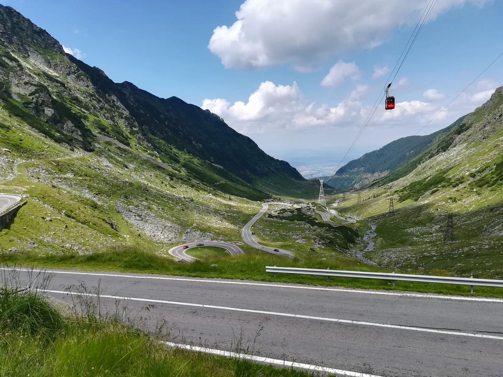
Photo: Michał Derela, CC BY-SA 4.0, via Wikimedia Commons
- Distance
- about 151 km (94 miles)
- Country
- Romania
- Difficulty
- Moderate
- Type of trip
- Road trip
The Transfăgărășan, numbered DN7C, crosses the Făgăraș Mountains, the highest in Romania, between Wallachia and Transylvania. It starts at Bascov, near Pitești, follows the Argeș valley through Curtea de Argeș and past Lake Vidraru, climbs to 2,042 m by Bâlea Lake, then drops down to the DN1 between Sibiu and Brașov, near Cârțișoara. It’s the second highest paved road in Romania, after the Transalpina at 2,145 m. Ceaușescu had it built in 1970–74 as a military route after the Soviet invasion of Czechoslovakia in 1968. It opened on 20 September 1974. Officially 40 people died building it, and workers from the time say it was hundreds.
It’s a slow road, with hairpin after hairpin, long S-bends and steep drops, and the average speed is about 40 km/h. You sleep in Curtea de Argeș or at the chalets on the road, and two of those at Bâlea Lake are open all year. The high section is closed at night in summer, because there’s little to stop you going over the edge in the dark.
Highlights along the way
- Curtea de Argeș: The town on the southern approach. Its cathedral, from the early 16th century, stands in the grounds of the monastery, faced in pale grey limestone with twisted cupolas.
- Poenari Castle: A ruined castle on a crag above the road near Arefu, rebuilt in 1459 by Vlad the Impaler and one of his main fortresses. You climb 1,480 concrete steps to reach it.
- Vidraru Dam: An arch dam 166 m high, finished in 1966. The road crosses the top of it and then follows the shore of the lake for almost 20 km.
- Bâlea Lake: A glacial lake at 2,034 m, just past the tunnel under the main ridge, which is almost 900 m long and the longest road tunnel in Romania. There’s a mountain rescue station, and a hotel made of ice has been built here most winters since 2006.
- The north side: The road drops 13 km down the glacial cirque in a stack of hairpins, past the Bâlea waterfall, a 68 m stepped fall at about 1,230 m. From the Bâlea Cascadă chalet it’s 21 km to the DN1.
Distance
About 151 km (94 miles) in all, from Bascov near Pitești to the DN1 near Cârțișoara. The mountain part, from the Vidraru Dam to Cârțișoara, is about 91 km (57 miles).
Best time to go
The high section between Piscul Negru on the south side and Bâlea Cascadă on the north is open only in summer and early autumn, usually from late June to the end of October, with dates set by the snow. In winter you can drive up as far as those two points, and a cable car runs from Bâlea Cascadă to the lake. In 2026 CNAIR, the national roads company, opened it on 12 June, for traffic between 07:00 and 21:00 every day, and closed it again from 18:00 on 27 October because of snow and fog, saying the weather would decide whether it reopened or stayed shut for the winter. Bears are often seen next to the road. Don’t go near them or feed them; feeding them is against the law, with fines of 10,000 to 30,000 lei. Check CNAIR (cnadnr.ro, or phone 021 9360) before you go.
More journeys in Romania
Flyby films from Romania
More routes like this
- Ruta del Silencio by motorbike road trip · about 63 km (39 miles) · Spain
- Ruta de los Pueblos Blancos road trip · about 125 km (78 miles) · Spain
- Amalfi Coast drive · about 50 km (31 miles) · Italy
- Route des Crêtes (Vosges) road trip · 77 km (48 miles) · France
- Pan-American Highway · 30,000 km (19,000 miles) · USA, Canada, Mexico, Guatemala, El Salvador, Honduras, Nicaragua, Costa Rica, Panama, Colombia, Ecuador, Peru, Chile, Argentina
- Ruta 40 road trip · 5,194 km (3,227 miles) · Argentina