Route des Crêtes (Vosges) road trip
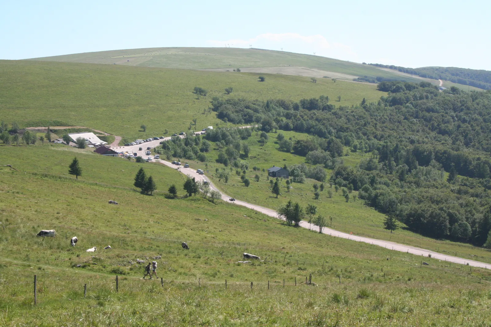
Photo: Pmau, CC BY-SA 4.0, via Wikimedia Commons
- Distance
- 77 km (48 miles)
- Country
- France
- Difficulty
- Easy to moderate
- Type of trip
- Road trip
The Route des Crêtes follows the ridge of the Vosges in eastern France, mostly along the line between Haut-Rhin, in Alsace, and the Vosges département, inside the Ballons des Vosges regional nature park. It starts above Sainte-Marie-aux-Mines, climbs to the Col des Bagenelles and the Col du Bonhomme, and runs south past the Col de la Schlucht, the Hohneck, Le Markstein and the Grand Ballon before dropping to Cernay. Most of it is above 950 m. The French army made it in the First World War to link the valleys behind the front, and kept it just below the crest on the west side, out of sight of German guns. That’s why between the Col du Bonhomme and Le Markstein you see less of Alsace than you might expect.
There are no towns along the top. Valleys come up to it from both sides, among them Munster, the Thur, the Doller and Sainte-Marie-aux-Mines, so you can join it at several cols and stay down in the valleys. On the high pastures, the old farms of the cheesemakers, the marcairies, have become fermes-auberges, farm inns. Walkers, cyclists, motorcyclists, cars and campervans all use the road, and summer weekends get crowded. On the Haut-Rhin sections the speed limit has been 70 km/h since 2012.
Highlights along the way
- Col du Bonhomme: At 949 m, where the ridge road crosses the road from Saint-Dié-des-Vosges to Colmar.
- Gazon du Faing: At 1,303 m, with a view across the Rhine valley to the Black Forest in Germany.
- Col de la Schlucht and the Hohneck: The Schlucht, at 1,139 m, is on the road from Gérardmer to Colmar. Just south, the Hohneck is the third highest summit in the Vosges.
- Grand Ballon: The road’s highest point is the Col du Grand Ballon, at 1,343 m. The summit above it, at 1,424 m, is the highest in the Vosges, with the Diables Bleus monument to the mountain infantry of the First World War and an air traffic radar built in 1997, with a viewing table underneath.
- Hartmannswillerkopf: Also called the Vieil Armand, a First World War battlefield with a military cemetery, on the way down to Cernay. Nearby are the ruins of Freundstein castle, which at 984 m is the highest castle in Alsace.
Distance
The figures depend on where you count the ends from. Visit Alsace and the Vosges tourist board give 77 km (48 miles) between Cernay and Sainte-Marie-aux-Mines, while Wikipedia gives 88 to 89 km (about 55 miles), finishing at Uffholtz, next to Cernay.
Best time to go
The road is generally open from April to November and shuts for the winter, from mid-November each year according to the Vosges tourist board. The closed stretches are between the Col des Bagenelles and the Col du Bonhomme, between the Col du Calvaire and the Col de la Schlucht, which becomes cross-country ski track, and from the La Bresse-Kastelberg ski area to the Grand Ballon. The dates move with the snow, so check the Collectivité européenne d’Alsace road reports if you go early or late in the year. In summer 2026 the Navette des Crêtes shuttle buses ran along the ridge from 30 May, daily in July and August and at weekends in September (Visit Alsace).
More journeys in France
- France June 2023 · Greg
- France Spain 2024 · Greg
- UK to Georgia by Bike · Simon & Lucy
- The Rick Trip · Phil
- Sailing Around The World · Adam
- Spain France Pyrenees 2026 · Greg
Flyby films from France
- PLM line - Champagnole to Pont-du-Navoy - 25483409 · CNJ tourisme
- Lamasquère Road Cycling · Michmich
- To sea, on a ferry, off the ferry · Phil
- The Great Escape · saeunn
More routes like this
- Transpirenaica by motorbike road trip · 930 km (578 miles) · Spain, France, Andorra
- Alsace Wine Route road trip · about 170 km (106 miles) · France
- Transfăgărășan road trip · about 151 km (94 miles) · Romania
- Amalfi Coast drive · about 50 km (31 miles) · Italy
- Great Ocean Road trip · 243 km (151 miles) · Australia
- Atlantic Ocean Road · about 36 km (22 miles) · Norway