Stelvio Pass road trip
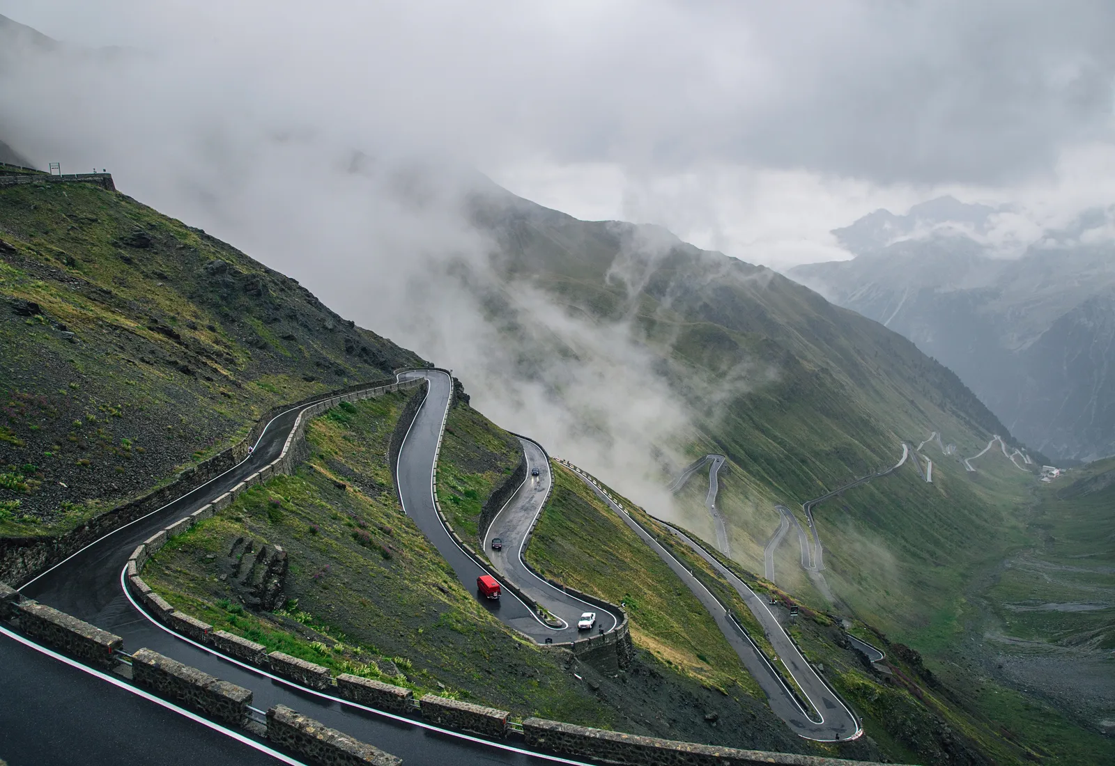
Photo: Raul Taciu, CC0, via Wikimedia Commons
- Distance
- 49 km (30 miles)
- Country
- Italy
- Difficulty
- Moderate
- Type of trip
- Road trip
The Stelvio Pass, Passo dello Stelvio in Italian and Stilfser Joch in German, takes the SS38 over the Ortler Alps between Bormio in Valtellina and Prato allo Stelvio in the Vinschgau, South Tyrol. At 2,757 m it’s the highest paved pass in the Eastern Alps and the second highest in the Alps, 7 m below the Col de l’Iseran in France. The Austrian Empire built the road in 1820–25 and it has changed very little since. You sleep in the towns at either end or the villages on the way, and there are hotels at the pass itself. There’s no toll.
The two sides are quite different. From Prato the road climbs through Trafoi and up 48 mostly tight hairpins, numbered on stones. The Bormio side has wider bends and six tunnels low down near the town. Near the top on that side a road branches off over the Umbrail Pass into Switzerland, with no customs post. Top Gear once called it the greatest driving road in the world. Cyclists are a big part of its fame. The Giro d’Italia first crossed it in 1953, so expect plenty of bikes on the climbs in summer.
Highlights along the way
- Prato allo Stelvio: The bottom of the South Tyrol side, at 907 m. The first 8 km or so are gentle, and the hairpins start after the turning for Solda.
- Trafoi: The village on the north ramp. Its Church of the Three Holy Fountains has drawn pilgrims since the 15th century.
- The 48 hairpins: Above Trafoi, past the Hotel Franzenshöhe, the bends stack up the head of the valley. The last kilometre on this side is the steepest, at up to 12%.
- The top: There’s a museum on the building of the road, and lifts up to summer skiing on the Livrio glacier.
- Umbrail Pass and the Bormio side: The Umbrail Pass, at 2,503 m, is about 3 km below the top and leads down to Santa Maria Val Müstair. Further down, at Pian di Grembo, is a First World War memorial opened in 1932, then the tunnels into Bormio.
Distance
The South Tyrol tourist board gives the pass road as 49 km (30 miles) from end to end. Measured as climbs, it’s nearly 25 km (15.5 miles) from Prato allo Stelvio to the top, gaining 1,851 m, and about 21.5 km (13.4 miles) from Bormio, gaining 1,533 m. The Umbrail road from Santa Maria is about 13 km (8 miles) to the border. The average gradient is about 7% on both main sides, with short stretches of 12%.
Best time to go
The pass is open in summer and closed for the winter on all three roads, roughly from November to late May, with the dates set by the snow each year. Snow can still fall in late May and early June. In 2026 the pass was still open on 24 October, after a morning closure on the South Tyrol side (Valtellina Mobile, 24 October 2026), so late in the season check the road reports for South Tyrol and Lombardy before you set off. On Stelvio Bike Day, the last Saturday of August or the first Saturday of September, the roads from Bormio, Prato and Santa Maria are closed to everything except bikes.
More journeys in Italy
- to Tuscany by bike · Yael Zekaria
- Euro Trip 2024 · mmalty
- Istanbul To Ashby · Harry
- Sicily Tour · fredmarien
- Livigno 2026 · Marc
- UK to Georgia by Bike · Simon & Lucy
Flyby films from Italy
- Alta_Via_1_day_1_ · harryknoblauch12
- Plane trip Saturday · fredmarien
- Dag 9: Innsbruck - Bruneck · johan
- Salzburg to Nice · Lucy
More routes like this
- Amalfi Coast drive · about 50 km (31 miles) · Italy
- Ring of Kerry road trip · 179 km (111 miles) · Ireland
- Ruta de los Pueblos Blancos road trip · about 125 km (78 miles) · Spain
- Great Ocean Road trip · 243 km (151 miles) · Australia
- Blue Ridge Parkway road trip · 755 km (469 miles) · USA
- Wild Atlantic Way road trip · 2,500 km (1,553 miles) · Ireland