Coast to Coast (C2C) by bike
- Distance
- 214 km (133 miles)
- Country
- England
- Difficulty
- Moderate to challenging
- Type of trip
- Cycling route
The C2C, or Sea to Sea, is a National Cycle Network route of about 200 to 220 km (125 to 137 miles) across northern England, from the Irish Sea in west Cumbria to the North Sea. It opened in 1994 and is run by Walk Wheel Cycle Trust (formerly Sustrans). You can start at Whitehaven or Workington and finish at Sunderland or Tynemouth. Since 2024 the whole road route from Whitehaven to Sunderland has been signed as National Cycle Route 7. Stretches only suited to mountain bikes are now signed separately as the Off-Road C2C.
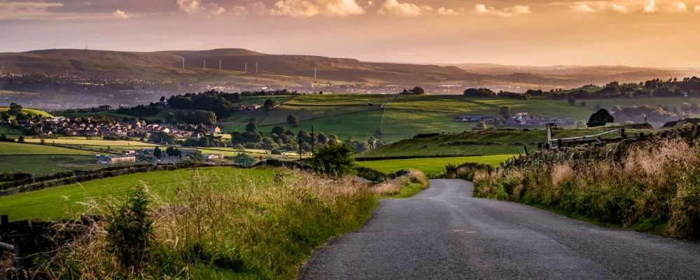
It goes over the northern Lake District to Keswick and Penrith, crosses the Eden Valley, climbs onto the North Pennines past old lead-mining villages, then drops through County Durham to Consett and the coast. About half is on quiet minor roads and nearly as much on paths and old railway lines. It’s usually ridden west to east, which puts the prevailing westerly wind behind you, and takes three to five days. Whitehaven and Workington are on the Cumbrian Coast railway line, and Sunderland and Tynemouth have Metro stations.
Highlights along the way
- Whinlatter Pass: the first big climb, on the B5292 between Lorton and Braithwaite, with Whinlatter Forest at the top. It was the first King of the Mountains climb of stage 2 of the 2016 Tour of Britain.
- Hartside: the long climb out of the Eden Valley onto the North Pennines, on the A686, topping out at about 580 m.
- Nenthead and Black Hill: Nenthead is one of England’s highest villages at about 438 m, and grew up around lead mining. The road beyond climbs to Black Hill near Allenheads, the highest point of the route at 609 m.
- Hownsgill Viaduct: a railway viaduct west of Consett, opened in 1858, 700 ft long and up to 150 ft high, now carrying the route over the gorge.
- The finish: dip your front wheel in the North Sea at Sunderland, or at Tynemouth below the ruined priory and castle.
Distance
It depends on where you start and finish. Whitehaven to Sunderland is about 214 km (133 miles) and Whitehaven to Tynemouth about 221 km (137.5 miles). From Workington it’s about 201 km (125 miles) to Sunderland and 208 km (129.5 miles) to Tynemouth.
If you have a GPX of this route from its official site or a planning app, open it in our free GPX viewer to see the distance, the climb and the height profile. The file stays on your device.
Best time to go
April to October. The Pennine tops are exposed, so check the forecast before the Hartside and Black Hill days. Parts of the route are closed from time to time for bridge repairs and other works, and in 2026 there were closures near Cleator Moor, Castleside and Sunderland. Check the Walk Wheel Cycle Trust C2C page for current closures and diversions before you go.
More journeys in England
- Exmouth towards Poole SWCP · Greg
- Folk on a Boat · Simon & Lucy
- Bristol Rides · David
- Scotland West Coast Train · Greg
- Week In UK · Greg
- Pangbourne · Ben
Flyby films from England
- Kenya safari · Alison Popper
- The Great Escape · saeunn
- Ferry to UK · Greg
- Exeter towards Poole · Greg
More routes like this
- Atlantic Coast Route – EuroVelo 1 by bike · about 11,000 km (6,835 miles) · England, France, Ireland, Norway, Portugal, Scotland, Spain, Wales, Northern Ireland
- Land’s End to John o’ Groats by bike · 1,600–1,900 km (990–1,180 miles) · England, Scotland
- Loire Valley by bike · about 900 km (559 miles) · France
- Hebridean Way by bike · about 298 km (185 miles) · Scotland
- Kystriksveien - The Coastal Route by bike · about 630 km (390 miles) · Norway
- Tauernradweg by bike · about 310 km (193 miles) · Austria