Cabot Trail by bike
- Distance
- about 298 km (185 miles)
- Country
- Canada
- Difficulty
- Challenging
- Type of trip
- Cycling route
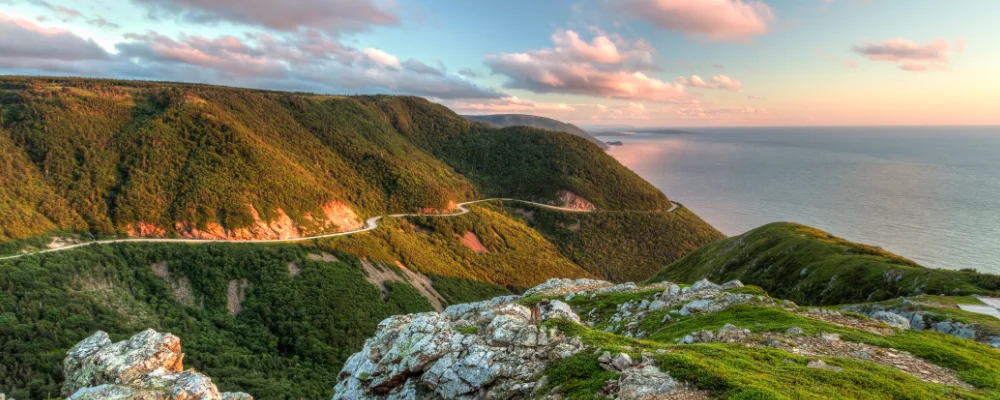
The Cabot Trail is a road, not a cycle route. It’s a 298 km loop round the northern tip of Cape Breton Island in Nova Scotia, made up of Trunk 30 and a short stretch of Highway 105, and it was finished in 1932. Cyclists ride it in both directions alongside cars and motorhomes. About a third of it runs through Cape Breton Highlands National Park, and a park pass is needed to use the park’s campgrounds, trails and other facilities, even on a bike. Check the current fee with Parks Canada. The west side follows the Gulf of St Lawrence past Chéticamp, the north crosses the highlands to Cape North, and the east side comes down the Atlantic coast through Ingonish. The south-west section runs up the Margaree River valley and along Bras d’Or Lake, back towards Baddeck.
Four long climbs set the difficulty: French and MacKenzie mountains between Chéticamp and Pleasant Bay, North Mountain beyond Pleasant Bay, and Smokey Mountain south of Ingonish. Parks Canada lists grades of 9% to 15% on them. The park is adding a paved shoulder for cyclists as it upgrades the road, but it isn’t continuous. There are eight park campgrounds, plus places to stay in the villages along the road. Between the Big Intervale and Broad Cove campgrounds there’s a 43 km stretch with no other park campground. Parks Canada lists drinking water at Chéticamp, Corney Brook, MacIntosh Brook, Black Brook, Broad Cove and Ingonish, and you can buy water in the villages. Nova Scotia law requires cyclists to wear a helmet.
Highlights along the way
- French and MacKenzie mountains: two linked summits at 452 m and 370 m, steep on both sides. The climb up French Mountain from the Chéticamp side is 5.5 km. From the MacKenzie look-off you see Fishing Cove 335 m below, where a fishing village used to be.
- The Skyline Trail: a 6.5 km out-and-back walk (or an 8.2 km loop) from the road on French Mountain to a boardwalk above the Gulf of St Lawrence. Parking reservations were needed from 26 June to 25 October in 2026, so check with Parks Canada whether that applies when you arrive by bike.
- North Mountain: at 467 m the highest climb on the loop, with grades of 12% to 15%. At its foot is the Lone Shieling, a replica Scottish crofter’s hut in a stand of sugar maples about 350 years old, and the look-off at the top faces down the Aspy Fault.
- Smokey Mountain: just outside the park, 366 m and also 12% to 15%. From Ingonish Harbour it’s 10 km to the top; from Wreck Cove on the south side it’s 7.2 km.
- Chéticamp and St Anns: Chéticamp is an Acadian fishing village on the west coast, with the park’s western visitor centre just outside it. St Anns, on the east side, is home to the Gaelic College of Celtic Arts and Crafts.
Distance
About 298 km (185 miles) for the full loop. About a third of it lies inside the national park.
Best time to go
Mid-May to late October, when the park’s visitor services are open (15 May to 25 October in 2026). July and August are the busiest months on the road. May, June, September and October are quieter, but some businesses close outside the peak. The Cabot Trail stays open all year, but the park has no visitor services in winter.
More journeys in Canada
- 🎶 I Would Drive 5000 Miles 🎶 · Matt
- White Rock Tour · Geoffrey
- Trip To Banff · Doug
- A Weekend In Whistler · jjsereday
- Three Bridges · Geoffrey
Flyby films from Canada
- ALASKA or BUST! · Matt
- deer · David
- Day 66 · Jeremy
More routes like this
- La Route Verte by bike · about 5,400 km (3,355 miles) · Canada
- Pacific Coast Bike Route · about 2,950 km (1,830 miles) · Canada, USA
- Great Divide Mountain Bike Route · about 4,418 km (2,745 miles) · Canada, USA
- Senda del Oso by bike · about 41 km (25 miles) · Spain
- La Vélo Francette by bike · about 640 km (400 miles) · France
- Camino del Cid by bike · about 1,485 km (923 miles) · Spain