Senda del Oso by bike
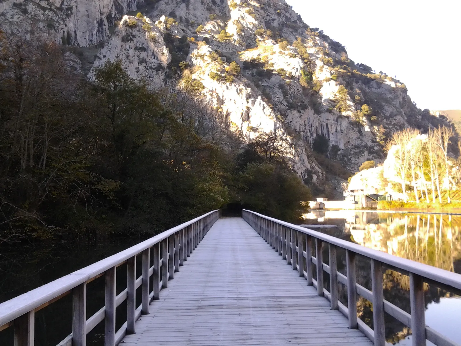
Photo: Sammy pompon, CC BY-SA 4.0, via Wikimedia Commons
- Distance
- about 41 km (25 miles)
- Country
- Spain
- Difficulty
- Easy
- Type of trip
- Cycling route
The Senda del Oso, the Bear Trail, is a greenway in central Asturias on the bed of an old mining railway. The line carried iron ore and coal down the Trubia valley until it closed in 1963. The greenway starts at Tuñón, in Santo Adriano, and follows the river Trubia past Proaza to Caranga Baxu, where it splits in two. One branch heads up the Teverga valley through Entrago to Cueva Huerta; the other goes into Quirós, past the Valdemurio reservoir to Santa Marina. The first stretch, Tuñón to Proaza, opened in 1995. It reached Entrago in 1996 and Cueva Huerta in 2011. Turismo Asturias reckons on half a day by bike for Tuñón to Caranga.
Spain's Vías Verdes programme gives the surface as asphalt or cement, and there are more than 30 tunnels cut in the rock. They're lit, but the floor is a bit uneven and hard to see. Tuñón to Caranga is close to flat, with 140 m of climbing. The Teverga branch climbs 588 m to Cueva Huerta and Turismo Asturias rates it moderate. The path is fenced, but between Proaza and Teverga it crosses the road twice. There are no bars or restaurants between Proaza and Entrago, so take food. There's no public transport back either, so plan to ride both ways or arrange a lift with a local activity company. Several of them hire bikes, some with child seats.
Highlights along the way
- Santo Adriano and the Trubia: Near the start at Tuñón is the pre-Romanesque church of Santo Adriano. The first stretch crosses the Trubia on the La Esgarrada bridge and passes a medieval bridge at Villanueva.
- The bear enclosure: Between Villanueva and Proaza, a fenced area of about 4 hectares is home to Molina, a brown bear found injured in 2013 at Rimolín, in Cangas del Narcea, who couldn't go back to the wild. You can park at Proaza or at the Buyera picnic area, both about 500 m away.
- Peñas Juntas: Here the limestone walls close in over the river, and the path hangs above the water on ledges, short tunnels and cuttings in the rock.
- Valdecerezales and Teverga: Just past Caranga the Teverga branch enters the Valdecerezales gorge, a narrow pass cut by the river Teverga. The branch passes the Teverga Prehistoric Park and ends at Cueva Huerta, a cave with 14.5 km of mapped galleries.
- Valdemurio and Quirós: The Quirós branch follows the river Quirós through the Cuevafurada gorge and crosses the Valdemurio reservoir, built in the 1960s for hydroelectric power, on a wooden bridge. It goes on past Bárzana and the Museo Etnográfico de Quirós to the old El Cribu coal loader at Santa Marina.
Distance
About 41 km (25 miles) of path in all, not counting the ride back. Tuñón to Caranga Baxu is 10 km (6 miles). From there the Teverga branch runs 19.1 km (11.9 miles) to Cueva Huerta and the Quirós branch 12 km (7.5 miles) to Santa Marina.
Best time to go
Turismo Asturias lists the route as open all year. If you want to see the bear, avoid the hibernation period, which the regional tourist board's blog (February 2024) puts at roughly late November to early March. When the official route page was checked in November 2026, it still described Molina living in the enclosure. Part of the route is in Natura 2000 protected areas. Keep dogs on a lead, and leave livestock and their guard mastiffs alone.
More journeys in Spain
- Camino De Santiago · Julia & James
- France Spain 2024 · Greg
- Cycling the Basque Region · Lucy
- Sailing Around The World · Adam
- Road trip tenerife · Josephine
- Camino De Santiago · Ruth
Flyby films from Spain
- Tenerife · Josephine
- The Great Escape · saeunn
- Bilbao to....? · Greg
- León, Mediterranean disease · Eike
More routes like this
- Camino Francés by Bike · about 770 km (480 miles) · Spain, France
- Camino Portugués by Bike · about 610 km (380 miles) · Portugal, Spain
- Atlantic Coast Route – EuroVelo 1 by bike · about 11,000 km (6,835 miles) · England, France, Ireland, Norway, Portugal, Scotland, Spain, Wales, Northern Ireland
- Camino del Cid by bike · about 1,485 km (923 miles) · Spain
- Emsradweg by bike · about 385 km (240 miles) · Germany
- Canal du Midi by bike · about 257 km (160 miles) · France