Pacific Coast Bike Route
- Distance
- about 2,950 km (1,830 miles)
- Countries
- Canada, USA
- Difficulty
- Moderate to challenging
- Type of trip
- Cycling route
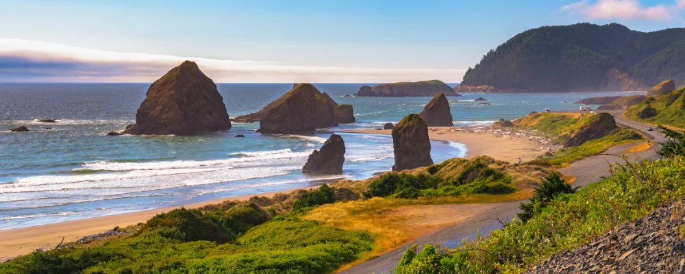
The Pacific Coast route is Adventure Cycling Association’s mapped bike route from Vancouver, British Columbia, to Border Field State Park at Imperial Beach, right next to the Mexican border. It’s about 2,950 km (1,830 miles), in five map sections, and it ends at the border rather than crossing it. From Vancouver it runs through farmland to the US border at Blaine, over Deception Pass onto Whidbey Island, across by ferry to Port Townsend and down the Olympic Peninsula. It then crosses the Columbia River into Oregon, and from Astoria the route stays close to the coast for most of the way through Oregon and California.
It’s a road ride, mostly on US 101 and California’s Highway 1, shared with motorhomes, logging trucks and, in the cities, heavy traffic. There are bike paths through some of the big towns, including the beach paths from Santa Monica. Oregon is hilly, northern California has steady ups and downs over the headlands, with a big climb between Leggett and the coast, and the hills only ease off south of Santa Barbara. Most nights you can camp: many state parks in Washington, Oregon and California have hiker-biker sites, usually first come, first served. Services are further apart through the northern California redwoods and Big Sur, so carry extra food and water there.
Highlights along the way
- Oregon Coast Bike Route: Oregon’s own signed route covers 365 miles (587 km) of US 101 from Astoria to the California border. Push the button at tunnels and on the Yaquina and McCullough bridges to switch on the warning lights that tell drivers a cyclist is there.
- The redwoods: south of Crescent City the road runs through Redwood National Park and Humboldt Redwoods State Park, and a herd of elk lives near Orick.
- Golden Gate Bridge: the route crosses it into San Francisco and stays on the western side of the city.
- Big Sur: Highway 1 south of Carmel, high above the sea along the Santa Lucia Mountains. It’s the part many riders rate highest, and also the part most often shut by landslides.
- San Diego to the border: residential streets and bike paths lead to the Coronado ferry, then a path along Silver Strand State Beach to the end at Border Field State Park.
Distance
About 2,950 km (1,830 miles) from Vancouver to Border Field State Park at Imperial Beach on the main route, in five map sections.
Best time to go
Adventure Cycling suggests roughly March to October for the most reliable weather, and warns of heavy motorhome traffic on US 101 and Highway 1 in high summer. The prevailing wind is from the north-west, which is why Oregon and Adventure Cycling both advise riding south. Winter storms bring landslides that close parts of Highway 1 through Big Sur from time to time. A stretch near Lucia shut by slides in January 2023 reopened in January 2026. Check current conditions on Caltrans QuickMap before you go.
More journeys in Canada, USA
- Biking Across Canada For Charity · Jeremy
- US Road Trip · Julia & James
- Southwest USA Road Trip · Qinggong
- World Trip - Zero Impact Expedition · David
- 🎶 I Would Drive 5000 Miles 🎶 · Matt
- Second day · Camila
Flyby films from Canada, USA
- Ginkgo forest · Xiao
- Second day · Camila
- Saindo de lake Havasu City · Camila
- ALASKA or BUST! · Matt
More routes like this
- Great Divide Mountain Bike Route · about 4,418 km (2,745 miles) · Canada, USA
- TransAmerica Trail by bike · 6,804 km (4,228 miles) · USA
- La Route Verte by bike · about 5,400 km (3,355 miles) · Canada
- Cabot Trail by bike · about 298 km (185 miles) · Canada
- Munda Biddi Trail by bike · about 1,070 km (665 miles) · Australia
- Alpe-Adria Cycle Path · about 410 km (255 miles) · Austria, Italy