How to track your journey offline, with no signal
A lot of the best places have no phone signal. A valley in the mountains, a week at sea, a long empty road. Pebbls keeps recording your route without it and sends everything up when you're back in range, an hour later or a week later.
The one thing worth doing before you go is downloading a map.
Download a map before you go
Tracking doesn't need a map, but you'll want to see where you are. With no signal the app can't load the map, so save the area to your phone first, at home on Wi-Fi if you can.
- Open the menu and tap Settings, then Offline Maps.
- Tap Add New Region.
- Move the map so the square covers the area you want, then tap Looks good?
- Give the region a name, say "North Cascades", and tap Download Region.
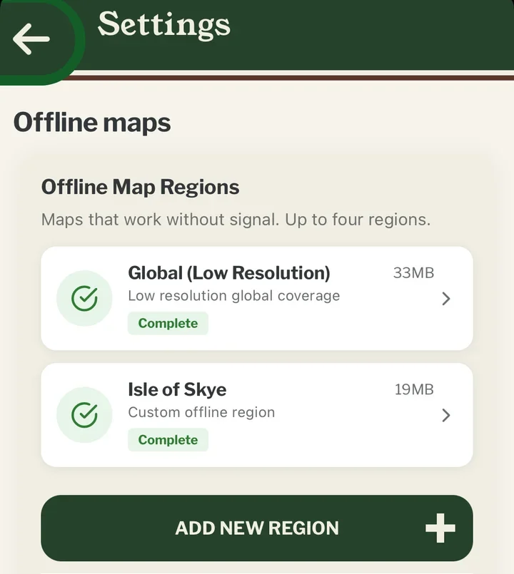
A region is usually 15 to 100 MB, which is why Wi-Fi is better. Only one downloads at a time.
You can keep 1 region, or 4 with Explorer. There's also a low-resolution world map built into the app, which doesn't count, so the screen is never blank. It just won't show small roads and paths.
Track as normal
Tap TRACK and set off. Your phone's GPS doesn't need signal, and the route is saved on the phone as you go. You'll see it drawn on the map in the app straight away.
Drop pebbls offline too
A pebbl is a photo, a note or both, pinned to the map where it happened. Add them as usual. With no signal they wait on your phone along with the route.
When you're back in range
You don't need to do anything. Pebbls syncs by itself: GPS points a few times an hour, pebbls straight away, photos and videos in the background. Allow up to 5 minutes for the website to catch up.
If you want to check, open the menu. The upload button next to your name shows a tick when everything is up, or a number if some things are still waiting. Tap it to see the queue, and Sync Now if you're in a hurry.
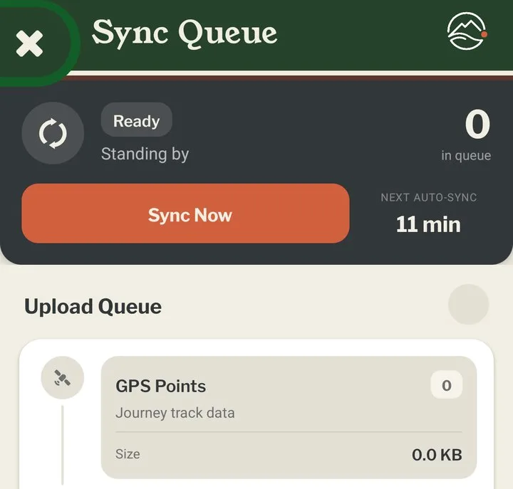
Don't log out, or switch to another journey, while things are still waiting. Anything left in the queue is lost. The app warns you if you try.
Saving mobile data
The route itself uses hardly any data. A whole day of tracking uses less than one photo. Photos and videos are what eat into your allowance, so on an expensive or limited plan, go to Settings › Uploads and choose to send all photos and videos over Wi-Fi only. Your route still goes up over mobile data, so people at home can see where you've got to, and the photos follow when you find Wi-Fi.
There's also an option to hold back the route until Wi-Fi, but then your online map only moves when you're on Wi-Fi.
Live tracking works differently. It sends your position as you move, and it uses mobile data even if you've chosen Wi-Fi only. Standard tracking, the default, sends your route a few times an hour.
Everything above is free except faster map updates and the extra map regions, which come with an Explorer membership along with private journeys and videos in your pebbls.
The help pages have more on offline maps and syncing.