Tongariro Alpine Crossing on foot
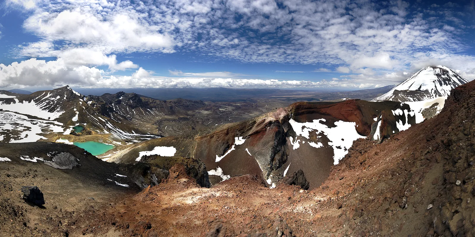
Photo: Jeffrey Pang, CC BY 2.0, via Wikimedia Commons
- Distance
- 20 km (13 miles)
- Country
- New Zealand
- Difficulty
- Moderate to challenging
- Type of trip
- Hiking trail
The Tongariro Alpine Crossing is a one-day walk over the volcanic ground of Mount Tongariro, in the middle of New Zealand's North Island. It runs one way from the Mangatepōpō road end at 1,120 m to Ketetahi Road at 760 m, past the foot of Mount Ngauruhoe. The Department of Conservation (DOC) gives it as 20.2 km and 7 to 8 hours in summer, with a high fitness rating. The mountains are sacred to Ngāti Hikairo ki Tongariro of Ngāti Tūwharetoa, and DOC asks you not to touch or go into any of the lakes or streams.
Because it's one way, the start is the thing to plan. In summer there's no parking at Mangatepōpō for people doing the crossing, the road ends have a 4-hour limit, and DOC advises against leaving a car on the state highway. There's a private car park near the Ketetahi end. DOC suggests a shuttle, which runs from the local towns. A free track booking is recommended for everyone and needed for shuttles and guides. Carry 2 to 3 litres of water, as water on the track isn't safe to drink.
Highlights along the way
- Mangatepōpō Valley: The first 5.4 km climb gently on a boardwalk and are shared with the Soda Springs Walk. Two fires in late 2025 burned the land around the start, and Ngāti Hikairo ki Tongariro has put a 10-year rāhui over it, so stay on the track.
- South Crater: At the head of the valley a staircase climbs about 350 m to the flat floor of South Crater.
- Red Crater: The highest point of the crossing, at 1,886 m. The way down is steep, loose scree that DOC calls a major slip hazard. Climbing Mount Ngauruhoe as a side trip is no longer allowed, at the request of local iwi, and its markers have been taken away.
- Emerald Lakes: Ngā Rotopounamu sit just below Red Crater, coloured by minerals from the volcano. There are steam vents around them. Keep away, as the steam is very hot and the ground can give way.
- Blue Lake and the descent: After Te Wai Whakaata o Te Rangihīroa, the Blue Lake, a long zig-zag path with many steps drops down the northern slopes, with views over Lake Rotoaira and Lake Taupō, and into forest.
Distance
DOC gives 20.2 km (12.6 miles) one way. Older figures, including Wikipedia's, say 19.4 km (12.1 miles). Most people walk from Mangatepōpō because it starts 360 m higher than the Ketetahi end. DOC allows 7 to 8 hours from November to April and 9 hours in winter.
Best time to go
The summer season runs from Labour weekend in late October to 30 April. Snow can fall at any time of year, even in summer. When the Red Crater forecast is bad, DOC puts out a 'Not Recommended Today' advisory at 6 am. From May to October the track is under snow and ice, with avalanche risk, and DOC treats it as an expert route. You need a helmet, crampons and an ice axe and the skills to use them, and DOC says it's best to go with a guide. Shuttles generally don't run in winter. This is an active volcanic area. Eruptions are unlikely but can happen at any time, and in 2012 the Te Maari craters threw ash and rocks over the track. Check the volcanic alert level on GeoNet and the forecast on NIWA before you go.
More journeys in New Zealand
- Van Life In New Zealand · Nick
- Bikepacking Through NZ · Kate
Flyby films from New Zealand
- French Polynesia to Fiji · Adam
- North Island · Nick
- Christchurch To Houston · k1w176
- Picton To Ships Cove · Kate
More routes like this
- Abel Tasman Coast Track · about 60 km (37 miles) · New Zealand
- Milford Track · 54 km (33 miles) · New Zealand
- Kepler Track · 60 km (37 miles) · New Zealand
- Te Araroa Trail · about 3,000 km (1,900 miles) · New Zealand
- Routeburn Track · 33 km (21 miles) · New Zealand
- Drakensberg Grand Traverse · 220–240 km (137–149 miles) · South Africa, Lesotho