Abel Tasman Coast Track
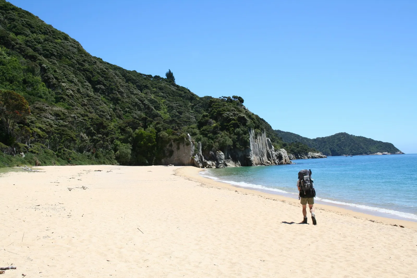
Photo: Department of Conservation, CC BY 2.0, via Wikimedia Commons
- Distance
- about 60 km (37 miles)
- Country
- New Zealand
- Difficulty
- Easy to moderate
- Type of trip
- Hiking trail
The Abel Tasman Coast Track is a 60 km walk along the coast of Abel Tasman National Park, at the north end of New Zealand's South Island. The track runs from Mārahau in the south to Wainui in the north, and it's one of the Great Walks run by the Department of Conservation (DOC). It's well marked and signposted, but some sections are steep, rough or muddy. Most people take 3 to 5 days. You can walk it either way, and plenty of people walk one way and come back by water taxi. The water taxis don't go north of Tōtaranui, so if you walk to the far end you loop back over Gibbs Hill to Tōtaranui for the boat.
You sleep in DOC huts or campsites, 4 huts and 18 campsites in all, and they have to be booked all year round. Turn up without a booking and you can be charged a penalty or sent away. On DOC's price list in November 2026, a hut bunk from 1 October to 30 April cost $84 a night for international adults and $55 for New Zealanders, and a campsite $31 and $21, in NZ dollars. There's no fee to walk it for the day. The huts have no gas for cooking and no lighting, so carry a stove and fuel. Water at huts and campsites isn't treated and has to be boiled.
Highlights along the way
- Cleopatra's Pool: A rock pool of clear, cool water with a moss-lined waterslide. You reach it from the all-tide track around the Torrent Bay estuary.
- Falls River: A 47 m suspension bridge takes the track over the river between Torrent Bay and Bark Bay.
- Onetahuti Bay: One of the longest beaches in the park, a short walk on from Tonga Quarry, looking out to Tonga Island. The sea off this stretch is the Tonga Island Marine Reserve, and DOC says to look out for fur seals.
- Awaroa Inlet: The one crossing you can only make at low tide, from 1 hour 30 minutes before to 2 hours after low water, and only in daylight. Allow 25 minutes. There's no track round it, so your days have to fit the tide table.
- Whariwharangi Hut: A former homestead built around 1896, just behind the beach at Whariwharangi Bay. From here you climb to a saddle above Wainui Inlet, or go over Gibbs Hill back to Tōtaranui.
Distance
About 60 km (37 miles) one way, from Mārahau to Wainui. DOC's sections are 12.4 km from Mārahau to Anchorage, 8.4 km on to Bark Bay if you cross the Torrent Bay estuary at low tide (11.5 km by the high tide track), 13.5 km to Awaroa, 7.1 km to Tōtaranui, 9.8 km to Whariwharangi Bay and 5.7 km to the Wainui car park. If you're going back by water taxi, the Gibbs Hill Track from Whariwharangi to Tōtaranui is 9 km.
Best time to go
You can walk the track all year, and it's busiest from October to April. Winter is quieter, with fewer insects, calmer water, cooler days and less daylight. From late spring through the summer strong westerlies blow along the coast, while autumn and winter are usually calm. There are sandflies and wasps, so carry repellent. You can book each hut or campsite for two nights at most from 1 October to 30 April, and five from 1 May to 30 September. Check the tide times before you book. Bookings for the 2026/27 season were open in November 2026. See the Abel Tasman Coast Track page on doc.govt.nz for prices, tide tables and track alerts.
More journeys in New Zealand
- Van Life In New Zealand · Nick
- Bikepacking Through NZ · Kate
Flyby films from New Zealand
- French Polynesia to Fiji · Adam
- North Island · Nick
- Christchurch To Houston · k1w176
- Picton To Ships Cove · Kate
More routes like this
- Routeburn Track · 33 km (21 miles) · New Zealand
- Te Araroa Trail · about 3,000 km (1,900 miles) · New Zealand
- Kepler Track · 60 km (37 miles) · New Zealand
- Tongariro Alpine Crossing on foot · 20 km (13 miles) · New Zealand
- Milford Track · 54 km (33 miles) · New Zealand
- John Muir Way · 215 km (134 miles) · Scotland