Bay of Islands sailing
- Distance
- Varies with your plan. For scale, the bay is about 16 km across, Urupukapuka is about 15 km from Paihia, and the Hole in the Rock is about 25 km from Paihia in a straight line.
- Country
- New Zealand
- Difficulty
- Easy to moderate
- Type of trip
- Sailing route
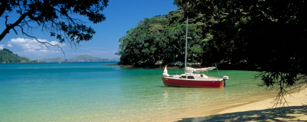
There’s no set route through the Bay of Islands. It’s a sailing area: a drowned valley system on the east coast of Northland, about 16 km wide and 260 km² in area, usually counted as having 144 islands. Most people plan short hops between anchorages. You can charter a yacht from Opua, or take the passenger ferries between Paihia and Russell and the day boats out to the islands. Opua has a marina with about 420 berths and is New Zealand’s northernmost port of entry, and a popular first stop for yachts that have sailed across the Pacific.
If you’re arriving from overseas, Opua is a Customs and Ministry for Primary Industries place of first arrival. Check the current arrival and biosecurity rules before you leave your last port. Inside the bay, the seven eastern islands form Project Island Song, a pest-free sanctuary. Check your boat and bags for rats, mice, ants and seeds before you land. Bottlenose dolphins visit the bay, though far fewer than in the 1990s. Since 2021 the bay has been a marine mammal sanctuary. Boats must stay more than 300 m from dolphins and whales, and no one may be in the water within 300 m of them.
Highlights along the way
- Russell (Kororāreka): once known as the "Hell Hole of the Pacific", a whaling port with no law to speak of, and sacked in 1845 in the Flagstaff War. The Pompallier Mission, where a Catholic mission printed books in Māori from 1842, is open to visitors.
- Waitangi Treaty Grounds: where the Treaty of Waitangi was first signed on 6 February 1840, outside James Busby’s house. The grounds hold the Treaty House, the carved meeting house Te Whare Rūnanga and two museums, and are a short walk from Paihia.
- Motuarohia (Roberton Island): Cook anchored off it in 1769 and named the bay. On the north coast are two shallow lagoons, and the middle of the island is public conservation land. The rest is private.
- Urupukapuka Island: the largest island in the bay at 208 ha, about 15 km from Paihia, with sheltered anchorages such as Indico Bay, an archaeological walk and a Department of Conservation campsite. It’s part of the Project Island Song sanctuary.
- Hole in the Rock: Motu Kōkako (Piercy Island), off the tip of the Cape Brett peninsula, has an 18 m hole through it at sea level.
Distance
Varies with your plan. For scale, the bay is about 16 km across, Urupukapuka is about 15 km from Paihia, and the Hole in the Rock is about 25 km from Paihia in a straight line.
Best time to go
November to April for the warmest weather. January and February are the warmest months (average about 19 to 20 °C at Kerikeri), and October, November and January usually the driest. June to August are cooler and much wetter, with July the wettest month.
Journeys that follow this route
On part of the route or all of it.
- Sailing Around The World · Adam · 36 km of the route
More journeys in New Zealand
- Van Life In New Zealand · Nick
- Te Araroa · The long walk of Te Waipounamu
- Bikepacking Through NZ · Kate
Flyby films from New Zealand
- Sunday 15th · The long walk of Te Waipounamu
- Auckland-Santiago-Buenos Aires · Karen
- French Polynesia to Fiji · Adam
- North Island · Nick
More routes like this
- Dalmatian Coast sailing · Croatia
- French Polynesia sailing · French Polynesia
- Mediterranean sailing grounds · Croatia, Greece, Italy, Turkey
- Chesapeake Bay sailing · USA
- Stockholm Archipelago sailing · Sweden
- Norwegian Fjords sailing · Norway