How to make a travel map of your trip
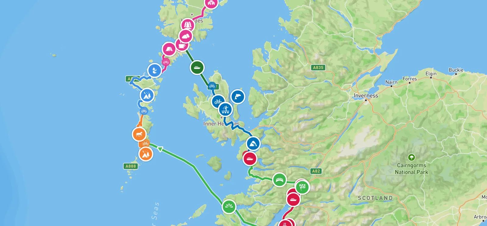
A list of the places you've been is easy to make. A map of how you got between them is harder, and that's usually the part you want to remember: the road over the pass, the ferry crossing, the day you walked further than you meant to. Our bike ride along the Hebridean Way is 764 km over 17 days, in 9 chapters, with the photos and notes sitting on the map where they happened.
How you make a map like that depends on where you are with the trip. Before you go, the easiest way is to let your phone record it as you travel. If the trip's already done, you can build the map from a GPS file. Either way, you can then print it, or turn it into a film.
Record it as you travel
Pebbls is a free app for iPhone and Android. Once it's recording, it draws your route while the phone stays in your pocket.
1. Start a journey
Open the app and tap Start my first journey. Give it a name people will understand ("Hebridean Way by bike" works better than "Trip"). The app asks who can see it. A public journey shows on the adventure map and in the feed, so other travellers can find it. A private one only opens for the people you send the link to, and you can add a password as well.
2. Add a chapter
A journey is split into chapters, like a book: a day, a stage, a country. Pick how you're travelling, and you're ready. On the Hebridean Way we started a new chapter for each island, each ferry and the rides at either end on the mainland, which is why the map has nine colours.
If you'd rather nobody saw exactly where you start or finish, your house or a campsite say, you can hide the first or last 500 m, 1 km or 3 km of a chapter. That's free.
3. Switch on tracking
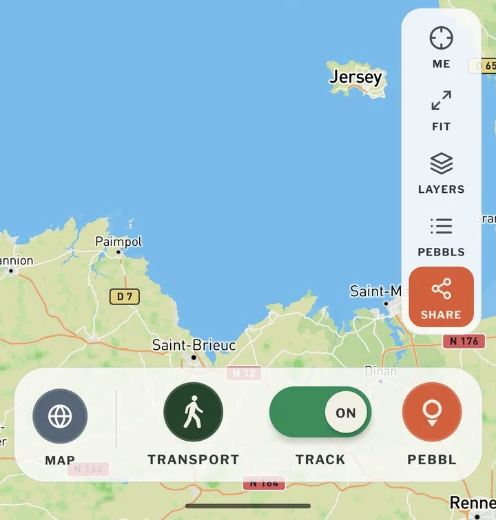
Turn on the TRACK switch at the bottom of the map screen and put the phone away. In Standard mode the app saves your route on the phone and sends it a few times an hour, which is easy on the battery. It doesn't need signal; it catches up when you're back in coverage.
If you'd like family to watch you move, tap the gear next to "Tracking on" and choose Live. It sends your position as you go, so the dot on their map moves with you, and it uses a bit more battery.
Switch tracking off at the end of the day, and start a new chapter when it makes sense to.
4. Add photos and notes where they happened
When something's worth remembering, press the PEBBL button in the bottom right corner and add photos, a video or a note. We call these pebbls, and they sit on the map at the spot where you added them. If something's just for you, make it a private pebbl and nobody else will see it.
5. Share it
The SHARE button on the right of the map screen gives you a link to send. The link never changes, so you can send it before you set off, and anyone who follows you is told when you add a chapter or a pebbl. To put the map on your own website or blog, use Embed on Website in the same menu, or the WordPress plugin if your site runs WordPress.
Build it after the trip from a GPS file
If you recorded the trip on a watch, a bike computer or an app like Strava or Komoot, you can usually save it as a GPX file. That's a list of points along your route, and most of these apps have an export button for it.
In the Pebbls app, start a new chapter and tap Import from GPX file. The route goes on the map, any waypoints saved in the file can become pebbls, and you can add more pebbls along it afterwards. The file needs at least 10 points. Importing only works in the app for now, and it's still marked Beta, so tell us if a file doesn't work.
If there's no file at all, Route to video lets you draw the route instead, by tapping along it on a map, and makes a film of it.
Print it, or turn it into a film
A printed map
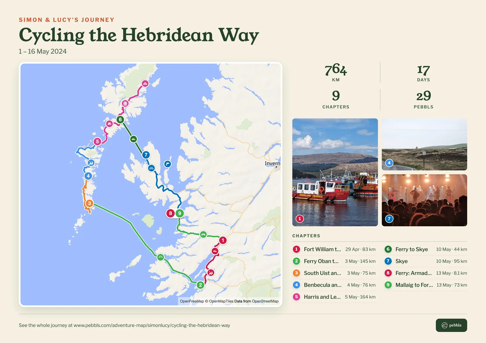
On the website, open any journey and press Share, then Print or download a map. You get a single page with the whole route, each chapter in its own colour and numbered, a few photos from along the way and the numbers: distance, days, chapters, pebbls and countries. A4 and US Letter are free, and there are bigger sizes for Explorers.
A flyby film of each chapter
Pebbls makes a 3D film of each chapter that has at least 2 pebbls and 3 photos. The film follows your route over satellite pictures, and your photos come up at the places you took them. It's free, and it appears about an hour after you stop adding to the chapter. This is the one Pebbls made of our 164 km across Harris and Lewis.

The films of the other chapters are on the journey's flyby page.
An animated map
For a flat map that draws your route as a video, with each country's name and flag coming up as you cross the border, there's the animated map maker. It runs in the browser on a phone or a computer, and you don't need an account. A Premium version costs one credit, and every account gets one free credit.
A film of a trip you didn't track
Route to video turns a GPX file, or a route you draw, into the same kind of 3D flyby film that Pebbls makes of each chapter. Routes up to 200 km are free.
What it costs
Everything above is free, the films included. If you'd like people at home to watch you move on the map as it happens, keep a journey to yourself and the people you send it to, add videos to your pebbls or print a poster, that's what an Explorer membership adds.
If something here doesn't match what you see in the app, email hello@pebbls.com and we'll fix the post.
For a quick map of every country you've been to, try the free countries visited map.