Canal du Midi by bike
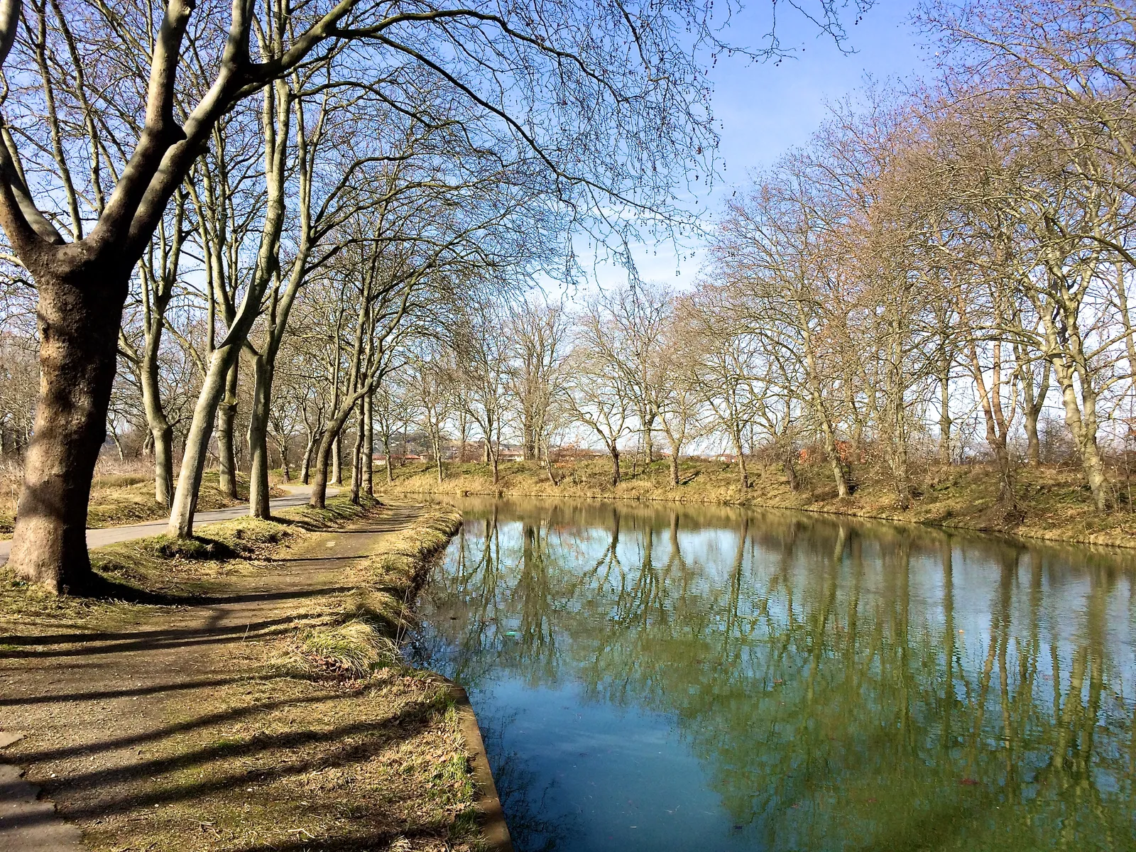
Photo: Mathilde Mongeau, CC BY-SA 3.0, via Wikimedia Commons
- Distance
- about 257 km (160 miles)
- Country
- France
- Difficulty
- Easy to moderate
- Type of trip
- Cycling route
The Canal du Midi runs for 240 km from Toulouse to the Étang de Thau near Sète. It was dug between 1666 and 1681 under Pierre-Paul Riquet to link the Garonne with the Mediterranean, and it's been a UNESCO World Heritage site since 1996. By bike it's the eastern end of the Canal des 2 Mers à vélo, the V80, which starts 750 km away at Royan on the Atlantic. The official stages from Toulouse to Sète add up to 257 km. You sleep in campsites, chambres d'hôtes, hotels and gîtes along the canal, and places with the Accueil Vélo label are set up for cyclists.
Don't expect a smooth cycle path the whole way. The towpath is paved for about 50 km from Toulouse to Avignonet-Lauragais. After the Seuil de Naurouze the official site recommends a mountain bike, France Vélo Tourisme says the towpath stays rough as far as Béziers, and between Naurouze and Carcassonne the signs stop. Take a hybrid, a gravel bike or a mountain bike. It is flat, though. The whole V80 never goes above 200 m.
Highlights along the way
- Toulouse: The canal starts at the Port de l'Embouchure, where it meets the Canal de Brienne and the Canal de Garonne.
- Seuil de Naurouze: This is the top of the canal, at about 189 m, and the watershed between the Atlantic and the Mediterranean. It's also where the rough towpath begins.
- Castelnaudary and Carcassonne: Castelnaudary's Grand Bassin, built between 1666 and 1671, is the biggest on the canal, and you leave town past the Saint-Roch lock with its four chambers. At Carcassonne the canal goes through the lower town. The medieval Cité above it has two rings of walls 3 km long and 52 towers.
- Le Somail and the Robine: Le Somail is a canal hamlet from the 17th century, with a chapel, an old icehouse and a shop full of old books. Here a branch heads south along the Canal de la Robine to Narbonne and on to Port-la-Nouvelle, on a strip of land between two lagoons.
- Malpas to the Étang de Thau: Near the Oppidum d'Ensérune the canal goes through the Malpas tunnel, 165 m long. At Béziers the Fonserannes locks drop 21.5 m in 300 m, and the canal crosses the Orb on an aqueduct opened in 1857. After the round lock at Agde it runs into the Étang de Thau by the lighthouse at Les Onglous, and a greenway beside the beach takes you on to Sète.
Distance
About 257 km (160 miles) from Toulouse to Sète on the official stages, or about 100 km (62 miles) if you stop at Carcassonne. The canal itself is 240 km (149 miles) long. At Le Somail you choose between 95 km (59 miles) more to Sète or 48 km (30 miles) down the Robine to Port-la-Nouvelle.
Best time to go
The official guide says you can ride it all year, with two warnings. After heavy rain the canals can flood suddenly, and summer can get very hot. Don't count on shade everywhere either. Canker stain, a fungus, was found in the plane trees in 2006, and English Wikipedia says all 42,000 of them will have to be felled and replaced. Boats use the canal from the third Saturday in March to the first week of November, and in winter it's closed to them for maintenance. When France Vélo Tourisme was checked on 3 November 2026 the route was fully open and hadn't been hit by the fires of July 2026.
More journeys in France
- France June 2023 · Greg
- France Spain 2024 · Greg
- UK to Georgia by Bike · Simon & Lucy
- The Rick Trip · Phil
- Sailing Around The World · Adam
- Spain France Pyrenees 2026 · Greg
Flyby films from France
- PLM line - Champagnole to Pont-du-Navoy - 25483409 · CNJ tourisme
- Lamasquère Road Cycling · Michmich
- To sea, on a ferry, off the ferry · Phil
- The Great Escape · saeunn
More routes like this
- Rhine Cycle Route (EuroVelo 15) · about 1,233 km (766 miles) · France, Germany, Netherlands, Switzerland, Austria, Liechtenstein
- La Véloscénie by bike · 450 km (280 miles) · France
- EuroVelo 6 - France to Romania by bike · about 4,700 km (2,900 miles) · Austria, France, Germany, Hungary, Romania, Switzerland, Slovakia, Croatia, Serbia, Bulgaria
- Atlantic Coast Route – EuroVelo 1 by bike · about 11,000 km (6,835 miles) · England, France, Ireland, Norway, Portugal, Scotland, Spain, Wales, Northern Ireland
- La Vélodyssée by bike · 1,300 km (808 miles) · France
- Loire Valley by bike · about 900 km (559 miles) · France