Garden Route by bike
- Distance
- Varies with where you start and finish. For scale, Mossel Bay to Storms River is about 200 km by road on the N2. Side trips to Robberg, Nature’s Valley or Storms River Mouth add more.
- Country
- South Africa
- Difficulty
- Moderate to challenging
- Type of trip
- Cycling route
The Garden Route is a stretch of coast, not a cycle route. There’s no official line or waymarking for riders. The name covers the shore of South Africa’s Western Cape and the edge of the Eastern Cape between the Indian Ocean and the Outeniqua and Tsitsikamma mountains. Definitions vary. One has it running about 300 km from Witsand to the Storms River. The trip described here goes from Mossel Bay to Storms River through George, Wilderness, Knysna and Plettenberg Bay. The main road is the N2, the national road that runs east from Cape Town along the coast. It carries through traffic and heavy lorries, it’s a divided freeway between Mossel Bay and George, and east of Plettenberg Bay it becomes the Tsitsikamma toll road over the Bloukrans Bridge.
So if you’re riding, plan your days around minor roads and the shorter, quieter sections of the N2, and treat the busier stretches as something to get through rather than enjoy. Long-distance buses and the Baz Bus run along the N2, and George has the nearest airport with regular domestic flights. Much of the coast between Wilderness and the Storms River is protected as the Garden Route National Park, run by SANParks, in three sections: Wilderness, Knysna and Tsitsikamma. Each charges a daily conservation fee, so check the current rates with SANParks.
Highlights along the way
- Mossel Bay: Bartolomeu Dias landed here on 3 February 1488. Sailors later left messages in a shoe hung from a milkwood tree, and the Post Office Tree still has a boot-shaped post box under it.
- Wilderness: the Wilderness section of the national park protects a chain of lakes, the Touw River and the Serpentine, a winding channel joining Island Lake to the Touw. The Ebb and Flow rest camp is on the river.
- Knysna lagoon and the Heads: the estuary reaches the sea between two big quartzite headlands known as the Heads, where the water is rough and boats have been lost.
- Robberg, Plettenberg Bay: a rocky peninsula just south of the town, protected as a nature reserve and marine protected area, with a Cape fur seal colony.
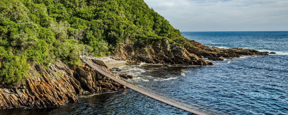
- Storms River Mouth: the main rest camp of the Tsitsikamma section. A path from the rest camp leads to a suspension footbridge over the river mouth, and the five-day Otter Trail to Nature’s Valley starts here. Up on the N2, the Paul Sauer Bridge crosses the Storms River gorge about 120 m above the water.
Distance
Varies with where you start and finish. For scale, Mossel Bay to Storms River is about 200 km by road on the N2. Side trips to Robberg, Nature’s Valley or Storms River Mouth add more.
Best time to go
Any month. Rain falls all year, with a small peak from September to November, and at sea level it rarely goes above 28 °C or below 10 °C. December and January are the main South African holiday season, so book ahead then. Southern right whales come into Plettenberg Bay to breed from July to December, and humpback whales pass in July and December.
Flyby films from South Africa
- Route from Maun to Makgadikgadi · Karin
More routes like this
- Cape to Cairo by bike · about 11,000 km (6,800 miles) · South Africa, Namibia, Botswana, Zambia, Zimbabwe, Malawi, Tanzania, Kenya, Ethiopia, Sudan, Egypt
- Lofoten Islands Cycling Route · about 130 km (81 miles) · Norway
- Death Road by bike · about 64 km (40 miles) · Bolivia
- North Sea Cycle Route in Germany (Nordseeküstenradweg) · about 900 km (560 miles) · Germany
- Danube Cycle Path · about 320 km (199 miles) · Austria, Germany, Hungary, Slovakia
- Moselradweg (Mosel Cycle Path) · about 311 km (193 miles) · Germany, Luxembourg, France