North Sea Cycle Route in Germany (Nordseeküstenradweg)
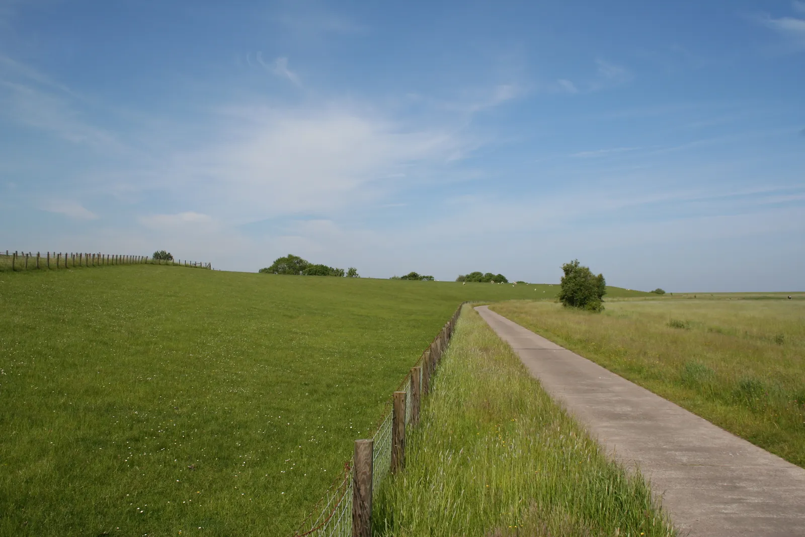
Photo: Andy1982, CC BY-SA 3.0, via Wikimedia Commons
- Distance
- about 900 km (560 miles)
- Country
- Germany
- Difficulty
- Easy to moderate
- Type of trip
- Cycling route
The North Sea Cycle Route, EuroVelo 12, goes round the North Sea through several countries. This guide covers only the German part, the Nordseeküsten-Radweg, which runs about 900 km from the Dutch border near Bunde to the Danish border near Rudbøl. In Germany it's also D-Route 1. It follows the Wadden Sea coast through Lower Saxony, round East Frisia, the Jade Bay and Butjadingen to Bremerhaven and Cuxhaven, then up the Elbe to Hamburg. From there it comes back down the other bank to Brunsbüttel and heads up the Schleswig-Holstein coast by Husum and Nordstrand. The Schleswig-Holstein tourist board suggests 10 to 14 days for the German part at 60 to 80 km a day. You sleep in hotels, guesthouses, holiday flats and campsites. Wikivoyage says to book beds early in high season, as some places don't want one-night guests, and in the summer holidays some campsites turn away cyclists with tents.
It's flat. Wikivoyage says the only climbs are up and down the dykes, but a headwind can make a long day of it, so good gears help. Most of the riding is on concrete or tarmac paths on one side of the dyke or the other, with gravel in places and some stretches on cycle paths beside roads. On the dykes you go through gates in the sheep fences. Lower Saxony's tourist board says you may have to get off for them, and Wikivoyage warns some are tight for a double child trailer. Give way to farm and dyke maintenance vehicles. The route doesn't stay on the seafront. In Lower Saxony it often heads several kilometres inland to the old harbour villages, and behind the dyke you mostly see the dyke. It's signed throughout as the North Sea Cycle Route, but Wikivoyage says signposts in East Frisia are sometimes turned round, so carry a map or GPS track.
Highlights along the way
- The Ems ferry and Greetsiel: Near the start a ferry dating from 1924 takes you across the Ems from Ditzum to Petkum in about 20 minutes. Past Emden, the lighthouse at Campen is the tallest in Germany at 65.3 m, and Greetsiel has a fishing harbour and windmills.
- Bremerhaven and the Weser ferry: On Butjadingen the route joins the Weser Cycle Route and crosses the river by ferry from Nordenham-Blexen to Bremerhaven. The next stage starts in the Havenwelten by the Klimahaus climate centre and runs through the container port.
- Cuxhaven and the Kugelbake: The Kugelbake, a ball beacon at Döse, marks the northernmost point of Lower Saxony. The Elbe, Weser and North Sea cycle routes all meet there. Lower Saxony's tourist board says not to miss the Wadden Sea visitor centre at Sahlenburg.
- The Altes Land and Hamburg: Before Hamburg you ride through the Altes Land, known for its huge fruit orchards, with the regional museum in Jork. Wikivoyage suggests crossing to the city centre on harbour ferry line 62 from Finkenwerder to the Landungsbrücken, about 30 minutes.
- Eidersperrwerk, St. Peter-Ording and Husum: In Schleswig-Holstein you cross the Eider barrier, Germany's biggest coastal flood defence. St. Peter-Ording has wide beaches and buildings on stilts, and old ships tie up in Husum's harbour.
Distance
About 900 km (560 miles) for the German part covered here, from the Dutch border to the Danish border. The bikeline guidebooks split it at Hamburg, with 564 km (350 miles) from Bad Nieuweschans to Hamburg and 368 km (229 miles) through Schleswig-Holstein. Wikivoyage splits Lower Saxony into nine stages of about 35 to 78 km. The whole North Sea Cycle Route is about 6,750 km (4,190 miles) by EuroVelo's current figure, though the text on the same EuroVelo page still says about 7,050 km. Older figures, including German Wikipedia's and the Schleswig-Holstein tourist board's, are nearer 6,000 km.
Best time to go
Wikivoyage says sheep go back onto the dykes from early April, and the paths on the sea side then get covered in droppings, so it suggests the landward paths from then on. In the season, village streets are busy with cars and don't always have a cycle lane. Lower Saxony's tourist board warns that gravel stretches may be restricted after long spells of rain. The dykes are being raised and rebuilt along the coast, so expect sections closed now and then, usually with signed diversions. German Wikipedia notes that in summer the wind mostly comes from the west. Before you go, check nordseetourismus.de for Schleswig-Holstein and niedersachsen-tourism.com for Lower Saxony.
More journeys in Germany
- Cycle Exped to Japan via Finland · Mark
- The Great Spirits Route · johan
- UK to Georgia by Bike · Simon & Lucy
- Denmark! · Christopher
- Istanbul To Ashby · Harry
- Beer hike · Christopher
Flyby films from Germany
- Dag 8: Schongau - Innsbruck · johan
- Stuttgart-Amsterdam · JereFü
- St Malo to Vienna · Lucy
- The Start · Christopher
More routes like this
- Rhine Cycle Route (EuroVelo 15) · about 1,233 km (766 miles) · France, Germany, Netherlands, Switzerland, Austria, Liechtenstein
- Ostseeküstenradweg by bike · about 1,100 km (680 miles) · Germany
- Ruhrtalradweg by bike · about 240 km (149 miles) · Germany
- EuroVelo 7 – Sun Route by bike · about 7,650 km (4,753 miles) · Austria, Czech Republic, Denmark, Germany, Italy, Malta, Norway, Sweden, Finland
- Rheinradweg (Rhine Cycle Route in Germany) · about 1,019 km (633 miles) · Germany
- Neckartal-Radweg by bike · about 370 km (230 miles) · Germany