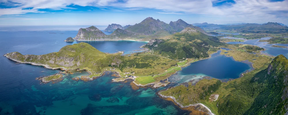
Lofoten Islands Cycling Route
- Distance
- about 130 km (81 miles)
- Country
- Norway
- Difficulty
- Moderate
- Type of trip
- Cycling route
The ride through Lofoten follows the E10, the one main road along the islands, from Å at the south-western tip through Reine, Ramberg and Leknes to Svolvær, and on to Raftsundet. That road is Norwegian Scenic Route Lofoten, and it’s also part of Norway’s National Cycle Route 1 and EuroVelo 1, which are signposted. It’s a road ride shared with cars and camper vans, not a separate cycle path, and in July traffic can be heavy. The Public Roads Administration suggests quieter county roads for some stretches: the Fv815 from Sundklakkstraumen to Leknes, and the Fv888 from Fiskebøl to Austnesfjorden.
Most riders start at Å, after the ferry from Bodø to Moskenes, which takes about 3 hours 15 minutes. The E10 crosses from island to island on bridges and through tunnels. The Nappstraum tunnel between Flakstadøya and Vestvågøya is 1,776 m long, drops 63 m below the sea and has gradients of up to 8%, and the official advice for cyclists is to skip it on the local bike boat between Nusfjord and Ballstad, booked through the operator. Bring lights for the other tunnels. At the north end, Hurtigruten stops at Svolvær and Stamsund, and since 2007 the Lofast road has linked Lofoten to the mainland without a ferry. Most people sleep in campsites or rorbuer, the old fishermen’s cabins.
Highlights along the way
- Reine and Hamnøy: fishing villages in Moskenes, on the E10 north-east of Å. Reine has been a trading post since 1743, and its islets are joined by bridges.
- Nusfjord: a fishing village on Flakstadøya, 6.2 km down a side road from the E10. It was one of three Norwegian pilot projects in European Architectural Heritage Year 1975, a Council of Europe campaign (it isn’t a World Heritage Site).
- Fredvang bridges: two cantilever bridges, each 240 m long, opened in 1988, linking Flakstadøya and Moskenesøya on a side road to Fredvang. They’re a short detour off the E10, not on it.
- Haukland beach: on Vestvågøy, the island Leknes is on, named Europe’s best beach by Lonely Planet in 2021.
- Svolvær: the town on Austvågøy where Hurtigruten calls and the ferry to Skrova and Skutvik leaves. Henningsvær is a side trip on the Fv816.
Distance
About 130 km on the E10 from Å to Svolvær, or about 180 km from Å to Raftsundet at the northern end. The Scenic Route, with its side roads to Nusfjord, Vikten, Utakleiv, Unstad, Eggum, Henningsvær and Grunnfør, adds up to 230 km.
Best time to go
June to August, for the longest days and the warmest weather (August averages about 13°C at Skrova). The midnight sun lasts from about 25 May to 17 July at Svolvær. The Svolvær–Skutvik ferry only runs for part of the year, so check sailings for your dates.
More journeys in Norway
- Cycle Exped to Japan via Finland · Mark
- The History of the Sea · saeunn
Flyby films from Norway
- The Great Escape · saeunn
- Stage 6 ETAP 1 September 6 2004 · Mark
More routes like this
- EuroVelo 7 – Sun Route by bike · about 7,650 km (4,753 miles) · Austria, Czech Republic, Denmark, Germany, Italy, Malta, Norway, Sweden, Finland
- Kystriksveien - The Coastal Route by bike · about 630 km (390 miles) · Norway
- Atlantic Coast Route – EuroVelo 1 by bike · about 11,000 km (6,835 miles) · England, France, Ireland, Norway, Portugal, Scotland, Spain, Wales, Northern Ireland
- Cape to Cairo by bike · about 11,000 km (6,800 miles) · South Africa, Namibia, Botswana, Zambia, Zimbabwe, Malawi, Tanzania, Kenya, Ethiopia, Sudan, Egypt
- Altmühltal-Radweg by bike · about 241 km (150 miles) · Germany
- Etschradweg (Adige cycle path) · about 270–300 km (170–185 miles) · Italy