Stubaier Höhenweg on foot
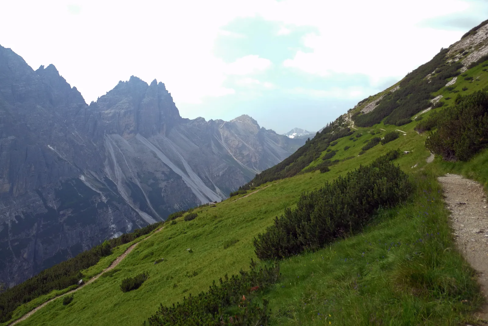
Photo: SchiDD, CC BY-SA 4.0, via Wikimedia Commons
- Distance
- about 80 km (50 miles)
- Country
- Austria
- Difficulty
- Challenging
- Type of trip
- Hiking trail
The Stubaier Höhenweg is a circuit of 8 Alpine Club huts high above the Stubai valley in Tirol. In order they're the Starkenburger, Franz-Senn, Neue Regensburger, Dresdner, Sulzenau, Nürnberger, Bremer and Innsbrucker huts. The usual start and finish is Neustift, and you can go either way round. It's about 80 km, and the valley's tourist board, stubai.at, reckons on a week. It counts 7 stages from hut to hut, while Wikipedia, adding the walk up to the first hut and down from the last, gets 8 or 9. You can start at any hut, and every hut's valley base can be reached by public transport. It recommends joining the Alpine Club for cheaper nights and insurance, and you can join in Neustift or at any hut. Bring a hut sleeping bag and enough cash.
It's a black mountain path under Tirol's grading, all in alpine and high alpine terrain, and Wikipedia puts most of it between 2,000 and 3,000 m. Parts have steel cables and rungs. stubai.at says the short climbing sections are like easy via ferratas, and the route is for sure-footed walkers with several years of mountain walking behind them. You never have to cross a glacier, but early in the season expect steep old snowfields, where light crampons and an ice axe can help. Bad weather makes the whole thing much harder.
Highlights along the way
- Starkenburger Hütte: At 2,237 m above Neustift, built in 1900 by the Starkenburg section of the German Alpine Club. From Fulpmes a cable car to the Kreuzjoch cuts the walk in to about 1.5 hours, by Wikipedia's timings.
- Franz-Senn-Hütte: With about 170 places to sleep it's the biggest hut of the Innsbruck section of the Austrian Alpine Club. The idea came from Franz Senn, a priest who last worked in Neustift, and the section has owned it since 1885.
- Dresdner Hütte: The stage from the Neue Regensburger Hütte is the steepest, with 900 m of climbing, and takes you over the highest point of the round at 2,858 m. The hut was built in 1887 and stands 5 minutes from the middle station of the Stubai glacier lifts.
- Sulzenauhütte: At 2,191 m, looking up at the Sulzenau glacier. From the Dresdner Hütte you can come over the Peiljoch at 2,672 m in about 2.5 hours, or over the Großer Trögler at 2,902 m in about 3.5.
- Innsbrucker Hütte: At 2,369 m at the foot of the Habicht, 3,277 m. The Alfaier See lies just behind it, and the same family has run the hut for nearly 70 years.
Distance
About 80 km (50 miles) for the whole circuit, with just under 6,000 m of climbing, according to stubai.at. Between the first and last huts alone it's 4,440 m up and 4,230 m down. Wikipedia's walking times between huts run from 2.5 to 7 hours, the longest being the Bremer Hütte to the Innsbrucker Hütte. These are walking times without stops. From the Innsbrucker Hütte you go down to Neustift, or to Neder for the bus to Fulpmes.
Best time to go
stubai.at gives mid-June to the end of September, depending on snow, and Wikipedia says mid-June to mid-September. For 2026 the Starkenburger Hütte gave 4 June, the Franz-Senn-Hütte 11 June to 3 October and the Dresdner Hütte only 26 June to 27 September, so check each hut's dates before you book. For up-to-date news on each stage, ask at the Alpinzentrum in Neustift or at the huts.
More journeys in Austria
- St Malo- Vienna- ...? · Lucy
- Greece - Sweden · Giorgos
- Passau - Vienna · JereFü
Flyby films from Austria
- Day 18 · Giorgos
- Dag 8: Schongau - Innsbruck · johan
- PASSAU - VIENNA · JereFü
- St Malo to Vienna · Lucy
More routes like this
- Munich to Venice on foot (Traumpfad) on foot · about 550 km (340 miles) · Germany, Austria, Italy
- Berliner Höhenweg on foot · 70 km (43 miles) · Austria
- Via Alpina on foot · 2,000 km (1,240 miles) · Slovenia, Italy, Austria, Germany, Switzerland, Liechtenstein, France, Monaco
- Karwendel Höhenweg on foot · about 70 km (43 miles) · Austria
- E5 from Oberstdorf to Meran on foot · about 120 km (75 miles) · Germany, Austria, Italy
- Jakobsweg on foot · about 770 km (480 miles) · Germany, Spain, France, Austria