Ruhrtalradweg by bike
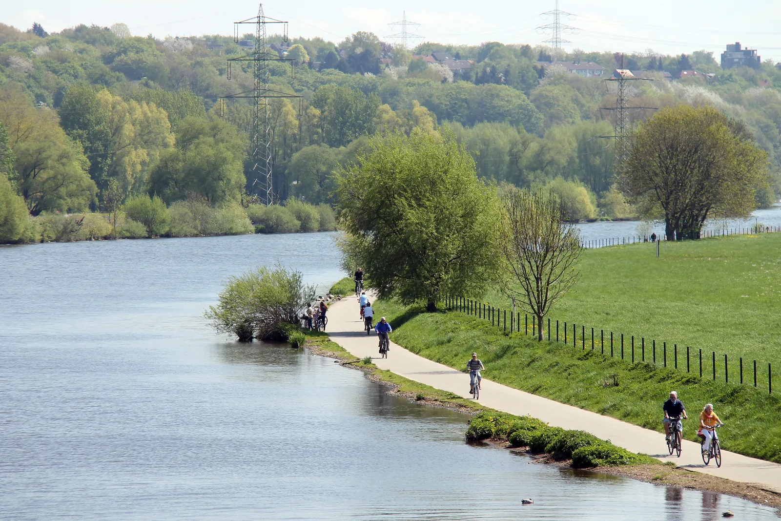
Photo: Maschinenjunge, CC BY-SA 3.0, via Wikimedia Commons
- Distance
- about 240 km (149 miles)
- Country
- Germany
- Difficulty
- Easy to moderate
- Type of trip
- Cycling route
The Ruhrtalradweg follows the Ruhr from its source on the Ruhrkopf near Winterberg, in the Sauerland, to where it meets the Rhine at Duisburg. It's about 240 km. The source is at 674 m and the mouth at 17 m, and the climbs are in the first 35 km, so riding downstream is mostly downhill. The top half runs through Sauerland valleys past Meschede and Arnsberg. From Hagen on you're in the Ruhr area, passing Witten, Hattingen, Essen and Mülheim, with old industry along the river. Wikivoyage splits it into four days of 32 to 76 km, and suggests about a week with time in Winterberg or the Ruhr cities. You stay in hotels and guesthouses in the towns. There's nothing to book for the route itself.
The official site says about half the route is on cycle paths away from roads, about 30% on forest and farm tracks or quiet town streets, and about 15% beside main roads with cycle lanes. Wikivoyage puts it at about 89% tarmac, with unsurfaced tracks in the upper valley. Sections that flood have signed bypasses. The ADFC rates it four stars out of five as a quality cycle route. It isn't a quiet country ride all the way. The lower half runs through towns and cities, and if you ride it upstream the Sauerland climbs are longer.
Highlights along the way
- Ruhrquelle: The source of the Ruhr is about 3 km from Winterberg, on the Ruhrkopf. 2026 is the route's 20th year.
- Arnsberg: Wikivoyage ends its first day here, 66 km from Winterberg. There's a viewpoint at the castle ruin above the old town.
- Hengsteysee and Harkortsee: Two reservoirs on the Ruhr near Hagen, at about km 135 and km 143.
- Hardenstein ferry: At Witten a small ferry takes up to 50 people across the Ruhr between the Herbede lock and the ruins of Burg Hardenstein, filling a gap in the path. Outside its season the usual way round was the Nachtigall bridge by the Zeche Nachtigall colliery, about 1.5 km upstream, but that bridge is shut for now and the official site says a signed detour is being set up.
- Baldeneysee to Duisburg: In Essen you ride along the Baldeneysee, then through Werden and Kettwig, which both have old half-timbered streets. The route ends at Rheinorange, a big orange sculpture where the Ruhr meets the Rhine.
Distance
About 240 km (149 miles) from Winterberg to Duisburg, according to the official site and German Wikipedia; Wikivoyage gives about 235 km (146 miles). The official site gives the height difference as about 650 m, and German Wikipedia as 621 m.
Best time to go
There's no official season. The Hardenstein ferry runs daily from April to November, from 09:00 until 21:00 at its latest in summer, and can stop at short notice when the river is high. As of 3 November 2026 there were several closures. Path works between Winterberg and Niedersfeld are due to last until the end of 2026, with the only diversion on the busy B480, so the official site suggests starting in Olsberg. Building works also disrupt trains to Winterberg from time to time in 2026. The Nachtigall bridge in Witten is closed long-term. At Duisburg the weir and the Karl-Lehr-Brücke are closed for several years, so the signed route ends for now in the Innenhafen and unsigned paths take you on to Rheinorange. Check the current route notices on ruhrtalradweg.de and trains on zuginfo.nrw before you go.
More journeys in Germany
- Cycle Exped to Japan via Finland · Mark
- The Great Spirits Route · johan
- UK to Georgia by Bike · Simon & Lucy
- Denmark! · Christopher
- Istanbul To Ashby · Harry
- Beer hike · Christopher
Flyby films from Germany
- Dag 8: Schongau - Innsbruck · johan
- Stuttgart-Amsterdam · JereFü
- St Malo to Vienna · Lucy
- The Start · Christopher
More routes like this
- Emsradweg by bike · about 385 km (240 miles) · Germany
- Moselradweg (Mosel Cycle Path) · about 311 km (193 miles) · Germany, Luxembourg, France
- Bodensee-Radweg (Lake Constance Cycle Path) · about 263 km (163 miles) · Germany, Austria, Switzerland
- Innradweg (Inn Cycle Path) · about 520 km (323 miles) · Switzerland, Austria, Germany
- Isarradweg by bike · 299 km (186 miles) · Germany, Austria
- Neckartal-Radweg by bike · about 370 km (230 miles) · Germany