Isarradweg by bike
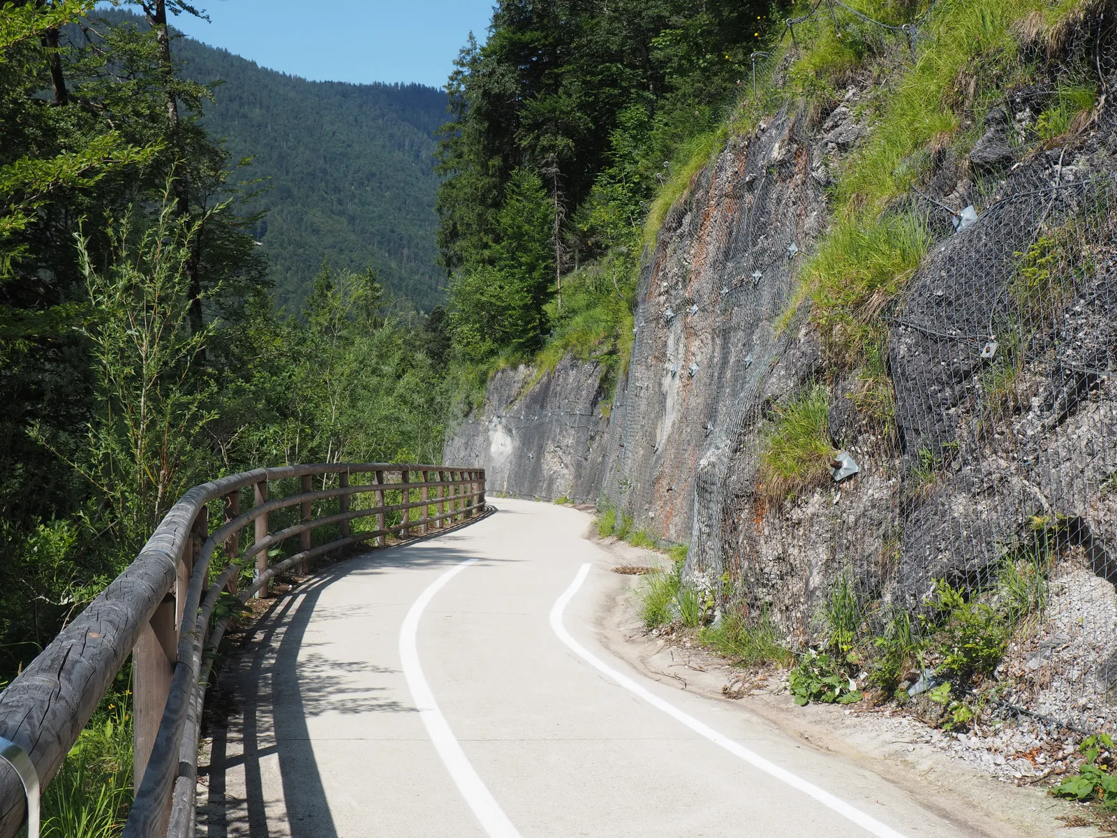
Photo: Harke, CC BY-SA 4.0, via Wikimedia Commons
- Distance
- 299 km (186 miles)
- Countries
- Germany, Austria
- Difficulty
- Easy to moderate
- Type of trip
- Cycling route
The Isarradweg follows the Isar from its source in the Karwendel mountains in Tyrol, Austria, to where it flows into the Danube near Deggendorf in Bavaria. Wikivoyage starts it at Scharnitz, on the railway from Munich via Garmisch-Partenkirchen, with regional trains about every two hours that take bikes. The source itself is 12 km up the Hinterau valley on a gravel forest road, so it's a 24 km ride there and back. From Scharnitz the route runs through Mittenwald, Lenggries, Bad Tölz and Wolfratshausen to Munich, then on through Freising, Landshut, Dingolfing and Plattling. Wikivoyage splits it into four or five days and suggests planning a week. You sleep in hotels and guesthouses in the towns, and there's nothing to book for the route itself.
It loses far more height than it gains. The official site gives 481 m of climbing and 1,329 m of descent, from 1,156 m down to 308 m. It isn't all tarmac, though. German Wikipedia calls it partly gravel, partly tarmac. Wikivoyage says the mountain half, south of Wolfratshausen, uses gravel farm tracks and quiet roads through hilly country, with bigger climbs between Bad Tölz and Geretsried. From Munich to Plattling it's mostly good gravel paths by the river, and Wikivoyage suggests a touring bike with at least seven gears. Before the Sylvenstein reservoir you ride a few km on the B307 with no cycle lane, and just before Landshut about 10 km beside a main road.
Highlights along the way
- Isarursprung: The source is 12 km from Scharnitz and about 200 m higher. The path over the Gleirschhöhe has steep drops, and Wikivoyage advises against it with small children. You leave the bike about 500 m before the Kastenalm, where cycling isn't allowed.
- Sylvenstein reservoir: The reservoir was built in the 1950s for flood protection, behind a 44 m dam. The path down from the dam into the Isar valley is built onto the rock face, with a cycle tunnel blasted through the rock.
- Bad Tölz: A spa town with a historic old town, where the Bodensee-Königssee-Radweg joins.
- Munich and Freising: Wikivoyage picks out Marienplatz, the Frauenkirche, the Deutsches Museum and the Englischer Garten in Munich. In Freising the cathedral stands on the Domberg.
- Landshut: The tower of St Martin's is 130.6 m high, which Wikivoyage says makes it the tallest brick tower in the world. Burg Trausnitz is above the town.
Distance
299 km (186 miles) from the source to the mouth, by the official count; German Wikipedia and Wikivoyage both say about 290 km (180 miles). Wikivoyage's days are about 55 km from Scharnitz to Lenggries, 67 km to Munich, 77 km to Landshut and 67 km to the Plattling weir. From there it's about 12 km (7 miles) to Deggendorf, or 19 km (12 miles) through the floodplain to Thundorf. The trip from Scharnitz up to the source and back adds 24 km (15 miles).
Best time to go
Neither the official site nor Wikivoyage names a season. After heavy rain the Isar can flood the riverside stretches, and the official site asks you to watch for closures and keep out of them. As of 3 November 2026 the official site had two undated notices. Between Vorderriß and Wallgau you have to stay on the official route, because the path on the other bank is damaged by floods and erosion, and you may only ride on the mountain-side half of the road. From Niederpöring to the Plattling weir the route is moved to the Dammhinterweg on the other bank because of building work, and the diversion is signed. Check isarradweg.de before you go.
More journeys in Germany, Austria
- Cycle Exped to Japan via Finland · Mark
- UK to Georgia by Bike · Simon & Lucy
- St Malo- Vienna- ...? · Lucy
- The Great Spirits Route · johan
- Istanbul To Ashby · Harry
- Greece - Sweden · Giorgos
Flyby films from Germany, Austria
- Day 18 · Giorgos
- Dag 8: Schongau - Innsbruck · johan
- Stuttgart-Amsterdam · JereFü
- St Malo to Vienna · Lucy
More routes like this
- Via Claudia Augusta by bike · about 700 km (435 miles) · Austria, Italy, Germany
- Danube Cycle Path · about 320 km (199 miles) · Austria, Germany, Hungary, Slovakia
- Rhine Cycle Route (EuroVelo 15) · about 1,233 km (766 miles) · France, Germany, Netherlands, Switzerland, Austria, Liechtenstein
- EuroVelo 6 - France to Romania by bike · about 4,700 km (2,900 miles) · Austria, France, Germany, Hungary, Romania, Switzerland, Slovakia, Croatia, Serbia, Bulgaria
- Innradweg (Inn Cycle Path) · about 520 km (323 miles) · Switzerland, Austria, Germany
- EuroVelo 7 – Sun Route by bike · about 7,650 km (4,753 miles) · Austria, Czech Republic, Denmark, Germany, Italy, Malta, Norway, Sweden, Finland