Altmühltal-Radweg by bike
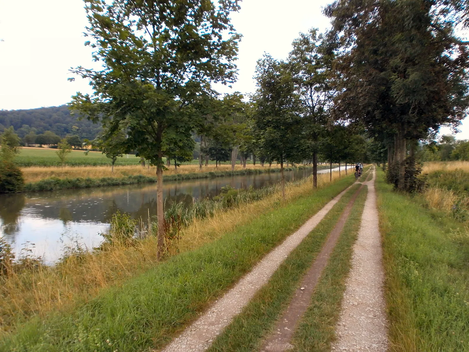
Photo: Bronstein, CC BY-SA 3.0, via Wikimedia Commons
- Distance
- about 241 km (150 miles)
- Country
- Germany
- Difficulty
- Easy
- Type of trip
- Cycling route
The Altmühltal-Radweg follows the river Altmühl from Rothenburg ob der Tauber to Kelheim, where the Altmühl meets the Danube. It's about 241 km. The first day is the only hilly one. You climb about 150 m over the Frankenhöhe to the source of the Altmühl at the Hornauer Weiher, with one stretch of about 15% for 300 to 400 m near Wachsenburg. After that the path follows the river down past Gunzenhausen and into the Naturpark Altmühltal, and from Dietfurt it runs beside the Main-Danube Canal to Kelheim. Wikivoyage splits it into five days of 44 to 55 km. There are campsites along much of the way, more of them around the lakes near Gunzenhausen, though Herrieden has none for tents. Colmberg has a hotel in its castle.
The route dates from 1979 and used to be called the Altmühlweg. The signs run the whole way but vary a little, and some still show a green bicycle with the old name above it. It's mostly tarmac, with some well-kept gravel and about 2 km of gravel forest track near the highest point, so a touring bike with treaded tyres suits it best. It isn't the same as the Tauber-Altmühl-Radweg, which starts in Wertheim and joins this route at Rothenburg. The Naturpark Altmühltal only describes the part from Gunzenhausen to Kelheim, about 160 km, and rates it easy. You can get on and off by train at Gunzenhausen, Treuchtlingen, Eichstätt, Kinding and Saal near Kelheim, and Rothenburg is a 15-minute ride on the branch line from Steinach.
Highlights along the way
- Altmühlsee: About 25 km after Herrieden the route runs along the north shore of this lake near Gunzenhausen. It has a bird island, and you can swim and camp there.
- Solnhofen and the Zwölf Apostel: Archaeopteryx was found in the Solnhofen limestone, and the Bürgermeister-Müller-Museum in the village shows fossils. About 2 km further on you pass the Zwölf Apostel, a row of limestone rocks above the valley.
- Eichstätt: A Baroque old town with the Willibaldsburg castle. Wikivoyage ends its third day here, 44 km from Treuchtlingen by way of Pappenheim and Dollnstein.
- Prunn and Essing: Burg Prunn, which charges for entry, is about 3 km past Riedenburg. About 5 km further on, Essing has a long wooden bridge called the Tatzlwurm.
- Kelheim: The route ends at Ludwigsplatz. The Befreiungshalle, built under King Ludwig I, stands above the town, and you can make a detour to the Danube Gorge and the monastery at Weltenburg, with ferries in season.
Distance
About 241 km (150 miles) from Rothenburg to Kelheim, according to Wikivoyage and German Wikipedia, though about 250 km (155 miles) is often quoted. The Naturpark Altmühltal gives 161 km (100 miles) for the section from Gunzenhausen. The highest point is 498 m, near the start, and the lowest 341 m. Over the whole route you climb about 1,257 m and drop about 1,340 m. Carry on along the Danube to Regensburg and it's about 40 km (25 miles) more.
Best time to go
Nobody sets an official season. The Naturpark's FreizeitBus, which tows a trailer for bikes, runs from spring to autumn on Saturdays, Sundays and public holidays, and the ferries to Weltenburg only run in season. Long weekends in May get busy. Before you set off, check the list of diversions at tauber-altmuehl-radweg.de/umleitungen.
More journeys in Germany
- Cycle Exped to Japan via Finland · Mark
- The Great Spirits Route · johan
- UK to Georgia by Bike · Simon & Lucy
- Denmark! · Christopher
- Istanbul To Ashby · Harry
- Beer hike · Christopher
Flyby films from Germany
- Dag 8: Schongau - Innsbruck · johan
- Stuttgart-Amsterdam · JereFü
- St Malo to Vienna · Lucy
- The Start · Christopher
More routes like this
- Elberadweg (Elbe Cycle Route) · 1,270 km (789 miles) · Germany, Czech Republic
- Ostseeküstenradweg by bike · about 1,100 km (680 miles) · Germany
- Isarradweg by bike · 299 km (186 miles) · Germany, Austria
- Fulda-Radweg by bike · about 255 km (158 miles) · Germany
- Rhine Cycle Route (EuroVelo 15) · about 1,233 km (766 miles) · France, Germany, Netherlands, Switzerland, Austria, Liechtenstein
- Weser-Radweg by bike · about 520 km (323 miles) · Germany